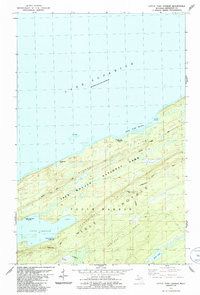
1985 Map of Little Todd Harbor
USGS Topo · Published 1986About this map
Isle Royale National Park dominates this mid-1980s landscape, illustrating the remote northern reaches of the island where wilderness management and hiker access intersect. The mapping reveals a series of prominent geological folds, most notably the Minong Ridge and Greenstone Ridge, which dictate the movement across the interior. At Ishpeming Point, a Lookout Tower serves as a critical vantage point over the dense forest and the waters of Lake Superior.
Find a feature on this map
18 named features on this map. Tap any name to fly to it.
Don’t see what you’re looking for? This feature index may not catch every label — zoom into the map to look around manually.
Map Details
Editions of this 1985 Little Todd Harbor Map
This is the sole edition of this map. No revisions or reprints were ever made.
Other maps of this area

1958 · Hancock
USGS Topo · 1:250,000

1959 · Fort William
USGS Topo · 1:250,000

1960 · Hancock
USGS Topo · 1:250,000

1961 · Hancock
USGS Topo · 1:250,000

1966 · Hancock
USGS Topo · 1:250,000

1968 · Fort William
USGS Topo · 1:250,000

1985 · Todd Harbor
USGS Topo · 1:100,000

1985 · Pigeon Point
USGS Topo · 1:100,000

1985 · Siskiwit Bay
USGS Topo · 1:100,000

1985 · Grand Portage
USGS Topo · 1:100,000