
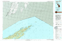
1985 Map of Todd Harbor
USGS Topo · Published 1985About this map
Isle Royale National Park dominates this 1985 survey, showcasing the island's complex glacial topography and its isolation within the waters of Lake Superior. The landscape is defined by the parallel spines of Greenstone Ridge and Minong Ridge, which shelter a network of interior waterways including the expansive Siskiwit Lake and Lake Richie. The map documents the infrastructure of the wilderness park, from the Park Headquarters and Rock Harbor Lodge to various designated campgrounds scattered along the coastlines of Todd Harbor and Tobin Harbor. Evidence of the island's industrial past remains visible through the presence of the Saginaw Mine and Mine Point on the southern shore near Conglomerate Bay. This mid-1980s data captures the park's managed wilderness state, including the international boundary with Ontario and the Canada-United States boundary running through the open water to the north.
Find a feature on this map
96 named features on this map. Tap any name to fly to it.
Don’t see what you’re looking for? This feature index may not catch every label — zoom into the map to look around manually.
Map Details
Editions of this 1985 Todd Harbor Map
2 editions found
Other maps of this area

1895 · Passage Island
USGS Topo · 1:62,500

1958 · Hancock
USGS Topo · 1:250,000

1959 · Fort William
USGS Topo · 1:250,000

1960 · Hancock
USGS Topo · 1:250,000

1961 · Hancock
USGS Topo · 1:250,000

1966 · Hancock
USGS Topo · 1:250,000

1968 · Fort William
USGS Topo · 1:250,000

1985 · Pigeon Point
USGS Topo · 1:100,000

1985 · Siskiwit Bay
USGS Topo · 1:100,000

1985 · Grand Portage
USGS Topo · 1:100,000