Old Maps of Chalkerville, Putnam Township for Academic Research
Study the evolution of Chalkerville with 14 high-resolution historic maps. Whether you're teaching, researching, or modeling changes in land use, these maps provide essential visual documentation of urban, environmental, and geographic change.
- Analyze long-term change: Track patterns in development, transportation, and natural features.
- Ideal for environmental or urban studies: Support academic projects with primary historical map data.
- Use in the classroom or lab: Educators and researchers rely on these maps to bring historical context to life.
These maps are a powerful tool for teaching, research, and visualizing how Chalkerville has changed over the decades.
Chalkerville, Putnam Township maps
(14)- 1919 Map of Stockbridge, 1958 Print
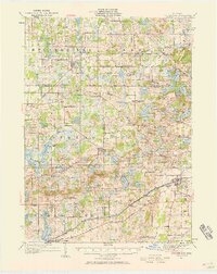 1919 Stockbridge1958 Print · USGSSouthern Michigan at the end of the Great War is a landscape of rural school districts and expanding rail lines. Genealogists and local historians can locate dozens of country schools like Stilson School, family-named landmarks such as Sackrider Hill, and the rail junction at Bullis Crossing.2 unique versions available
 - 1922 Map of Stockbridge
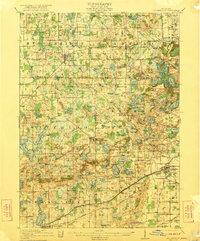 1922 Stockbridge1922 Print · USGSSoutheastern Michigan at the start of the twenties is a land of rail-connected hamlets and countless country schools. Genealogists can trace family footprints near Stockbridge and Unadilla, or locate rural landmarks like Strobel School and Sylvan Sta.3 unique versions available
 - 1942 Map of Stockbridge, 1943 Print
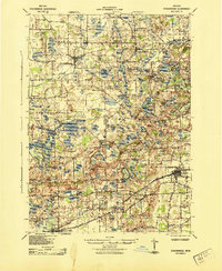 1942 Stockbridge1943 Print · USGSSouth-central Michigan during the early Forties is revealed here as a landscape of interconnected rail towns and scattered country schoolhouses. Genealogists can locate family landmarks like Livermore School, Mausbach School, and the remote Bullis Crossing Cem near the Grand Trunk line.
 - 1958 Map of Grand Rapids, 1973 Print
 1958 Grand Rapids1973 Print · USGSSouthern Michigan at the peak of the postwar era shows a landscape of burgeoning cities and new interstate highways. Trace family roots and regional growth in Grand Rapids, Battle Creek, and the glacial lake country around Gun Lake or Gull Lake.2 unique versions available
 - 1961 Map of Grand Rapids
 1961 Grand Rapids1961 Print · USGSSouthern Michigan at the dawn of the 1960s reveals a region shaped by major river systems and a robust rail network. Trace mid-century industrial growth and land use from Grand Rapids to the Fort Custer Military Reservation and Gun Lake.
 - 1962 Map of Grand Rapids
 1962 Grand Rapids1962 Print · USGSMid-century Southern Michigan is mapped here at a time of massive growth, showing the expanding urban footprints of Grand Rapids and Lansing. Researchers can trace the legacy of the Grand Trunk Western RR, find historic boundaries of the Fort Custer Military Reservation, or locate sporting camps around Gun Lake.2 unique versions available
 - 1973 Map of Gregory, 1977 Print
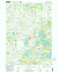
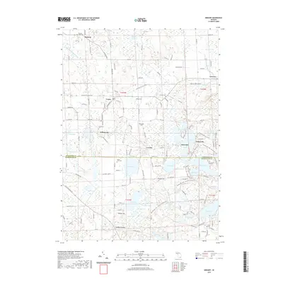
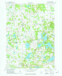 1973 Gregory1977 Print · USGSLivingston County lake country is captured here in the early 1970s, showcasing a landscape of summer camps and small settlements. Researchers can trace family history at Unadilla Cem, locate the Richmond Airport, or follow the Old RR Grade through the township.3 unique versions available
 - 1983 Map of Jackson, 1984 Print
 1983 Jackson1984 Print · USGSJackson and the surrounding lake country are shown in the early eighties as a hub of rail transit and outdoor recreation. Local historians can trace institutional footprints like the State Prison Farm or explore the landscape of Minards Mill and Olivet College.
 - 1996 Map of Gregory, 1999 Print
 1996 Gregory1999 Print · USGSThe rural townships of Livingston and Washtenaw counties appear here in the mid-1990s, defined by glacial lakes and public recreation lands. Researchers can trace historic family burial sites at Unadilla Cem, the path of the Old RR Grade, and the quiet hamlets of Gregory and Anderson.
 - 2011 Map of Gregory, 2011 Print
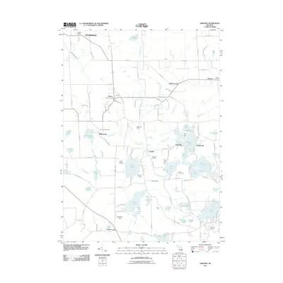 2011 Gregory2011 Print · USGSCovers Chalkerville, including Putnam Township, Dexter Township, and other nearby areas
 - 2014 Map of Gregory, 2014 Print
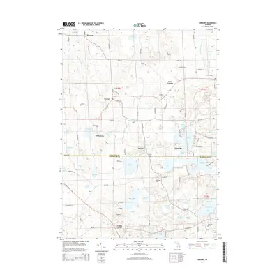 2014 Gregory2014 Print · USGSCovers Chalkerville, including Putnam Township, Dexter Township, and other nearby areas
 - 2017 Map of Gregory, 2017 Print
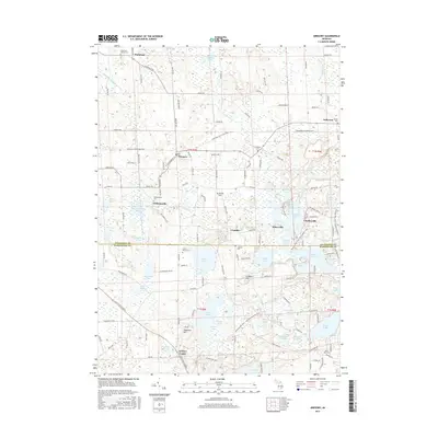 2017 Gregory2017 Print · USGSCovers Chalkerville, including Putnam Township, Dexter Township, and other nearby areas
 - 2019 Map of Gregory, 2019 Print
 2019 Gregory2019 Print · USGSCovers Chalkerville, including Putnam Township, Dexter Township, and other nearby areas
 - 2023 Map of Gregory, 2023 Print
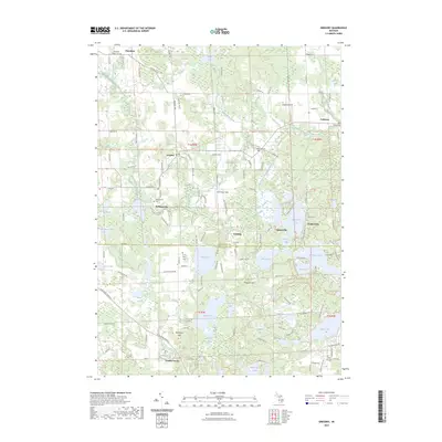 2023 Gregory2023 Print · USGSThe rural borderlands of Livingston and Washtenaw counties are captured here in the early twenty-first century, showing a landscape of deep-rooted settlements and glacial lakes. Genealogists and historians can trace family sites at Plainfield Village Cem and Unadilla Cem, or locate the hamlets of Williamsville and Anderson.
End of results
Showing maps 1-14 of 14
Top cities near Chalkerville
- Ann Arbor historical maps
- Hamburg Township historical maps
- Genoa Charter Township historical maps
- Brighton Charter Township historical maps
- Scio Township historical maps
- Hartland Township historical maps
See more
Frequently asked questions
- What are the different types of historical maps available for Chalkerville?
- What is the oldest map of Chalkerville?
- Where can I purchase historical maps of Chalkerville for my home or office?
- Where can I download high-res historical maps of Chalkerville?
- Are there historical topographic maps available for Chalkerville?
- Is there historical aerial imagery available for Chalkerville?
- Where are historical maps of Chalkerville sourced from?