1990s Maps of Marquette County, Michigan
Explore 5 historic maps of Marquette County from the 1990s. These maps offer a rare glimpse into what life looked like during the 1990s — showing old roads, neighborhoods, homes, and landmarks that have changed or disappeared over time.
Whether you're researching your family's past, planning a metal detecting trip, or studying how Marquette County's landscape evolved across the 1990s, these high-resolution maps are a powerful tool for exploring the history of this region.
- Focus on a specific era: All maps on this page are from the 1990s, giving you a focused view of this time period.
- See what’s changed: Compare century-old streets, trails, and buildings to today's modern landscape using overlays and satellite layers.
- Research with precision: Use these maps for genealogy, historical research, land use analysis, or educational projects.
- View, download, or print: Maps are fully viewable online in high resolution, and can be downloaded or printed for your own records.
Start exploring Marquette County's history through authentic maps from the 1990s. This is your window into the past.
Marquette County, MI maps
(5)- 1991 Map of L'Anse
 1991 L'Anse1991 Print · USGSUpper Peninsula life in the early nineties centered on the waters of Keweenaw Bay and the timber-rich highlands of the Huron Mountains. Genealogists and researchers can trace the rail-and-road connections between L'Anse, Baraga, and smaller communities like Pequaming and Assinins.2 unique versions available
 - 1996 Map of Negaunee NW, 1999 Print
 1996 Negaunee NW1999 Print · USGSUpper Peninsula timberlands and headwaters are captured here in the mid-1990s as the wilderness north of Ishpeming remained largely undeveloped. You can trace the Old Grade and Yellow Dog River or locate remote camps near Regan Lake and First Bass Lake.
 - 1996 Map of Silver Lake Basin, 1999 Print
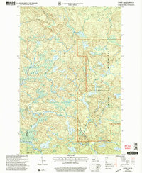
 1996 Silver Lake Basin1999 Print · USGSMarquette County's high country is documented in the mid-1990s, centered on the sprawling Silver Lake Basin and the wild Yellow Dog Plains. You can trace historical mining footprints at Silver Lead Mine Lake and locate remote landmarks like Pinnacle Falls.
 - 1999 Map of Summit Lake, 2004 Print
 1999 Summit Lake2004 Print · USGSUpper Peninsula wilderness at the turn of the millennium shows a land defined by water and protected forests. You can trace the remote routes of the Upper Baraga Lake Trail or locate secluded water bodies like White Deer Lake and Hasselb Lake.
 - 1999 Map of Bulldog Lake, 2004 Print
 1999 Bulldog Lake2004 Print · USGSMarquette County's north woods were a sanctuary of lakes and trails at the turn of the millennium. Researchers can trace the path of the North Country Trail through the McCormick Wilderness or locate remote water bodies like White Deer Lake and Dishno Lake.
End of results
Showing maps 1-5 of 5
Top cities of Marquette County
Frequently asked questions
- What are the different types of historical maps available for Marquette County?
- What is the oldest map of Marquette County?
- Where can I purchase historical maps of Marquette County for my home or office?
- Where can I download high-res historical maps of Marquette County?
- Are there historical topographic maps available for Marquette County?
- Is there historical aerial imagery available for Marquette County?
- Where are historical maps of Marquette County sourced from?