Old Maps of Powell Township, Michigan for Academic Research
Study the evolution of Powell Township with 75 high-resolution historic maps. Whether you're teaching, researching, or modeling changes in land use, these maps provide essential visual documentation of urban, environmental, and geographic change.
- Analyze long-term change: Track patterns in development, transportation, and natural features.
- Ideal for environmental or urban studies: Support academic projects with primary historical map data.
- Use in the classroom or lab: Educators and researchers rely on these maps to bring historical context to life.
These maps are a powerful tool for teaching, research, and visualizing how Powell Township has changed over the decades.
Powell Township, MI maps
(75)- 1954 Map of Negaunee, 1955 Print
 1954 Negaunee1955 Print · USGSIron mining and hydroelectric power define the Marquette Range in the mid-fifties. Genealogists and industrial historians can trace the workings of the Mather Mine A, the Eagle Mills settlement, and the Morgan Heights Sanatorium.3 unique versions available
 - 1954 Map of Huron Mountain, 1956 Print
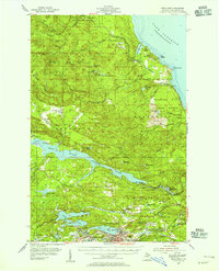
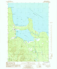
 1954 Huron Mountain1956 Print · USGSThe Lake Superior coast and the interior peaks of the Huron Mountains are captured here in the mid-1950s. Trace the remote northern shoreline from the Lighthouse on Lighthouse Island to the secluded waters of Ives Lake and Gillet Landing.3 unique versions available
 - 1954 Map of Big Bay, 1956 Print
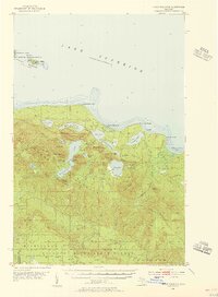
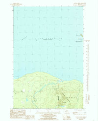
 1954 Big Bay1956 Print · USGSBig Bay and the Marquette County shoreline are documented here in the mid-1950s as a mix of remote state forest and coastal settlement. Genealogists and local historians can trace the community around Big Bay and Lake Independence, finding landmarks like the lighthouse and Alder Cem.3 unique versions available
 - 1954 Map of Skanee, 1956 Print
 1954 Skanee1956 Print · USGSThe Baraga County shoreline and the Huron Mountains are captured here in the mid-fifties as the logging industry shaped the remote Upper Peninsula. Genealogists and historians can locate the Swedish Ch, trace the Old Railroad Grade, or find family names at Glovers Corner and McComb Corner.2 unique versions available
 - 1958 Map of Marquette, 1968 Print
 1958 Marquette1968 Print · USGSThe Upper Peninsula’s central corridor is captured here in the mid-twentieth century as mining and timber industries thrived alongside new military installations. Genealogists and historians can trace the rail lines of the Soo Line Railroad through settlements like Gwinn, Turin, and Chatham.2 unique versions available
 - 1958 Map of Iron River, 1968 Print
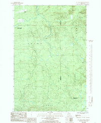
 1958 Iron River1968 Print · USGSThe Upper Peninsula in the late fifties is captured here as a landscape of timber, iron, and rail. Genealogists and historians can trace rail stops like Mass Station or explore the coastlines of Lake Gogebic and Keweenaw Bay.3 unique versions available
 - 1960 Map of Iron River
 1960 Iron River1960 Print · USGSThe Upper Peninsula’s western reaches are shown in the late fifties, featuring the industrial infrastructure of the Copper Country and the vast Ottawa National Forest. Researchers can trace the rail lines of the Milwaukee Road through settlements like Bruce Crossing and the White Pine Mine.
 - 1960 Map of Marquette
 1960 Marquette1960 Print · USGSUpper Peninsula mining and maritime commerce reach their peak in the late fifties across the Lake Superior shoreline. Genealogists and historians can locate remote settlements like Big Bay and Dukes, while tracing the Cyr Mine and the active rail lines of the Lake Superior and Ishpeming railroad.
 - 1961 Map of Marquette
 1961 Marquette1961 Print · USGSUpper Peninsula life in the early sixties centered on the iron docks and timber stands of the Lake Superior shore. Genealogists and historians can trace rail-to-port connections via the Lake Superior and Ishpeming Railroad and locate active sites like Republic Mine or the K.I. Sawyer Air Force Base.
 - 1961 Map of Iron River
 1961 Iron River1961 Print · USGSThe Upper Peninsula and northern Wisconsin are shown here in the early 1960s, a landscape defined by the iron range and vast timberlands. Researchers can trace the legacy of mining and rail transport through Caspian, the Lac Du Flambeau Indian Reservation, and the Milwaukee Road.
 - 1967 Map of Iron River, 1968 Print
 1967 Iron River1968 Print · USGSThe Upper Peninsula and northern Wisconsin borderlands are shown here in the late sixties, a landscape of deep woods and iron-country rail lines. Genealogists and historians can trace the lakeside settlements of L'Anse and Ontonagon or follow the Soo Line through towns like Michigamme and Nestoria.
 - 1968 Map of Marquette, 1977 Print
 1968 Marquette1977 Print · USGSThe Upper Peninsula iron range and Lake Superior coastline are captured here in the late sixties. Genealogists and historians can trace the rail-to-port infrastructure and the Cold War presence of K I Sawyer Air Force Base alongside towns like Ishpeming and Munising.
 - 1984 Map of Ives Hill, 1985 Print
 1984 Ives Hill1985 Print · USGSUpper Michigan's wilderness remains largely untouched in the mid-eighties as shown in this survey of the Huron Mountains. Map collectors and hikers can trace remote landmarks like Ives Hill, Hogback Falls, and the shoreline at Gillet Landing.2 unique versions available
 - 1984 Map of Glovers Corner, 1985 Print
 1984 Glovers Corner1985 Print · USGSThe Upper Peninsula shoreline during the early 1980s reveals a landscape of protected forests and isolated outposts. Trace the winding paths of the Huron River and Little Huron River past landmarks like Bald Mountain and Glovers Corner.
 - 1984 Map of Howe Lake, 1985 Print
 1984 Howe Lake1985 Print · USGSThe Marquette shoreline and its outlying archipelago come into focus in this mid-1980s study of the Michigan coast. Researchers can trace historic maritime landmarks like Huron Island L.H. and the rugged interior peaks of Mount Ida and the Huron Mountains.
 - 1984 Map of McComb Corner, 1985 Print
 1984 McComb Corner1985 Print · USGSUpper Peninsula wilderness at the edge of Baraga and Marquette Counties is captured here in the early 1980s. Genealogists and local historians can trace remote outposts like McComb Corner and Erickson Camp, or follow the path of the Old RR Grade through the forest.
 - 1985 Map of Mountain Lake
 1985 Mountain Lake1985 Print · USGSUpper Peninsula wilderness and high peaks define this 1980s survey of the Marquette and Baraga county line. Researchers can trace the drainage of the Salmon Trout River and locate remote landmarks like Dodge City, Mountain Lake, and Mummy Mountain.
 - 1985 Map of Huron Mountain
 1985 Huron Mountain1985 Print · USGSThe Lake Superior shoreline in Marquette County is captured in the mid-1980s, documenting a landscape defined by water and woods. Local historians can trace the paths of the Pine River and identify landmarks like Huron Mountain and Conway Lake.
 - 1985 Map of Granite Point
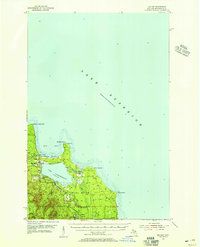
 1985 Granite Point1985 Print · USGSThe Marquette County coastline in the mid-eighties remains a pristine stretch of woods and water. Trace the shoreline from Granite Point through the Escanaba River State Forest to see how this rugged landscape appeared decades ago.
 - 1985 Map of Big Bay
 1985 Big Bay1985 Print · USGSMarquette County's northern coast is documented here in the mid-1980s, centered on the settlement of Big Bay and its lumbering roots. Researchers can trace the Old RR Grade through the Escanaba River State Forest or locate family sites near Homeier and Burns Landing.
 - 1985 Map of Buckroe
 1985 Buckroe1985 Print · USGSMarquette County's rugged Lake Superior coastline is captured here in the mid-1980s, showcasing a landscape of state forests and quiet river outlets. You can trace the Old Railroad Grade past Garlic Mountain or locate the old Sawmill and the settlement at Buckroe.
 - 1985 Map of Marquette
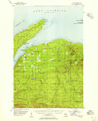
 1985 Marquette1985 Print · USGSThe iron mining country of Michigan's Upper Peninsula is shown here during the mid-1980s as industrial transport networks connected the interior to the coast. Researchers can trace historic rail lines like the Soo Line and Ls&I or locate local landmarks like Holy Cross Cem and Northern Michigan University.3 unique versions available
 - 1985 Map of Negaunee NW
 1985 Negaunee NW1985 Print · USGSThe backcountry of Marquette County is documented in the mid-eighties, showing the transition between the Escanaba River State Forest and the surrounding townships. Trace the paths of the Yellow Dog River and discover remote landmarks like Hairpin Curve and Third Bass Lake.2 unique versions available
 - 1991 Map of L'Anse
 1991 L'Anse1991 Print · USGSUpper Peninsula life in the early nineties centered on the waters of Keweenaw Bay and the timber-rich highlands of the Huron Mountains. Genealogists and researchers can trace the rail-and-road connections between L'Anse, Baraga, and smaller communities like Pequaming and Assinins.2 unique versions available
 - 1996 Map of Negaunee NW, 1999 Print
 1996 Negaunee NW1999 Print · USGSUpper Peninsula timberlands and headwaters are captured here in the mid-1990s as the wilderness north of Ishpeming remained largely undeveloped. You can trace the Old Grade and Yellow Dog River or locate remote camps near Regan Lake and First Bass Lake.
Showing maps 1-25 of 75
Top cities near Powell Township
Top neighborhoods of Powell Township
- Alder historical maps
- Birch historical maps
- Burns Landing historical maps
- Gillet Landing historical maps
- Homeier historical maps
- Halfway Village historical maps
See more
Frequently asked questions
- What are the different types of historical maps available for Powell Township?
- What is the oldest map of Powell Township?
- Where can I purchase historical maps of Powell Township for my home or office?
- Where can I download high-res historical maps of Powell Township?
- Are there historical topographic maps available for Powell Township?
- Is there historical aerial imagery available for Powell Township?
- Where are historical maps of Powell Township sourced from?