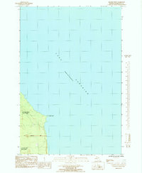
1985 Map of Granite Point
USGS Topo · Published 1985About this map
Lake Superior dominates this mid-1980s coastal survey, where the deep waters of the lake meet the shoreline of Marquette County. The prominent rocky protrusion of Granite Point serves as a clear landmark along this section of the coast, situated north of the expansive Escanaba River State Forest. The map captures a largely undeveloped wilderness character, defined by the Sand deposits and dense woodlands that characterize this part of the Upper Peninsula. Surveying details such as the Fifth Correction Line and section markers for T 50 N and R 26 W provide essential geographic context for researchers tracing land divisions and property boundaries within the state forest and along the lake's edge.
Find a feature on this map
8 named features on this map. Tap any name to fly to it.
Don’t see what you’re looking for? This feature index may not catch every label — zoom into the map to look around manually.
Map Details
Editions of this 1985 Granite Point Map
This is the sole edition of this map. No revisions or reprints were ever made.
Other maps of this area

1907 · Marquette
USGS Topo · 1:62,500

1953 · Marquette NW
USGS Topo · 1:24,000

1954 · Negaunee
USGS Topo · 1:62,500

1954 · Big Bay
USGS Topo · 1:62,500

1954 · Marquette
USGS Topo · 1:62,500

1958 · Marquette
USGS Topo · 1:250,000

1960 · Marquette
USGS Topo · 1:250,000

1961 · Marquette
USGS Topo · 1:250,000

1968 · Marquette
USGS Topo · 1:250,000
1985 · Big Bay
USGS Topo · 1:24,000