1900s (20th Century) Maps of Tilden Township, Michigan
Explore 15 historic maps of Tilden Township from the 1900s (20th Century). These maps offer a rare glimpse into what life looked like during the 1900s — showing old roads, neighborhoods, homes, and landmarks that have changed or disappeared over time.
Whether you're researching your family's past, planning a metal detecting trip, or studying how Tilden Township's landscape evolved across the 1900s, these high-resolution maps are a powerful tool for exploring the history of this region.
- Focus on a specific era: All maps on this page are from the 1900s, giving you a focused view of this time period.
- See what’s changed: Compare century-old streets, trails, and buildings to today's modern landscape using overlays and satellite layers.
- Research with precision: Use these maps for genealogy, historical research, land use analysis, or educational projects.
- View, download, or print: Maps are fully viewable online in high resolution, and can be downloaded or printed for your own records.
Start exploring Tilden Township's history through authentic maps from the 1900s. This is your window into the past.
Tilden Township, MI maps
(15)- 1952 Map of Ishpeming, 1954 Print
 1952 Ishpeming1954 Print · USGSMarquette County’s iron mining heartland is shown in the early fifties, detailing the industrial hubs of Ishpeming and Negaunee. Genealogists and historians can trace rail-side settlements like Frenchtown and Winthrop Junction alongside the Tracy Mine.4 unique versions available
 - 1952 Map of Ishpeming, 1954 Print
 1952 Ishpeming1954 Print · USGSIshpeming and the Marquette Iron Range were hubs of post-war industrial activity when this survey was conducted. Local historians can trace the intricate rail network at Winthrop Junction or locate family roots near the Tilden Mine and National Mine.4 unique versions available
 - 1952 Map of Palmer, 1954 Print
 1952 Palmer1954 Print · USGSThe Marquette Range iron mining industry is in full swing during this mid-century period near Negaunee. Genealogists and industrial historians can trace the foundations of local life through landmarks like the Finnish Ch, the Standard Sch, and the Tracy Mine.4 unique versions available
 - 1955 Map of Greenwood, 1956 Print
 1955 Greenwood1956 Print · USGSThe iron-rich country of the Upper Peninsula is captured here in the mid-1950s, showing a landscape defined by mining, timber, and the railroad. Genealogists and historians can trace the rail corridor between Clarksburg and Greenwood, including the Greenwood Mine and Dexter Landing Field.3 unique versions available
 - 1955 Map of Republic, 1957 Print
 1955 Republic1957 Print · USGSThe iron mining heart of the Upper Peninsula is frozen in time during the mid-fifties, showing the heavy rail and industrial footprint in Marquette County. Researchers can trace the legacy of extractive industry through the Republic Mine, Humboldt Cemetery, and the abandoned Black River School.3 unique versions available
 - 1957 Map of Northland, 1958 Print
 1957 Northland1958 Print · USGSThe Upper Peninsula interior shows its mid-century character during the late 1950s, where rail lines still connected remote forest outposts. Trace the old rail stops at Northland and Alfred or locate the Alfred Lookout Tower and Education Camp near the Ford River.2 unique versions available
 - 1958 Map of Marquette, 1968 Print
 1958 Marquette1968 Print · USGSThe Upper Peninsula’s central corridor is captured here in the mid-twentieth century as mining and timber industries thrived alongside new military installations. Genealogists and historians can trace the rail lines of the Soo Line Railroad through settlements like Gwinn, Turin, and Chatham.2 unique versions available
 - 1960 Map of Marquette
 1960 Marquette1960 Print · USGSUpper Peninsula mining and maritime commerce reach their peak in the late fifties across the Lake Superior shoreline. Genealogists and historians can locate remote settlements like Big Bay and Dukes, while tracing the Cyr Mine and the active rail lines of the Lake Superior and Ishpeming railroad.
 - 1961 Map of Marquette
 1961 Marquette1961 Print · USGSUpper Peninsula life in the early sixties centered on the iron docks and timber stands of the Lake Superior shore. Genealogists and historians can trace rail-to-port connections via the Lake Superior and Ishpeming Railroad and locate active sites like Republic Mine or the K.I. Sawyer Air Force Base.
 - 1968 Map of Marquette, 1977 Print
 1968 Marquette1977 Print · USGSThe Upper Peninsula iron range and Lake Superior coastline are captured here in the late sixties. Genealogists and historians can trace the rail-to-port infrastructure and the Cold War presence of K I Sawyer Air Force Base alongside towns like Ishpeming and Munising.
 - 1983 Map of Gwinn
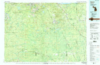 1983 Gwinn1983 Print · USGSThe heart of Michigan's Marquette Iron Range is captured here during the 1980s, when mining and military operations defined the local landscape. Genealogists and industrial historians can trace the tracks of the Chicago and North Western to the National Mine or the airman's life at K I Sawyer Air Force Base.2 unique versions available
 - 1986 Map of Green Hills
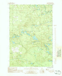 1986 Green Hills1986 Print · USGSMarquette County's timberlands and river valleys are captured here in the mid-1980s, showcasing a landscape of managed wilderness. Genealogists and historians can trace the path of the Old R.R. Grade or locate remote landmarks like Green Hills and Camp Eleven Creek.3 unique versions available
 - 1986 Map of Cataract Basin
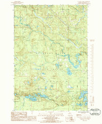 1986 Cataract Basin1986 Print · USGSMarquette County's dense woodlands and river systems are shown here in the mid-eighties, centered on the Cataract Basin. Researchers can trace old logging and recreation sites like the Chipmunk Airstrip, Trailer Park, and the intricate shoreline of Shag Lake.
 - 1986 Map of Northland NW
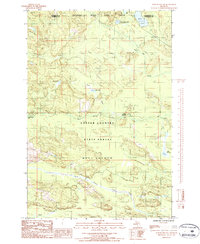 1986 Northland NW1986 Print · USGSUpper Peninsula timberlands and river systems are documented in detail during the mid-1980s along the Marquette and Dickinson county line. Researchers can trace the winding paths of the West Branch Escanaba River and find remote sites like Camp Sanford Campground.
 - 1986 Map of Northland NE, 1987 Print
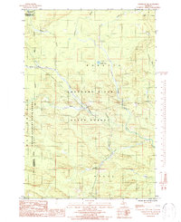 1986 Northland NE1987 Print · USGSThe Upper Peninsula interior comes into focus in the mid-1980s, centered on the junction of the Escanaba River and its West Branch. Trace timber-access trails through the Copper Country State Forest or find old landmarks like Landon Lake and the Gravel Pit.
End of results
Showing maps 1-15 of 15
Top cities near Tilden Township
Top neighborhoods of Tilden Township
Frequently asked questions
- What are the different types of historical maps available for Tilden Township?
- What is the oldest map of Tilden Township?
- Where can I purchase historical maps of Tilden Township for my home or office?
- Where can I download high-res historical maps of Tilden Township?
- Are there historical topographic maps available for Tilden Township?
- Is there historical aerial imagery available for Tilden Township?
- Where are historical maps of Tilden Township sourced from?