
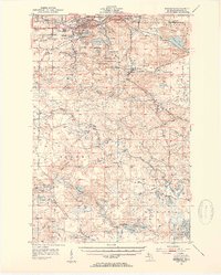
1952 Map of Ishpeming
USGS Topo · Published 1954About this map
Iron mining infrastructure dominates the landscape of the Marquette Range in the early 1950s, centering on the busy industrial corridor of Ishpeming and Negaunee. The map captures the complex interaction of rail and resource extraction, featuring the Duluth South Shore and Atlantic and Chicago and North Western railroads servicing prominent operations like Tracy Mine and the Tilden Mines.
Find a feature on this map
78 named features on this map. Tap any name to fly to it.
Don’t see what you’re looking for? This feature index may not catch every label — zoom into the map to look around manually.
Map Details
Editions of this 1952 Ishpeming Map
4 editions found
Other maps of this area

1907 · Marquette
USGS Topo · 1:62,500

1932 · Helena NW
USGS Topo · 1:31,680

1932 · Harvey NW
USGS Topo · 1:31,680

1932 · Harvey SW
USGS Topo · 1:31,680

1951 · Helena NW
USGS Topo · 1:31,680

1952 · Sands
USGS Topo · 1:24,000

1952 · Ishpeming
USGS Topo · 1:24,000

1952 · Gwinn
USGS Topo · 1:62,500

1952 · Palmer
USGS Topo · 1:24,000

1952 · Gwinn
USGS Topo · 1:24,000