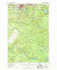
1952 Map of Ishpeming
USGS Topo · Published 1969About this map
The iron ore mining hubs of Ishpeming and Negaunee anchor this mid-century survey of Michigan’s Upper Peninsula, revealing a landscape defined by industrial extraction. Large Mine Dumps and active operations like the Empire Mine and Athens Mine surround the urban centers, while the Tilden Mines and National Mine mark the rugged interior. These industrial footprints are countered by a high density of named water bodies, including Lake Angeline, Goose Lake, and Lake Gribben.
Find a feature on this map
82 named features on this map. Tap any name to fly to it.
Don’t see what you’re looking for? This feature index may not catch every label — zoom into the map to look around manually.
Map Details
Editions of this 1952 Ishpeming Map
4 editions found
Other maps of this area

1907 · Marquette
USGS Topo · 1:62,500

1932 · Helena NW
USGS Topo · 1:31,680

1932 · Harvey NW
USGS Topo · 1:31,680

1932 · Harvey SW
USGS Topo · 1:31,680

1951 · Helena NW
USGS Topo · 1:31,680

1952 · Sands
USGS Topo · 1:24,000

1952 · Ishpeming
USGS Topo · 1:62,500

1952 · Ishpeming
USGS Topo · 1:24,000

1952 · Gwinn
USGS Topo · 1:62,500

1952 · Palmer
USGS Topo · 1:24,000