Old Maps of Raisinville Township, Michigan for Academic Research
Study the evolution of Raisinville Township with 43 high-resolution historic maps. Whether you're teaching, researching, or modeling changes in land use, these maps provide essential visual documentation of urban, environmental, and geographic change.
- Analyze long-term change: Track patterns in development, transportation, and natural features.
- Ideal for environmental or urban studies: Support academic projects with primary historical map data.
- Use in the classroom or lab: Educators and researchers rely on these maps to bring historical context to life.
These maps are a powerful tool for teaching, research, and visualizing how Raisinville Township has changed over the decades.
Raisinville Township, MI maps
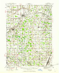
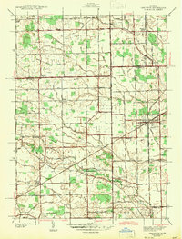
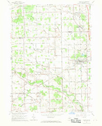
(43)- 1906 Map of Romulus
 1906 Romulus1906 Print · USGSSoutheast Michigan at the turn of the century shows a landscape defined by the winding Huron River and a dense network of competing steam and electric railways. Genealogists can trace early homesteads and rail stops in settlements like New Boston, Waltz, and the early crossroads at Carleton.2 unique versions available
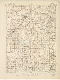
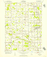
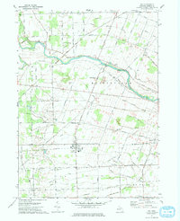
 - 1912 Map of Monroe
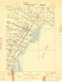 1912 Monroe1912 Print · USGSMonroe County before the First World War was a landscape defined by its strategic lakefront positioning and a massive concentration of competing railroads. Genealogists can trace the early footprints of Monroe, Brest P.O., and Erie while following local landmarks like Sandy Creek and Plum Creek.
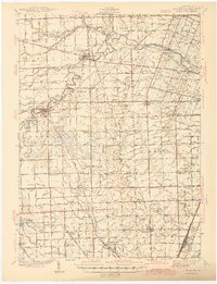
 - 1912 Map of Dundee
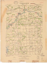 1912 Dundee1912 Print · USGSMonroe County was a bustling intersection of rail and river commerce just before the First World War. Local historians can trace the exact routes of the Cincinnati Northern R. R. and the Ann Arbor R. R. as they pass through Dundee and Petersburg.
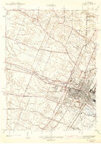
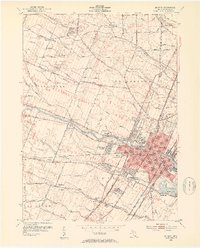
 - 1914 Map of Monroe, 1928 Print
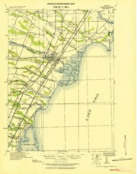 1914 Monroe1928 Print · USGSCoastal Michigan between Detroit and Toledo is shown here in the early twentieth century as a bustling hub of rail and river commerce. Genealogists and historians can trace the paths of six different railroads through Monroe and locate the old Brest Post Office near Point Aux Peaux.
 - 1926 Map of Dundee
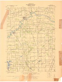 1926 Dundee1926 Print · USGSSoutheastern Michigan is captured here during the height of the steam-rail era, showing the intricate network of Monroe County townships. Genealogists and historians can trace family locations near Dundee, Lambertville, or the rail junctions at Ida and Strasburgh.
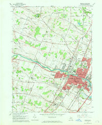
 - 1927 Map of Monroe
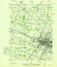 1927 Monroe1927 Print · USGSMonroe and the surrounding Lake Erie shoreline are shown here during the late 1930s as a thriving industrial and rail corridor. Researchers can locate family landmarks like the Monroe Co Cem, Strasburg Sch, and the notable Monroe Co Infirmary.
 - 1928 Map of Romulus
 1928 Romulus1928 Print · USGSSoutheast Michigan at the height of its rail-and-river era shows a dense network of transit lines and river towns. Genealogists can trace family roots through settlements like French Landing, Waltz, and South Rockwood or follow the path of the Pere Marquette RR.
 - 1936 Map of Ida
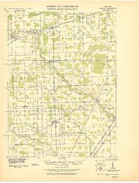
 1936 Ida1936 Print · USGSMonroe County agriculture and rural life are captured here in the mid-1930s as a complex network of drains and creeks shaped the land. Researchers can locate several country schoolhouses like Grape Sch, the Immanuel Cem, and the village of Strasburg.
 - 1936 Map of Carleton
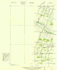
 1936 Carleton1936 Print · USGSSoutheast Michigan farm country is captured here during the mid-thirties, showing the rural landscape surrounding the village of Carleton. Researchers can trace old family schoolhouses like Long Bridge Sch and early church sites including St Johns Ch along the Pere Marquette line.
 - 1939 Map of Dundee, 1961 Print
 1939 Dundee1961 Print · USGSMonroe County before the war was a landscape of river-bend towns and rural school districts linked by an intricate rail and water network. Genealogists can locate family landmarks such as St Anthonys Ch, Wells Sch, and numerous burial grounds like Oak Grove Cem.2 unique versions available
 - 1940 Map of Ida
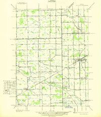
 1940 Ida1940 Print · USGSMonroe County farmland and the village of Ida are captured here just before the war, when the New York Central railroad still fueled local transit. Researchers can trace rural school districts like King Sch and find family sites near Immanuel Cem.2 unique versions available
 - 1940 Map of Dundee
 1940 Dundee1940 Print · USGSMonroe County's rural landscape is captured here in the late 1930s, showing a network of rail-side towns and country schools. Genealogists can locate family landmarks like St Joseph Cem, Hull Sch, and the riverside settlement of Dundee.
 - 1941 Map of Dundee
 1941 Dundee1941 Print · USGSMonroe County was a thriving network of rail lines and rural school districts in the years just before the war. Genealogists can trace family landmarks and local institutions like St Anthonys Ch, Maplegrove Cem, and dozens of named schools including Hull Sch.2 unique versions available
 - 1942 Map of Monroe
 1942 Monroe1942 Print · USGSMonroe and its riverfront townships are shown here in the early 1940s, revealing a busy rail corridor and the city's growth. Genealogists can trace family sites like Sandy Creek Cem, St Marys Academy, and the County Infirmary.2 unique versions available
 - 1942 Map of Carleton
 1942 Carleton1942 Print · USGSMonroe and Wayne counties come into focus during the early 1940s, showing a landscape shaped by rail-line junctions and agricultural drains. Genealogists can trace family names through landmarks like Felt Cem, St Patricks Cem, and local schoolhouses like Willow Sch or Long Bridge Sch.2 unique versions available
 - 1952 Map of Carleton, 1954 Print
 1952 Carleton1954 Print · USGSThe crossroads of Wayne and Monroe Counties are captured here during a period of post-war rural transition. Researchers can trace family homesteads near landmarks like Felt Cem, the McGowan Sch, or the rail junction at Carleton.2 unique versions available
 - 1952 Map of Monroe, 1954 Print
 1952 Monroe1954 Print · USGSMonroe and its surrounding townships thrive in the early fifties as a hub of Lake Erie commerce and industry. Researchers can trace the layout of family neighborhoods and local landmarks like St Marys Academy, Tamarack, and the Custer Airport.2 unique versions available
 - 1954 Map of Detroit
 1954 Detroit1954 Print · USGSThe Detroit metro and its Ontario neighbors are shown at the height of the mid-century industrial era, just as the suburbs were rapidly expanding. Researchers can trace the massive rail networks of the Wabash Railroad or locate landmarks like Grosse Ile and Selfridge Air Force Base.
 - 1956 Map of Toledo, 1968 Print
 1956 Toledo1968 Print · USGSNorthwest Ohio and the Lake Erie shoreline are shown in detail during the late fifties, showcasing a landscape of heavy industry, railroads, and island communities. Genealogists and historians can trace rail networks like the Chesapeake & Ohio RR or locate landmarks such as the Erie Proving Ground and Kelleys Island.4 unique versions available
 - 1961 Map of Toledo
 1961 Toledo1961 Print · USGSThe western basin of Lake Erie and the industrial heart of Northern Ohio are captured here during the post-war era. Researchers can trace historical rail lines like the New York Central or locate landmarks like the Erie Ordnance Depot and Pelee Island.
 - 1961 Map of Detroit, 1973 Print
 1961 Detroit1973 Print · USGSThe international border between Michigan and Ontario was a bustling industrial corridor in the early sixties. Researchers can trace the transit networks and riverfront infrastructure connecting Detroit to Windsor via the Detroit-Windsor Tunnel and major air hubs like Willow Run Airport.2 unique versions available
 - 1965 Map of Detroit
 1965 Detroit1965 Print · USGSThe industrial corridor between Michigan and Ontario is captured here at mid-century, showing the dense rail and river networks of the Great Lakes. Local historians can trace the paths of the Grand Trunk Western RR and locate key landmarks like Selfridge Air Force Base and Grosse Ile.
 - 1967 Map of Monroe, 1969 Print
 1967 Monroe1969 Print · USGSMonroe and its surrounding townships show a mix of industrial growth and rural tradition during the late sixties. Genealogists can trace family names through several burial grounds, including McIntyre Cem and Woodland Cem, while mapping the expansion of South Monroe.3 unique versions available
 - 1967 Map of Carleton, 1969 Print
 1967 Carleton1969 Print · USGSSoutheast Michigan's rural landscape is captured here in the late 1960s as a network of rail lines and drainage canals connected small farming communities. Genealogists can trace family landmarks like Woodmere Cem, St Patricks Sch, and the village of Waltz.3 unique versions available
 - 1972 Map of Ida, 1975 Print
 1972 Ida1975 Print · USGSMonroe County farmland and the village of Ida are captured in the early seventies as the region maintained its rural character. Genealogists and local historians can trace family locations through numerous rural burial grounds like St Joseph Cem and the Lulu Cem near the Lulu settlement.
Showing maps 1-25 of 43
Top cities near Raisinville Township
- Toledo historical maps
- Ypsilanti Charter Township historical maps
- Pittsfield Charter Township historical maps
- Brownstown Charter Township historical maps
- Bedford Township historical maps
- Frenchtown Charter Township historical maps
See more
Top neighborhoods of Raisinville Township
- Grape historical maps
- Strasburg historical maps
- Plum Grove historical maps
- Raisin Ridge historical maps
Frequently asked questions
- What are the different types of historical maps available for Raisinville Township?
- What is the oldest map of Raisinville Township?
- Where can I purchase historical maps of Raisinville Township for my home or office?
- Where can I download high-res historical maps of Raisinville Township?
- Are there historical topographic maps available for Raisinville Township?
- Is there historical aerial imagery available for Raisinville Township?
- Where are historical maps of Raisinville Township sourced from?