1940s Maps of Highland Charter Township, Michigan
Explore 3 historic maps of Highland Charter Township from the 1940s. These maps offer a rare glimpse into what life looked like during the 1940s — showing old roads, neighborhoods, homes, and landmarks that have changed or disappeared over time.
Whether you're researching your family's past, planning a metal detecting trip, or studying how Highland Charter Township's landscape evolved across the 1940s, these high-resolution maps are a powerful tool for exploring the history of this region.
- Focus on a specific era: All maps on this page are from the 1940s, giving you a focused view of this time period.
- See what’s changed: Compare century-old streets, trails, and buildings to today's modern landscape using overlays and satellite layers.
- Research with precision: Use these maps for genealogy, historical research, land use analysis, or educational projects.
- View, download, or print: Maps are fully viewable online in high resolution, and can be downloaded or printed for your own records.
Start exploring Highland Charter Township's history through authentic maps from the 1940s. This is your window into the past.
Highland Charter Township, MI maps
(3)- 1942 Map of Highland, 1965 Print
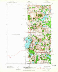 1942 Highland1965 Print · USGSOakland County's lake country is captured here in the early 1940s, showing a landscape of scattered rural schoolhouses and developing shoreline communities. Researchers can trace the local educational history at White Lake Sch or explore early lakeside life at Seven Harbors.
 - 1945 Map of Highland
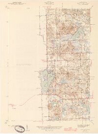 1945 Highland1945 Print · USGSOakland County's lake country in the mid-1940s reveals a landscape of lakeside settlements and rural schools amidst a growing recreation area. Researchers can trace early family connections through sites like Seven Harbors, White Lake Sch, and the winding Huron River.2 unique versions available
 - 1945 Map of Wixom
 1945 Wixom1945 Print · USGSThe Wixom area in the mid-1940s was a landscape defined by the intersection of the Pere Marquette railway and a burgeoning lakefront community. Local historians can trace early school sites like Stephens Sch or explore the drainage of the Huron River and Proud Lake.2 unique versions available
End of results
Showing maps 1-3 of 3
Top cities near Highland Charter Township
- Livonia historical maps
- Farmington Hills historical maps
- Waterford Township historical maps
- Novi historical maps
- West Bloomfield Township historical maps
- Commerce Charter Township historical maps
See more
Top neighborhoods of Highland Charter Township
- Clyde historical maps
- East Highland historical maps
- Hickory Ridge historical maps
- West Highland historical maps
- Seven Harbors historical maps
Frequently asked questions
- What are the different types of historical maps available for Highland Charter Township?
- What is the oldest map of Highland Charter Township?
- Where can I purchase historical maps of Highland Charter Township for my home or office?
- Where can I download high-res historical maps of Highland Charter Township?
- Are there historical topographic maps available for Highland Charter Township?
- Is there historical aerial imagery available for Highland Charter Township?
- Where are historical maps of Highland Charter Township sourced from?