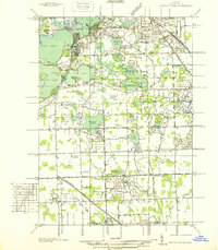
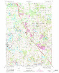
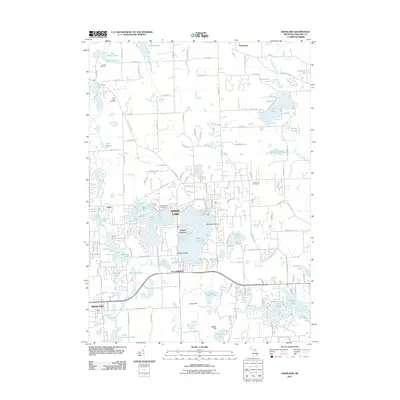
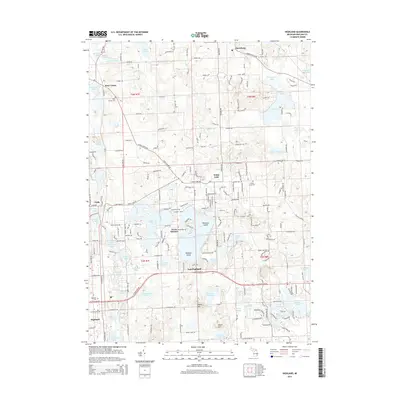
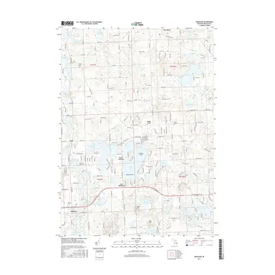
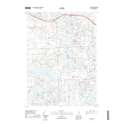
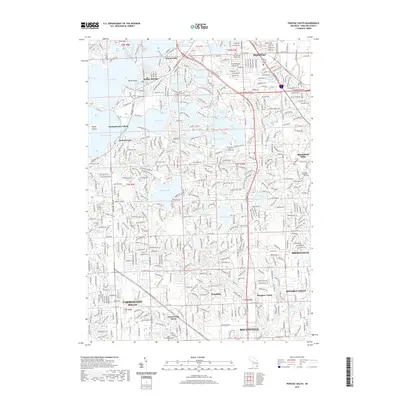
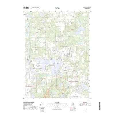
1942 Map of Highland
USGS Topo · Published 1965About this map
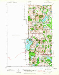
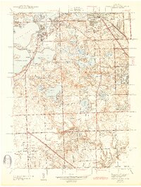
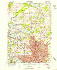
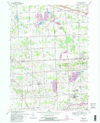
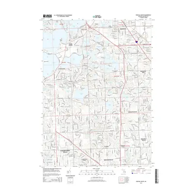
White Lake and its surrounding water bodies dominate this Oakland County landscape as it appeared in the early 1940s. The area is characterized by a network of rural schoolhouses serving dispersed lakeside communities, including White Lake Sch, Gibson Sch, and Thompson Sch. These small educational hubs, along with the Town Hall near White Lake Center Sch, indicate the civic structure of these townships before significant mid-century suburbanization. The shoreline of White Lake shows early residential development at Seven Harbors and near Hubbels Island, while the southern reaches remain dominated by smaller basins like Haven Hill Lake and Teeple Lake. This period of Michigan's history reflects a transitional phase where the natural drainage of the Huron River and various glacial lakes supported a mix of seasonal recreation and established agricultural holdings, connected by a strictly grid-based road system including Pontiac Lake RD and Elizabeth Lake RD.
Find a feature on this map
40 named features on this map. Tap any name to fly to it.
Don’t see what you’re looking for? This feature index may not catch every label — zoom into the map to look around manually.
Map Details
Editions of this 1942 Highland Map
This is the sole edition of this map. No revisions or reprints were ever made.
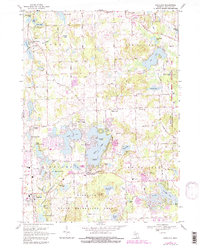
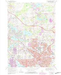
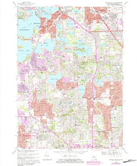
Historical Maps of White Lake Charter Township Through Time
54 maps found
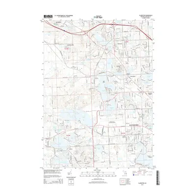
1936 Clarkston
Oakland County, MI
1936 Highland
Oakland County, MI
1936 Pontiac North
Oakland County, MI
1936 Pontiac South
Oakland County, MI
1936 Salem
Oakland County, MI
1942 Highland
Oakland County, MI
1943 Clarkston
Oakland County, MI
1943 Pontiac North
Oakland County, MI
1943 Pontiac South
Oakland County, MI
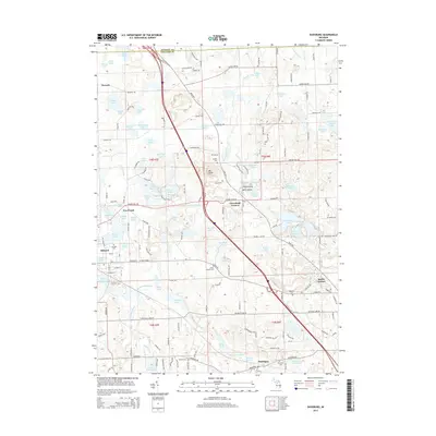
1945 Davisburg
Oakland County, MI
1945 Highland
Oakland County, MI

1945 Salem
Oakland County, MI
1952 Clarkston
Oakland County, MI
1952 Pontiac North
Oakland County, MI
1952 Pontiac South
Oakland County, MI
1953 Salem
Oakland County, MI
1968 Clarkston
Oakland County, MI
1968 Davisburg
Oakland County, MI
1968 Highland
Oakland County, MI
1968 Pontiac North
Oakland County, MI
1968 Pontiac South
Oakland County, MI
1969 Salem
Oakland County, MI
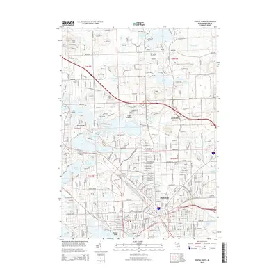
1997 Pontiac North
Oakland County, MI
1997 Pontiac South
Oakland County, MI
2011 Clarkston
Oakland County, MI

2011 Davisburg
Oakland County, MI
2011 Highland
Oakland County, MI
2011 Pontiac North
Oakland County, MI
2011 Pontiac South
Oakland County, MI
2011 Salem
Oakland County, MI
2014 Clarkston
Oakland County, MI
2014 Davisburg
Oakland County, MI
2014 Highland
Oakland County, MI
2014 Pontiac North
Oakland County, MI
2014 Pontiac South
Oakland County, MI
2014 Salem
Oakland County, MI
2017 Clarkston
Oakland County, MI
2017 Davisburg
Oakland County, MI
2017 Highland
Oakland County, MI
2017 Pontiac North
Oakland County, MI
2017 Pontiac South
Oakland County, MI
2017 Salem
Oakland County, MI
2019 Clarkston
Oakland County, MI
2019 Davisburg
Oakland County, MI
2019 Highland
Oakland County, MI
2019 Pontiac North
Oakland County, MI
2019 Pontiac South
Oakland County, MI
2019 Salem
Oakland County, MI
2023 Clarkston
Oakland County, MI
2023 Davisburg
Oakland County, MI
2023 Highland
Oakland County, MI
2023 Pontiac North
Oakland County, MI
2023 Pontiac South
Oakland County, MI
2023 Salem
Oakland County, MI
Featured Locations
- Highland Charter Township, MI
- White Lake Charter Township, MI
- Rose Township, MI
- Springfield Charter Township, MI
- Seven Harbors, Highland Charter Township