1940s Maps of Oakland Charter Township, Michigan
Explore 6 historic maps of Oakland Charter Township from the 1940s. These maps offer a rare glimpse into what life looked like during the 1940s — showing old roads, neighborhoods, homes, and landmarks that have changed or disappeared over time.
Whether you're researching your family's past, planning a metal detecting trip, or studying how Oakland Charter Township's landscape evolved across the 1940s, these high-resolution maps are a powerful tool for exploring the history of this region.
- Focus on a specific era: All maps on this page are from the 1940s, giving you a focused view of this time period.
- See what’s changed: Compare century-old streets, trails, and buildings to today's modern landscape using overlays and satellite layers.
- Research with precision: Use these maps for genealogy, historical research, land use analysis, or educational projects.
- View, download, or print: Maps are fully viewable online in high resolution, and can be downloaded or printed for your own records.
Start exploring Oakland Charter Township's history through authentic maps from the 1940s. This is your window into the past.
Oakland Charter Township, MI maps
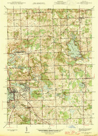
(6)- 1943 Map of Lake Orion, 1960 Print
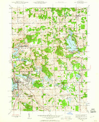 1943 Lake Orion1960 Print · USGSOakland County's lake country and agricultural highlands are captured here during the wartime era. Genealogists and local historians can locate old rural schoolhouses like National Sch, early settlements at Rudds Mill, and original railroad alignments for the Grand Trunk Western.2 unique versions available
 - 1943 Map of Romeo, 1965 Print
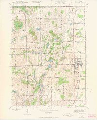 1943 Romeo1965 Print · USGSNorthern Macomb and Oakland counties are captured during the 1940s, centered on the village of Romeo and its surrounding townships. Researchers can trace the rural school systems at Clifton Sch and Mack Sch or locate the Simpson Park Camp Ground near East Mill Lake.
 - 1945 Map of Rochester
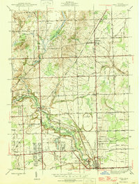
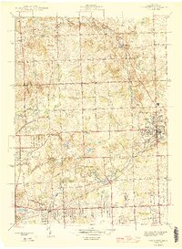 1945 Rochester1945 Print · USGSOakland County was shifting from a quiet rural landscape to a suburban corridor in the mid-1940s. Genealogists can locate family landmarks like Snell Sch, the Oakland Cem, and old settlements like Goodison and Auburn Heights.2 unique versions available
 - 1945 Map of Romeo
 1945 Romeo1945 Print · USGSNorthern Macomb County comes into focus just after the war, centered on the village of Romeo. Researchers can trace the rural schoolhouse system through Clifton Sch and Sikes Sch, or locate the Clifton Mill along the winding Stony Creek.2 unique versions available
 - 1945 Map of Lake Orion
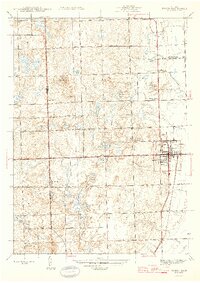
 1945 Lake Orion1945 Print · USGSOakland County's lake district is captured here just after the war, showing the rural character of northern townships like Oxford and Addison. Genealogists can locate family-named landmarks and institutions like Rudds Mill, Kingsbury Sch, and Lakeville Cem.
 - 1946 Map of Utica
 1946 Utica1946 Print · USGSMacomb and Oakland counties are captured here just after the war as the township of Shelby begins its post-war transition. Genealogists and local historians can trace family roots through numerous country schools like Plain Sch and cemeteries such as Prestonville Cem or Stony Creek Cem.2 unique versions available
End of results
Showing maps 1-6 of 6
Top cities near Oakland Charter Township
- Sterling Heights historical maps
- Warren historical maps
- Clinton Township historical maps
- Macomb Township historical maps
- Troy historical maps
- Shelby Charter Township historical maps
See more
Top neighborhoods of Oakland Charter Township
Frequently asked questions
- What are the different types of historical maps available for Oakland Charter Township?
- What is the oldest map of Oakland Charter Township?
- Where can I purchase historical maps of Oakland Charter Township for my home or office?
- Where can I download high-res historical maps of Oakland Charter Township?
- Are there historical topographic maps available for Oakland Charter Township?
- Is there historical aerial imagery available for Oakland Charter Township?
- Where are historical maps of Oakland Charter Township sourced from?