Old Maps of Oakland Charter Township, Michigan for Academic Research
Study the evolution of Oakland Charter Township with 43 high-resolution historic maps. Whether you're teaching, researching, or modeling changes in land use, these maps provide essential visual documentation of urban, environmental, and geographic change.
- Analyze long-term change: Track patterns in development, transportation, and natural features.
- Ideal for environmental or urban studies: Support academic projects with primary historical map data.
- Use in the classroom or lab: Educators and researchers rely on these maps to bring historical context to life.
These maps are a powerful tool for teaching, research, and visualizing how Oakland Charter Township has changed over the decades.
Oakland Charter Township, MI maps
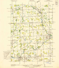
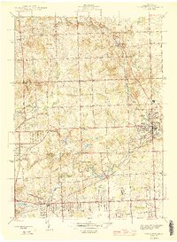
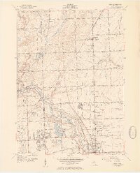
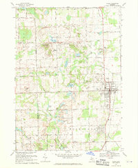
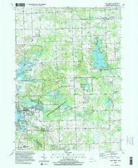
(43)- 1908 Map of Rochester
 1908 Rochester1908 Print · USGSSoutheast Michigan at the turn of the century shows a bustling landscape of early electric railways and rural township life. Genealogists and local historians can trace the foundations of Rochester, Birmingham, and Utica, alongside vanished landmarks like Snell School and the Stone Shop.3 unique versions available
 - 1936 Map of Rochester
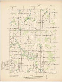
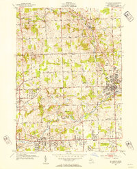
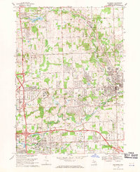
 1936 Rochester1936 Print · USGSOakland County was witnessing a surge in residential planning during the mid-1930s as new subdivisions began to fill the space between established towns. Genealogists and historians can trace numerous rural schoolhouses like Ross Sch and Hamlin Sch, or explore the early footprints of the Dodge Subdivision and Rochester.
 - 1936 Map of Washington
 1936 Washington1936 Print · USGSMacomb County townships were transitioning from rural agriculture to automotive industry in the mid-1930s. Genealogists and historians can trace the Packard Proving Grounds, Ferry Morse Seed Co Farms, and old burial sites like Washington Cem.
 - 1943 Map of Lake Orion, 1960 Print
 1943 Lake Orion1960 Print · USGSOakland County's lake country and agricultural highlands are captured here during the wartime era. Genealogists and local historians can locate old rural schoolhouses like National Sch, early settlements at Rudds Mill, and original railroad alignments for the Grand Trunk Western.2 unique versions available
 - 1943 Map of Romeo, 1965 Print
 1943 Romeo1965 Print · USGSNorthern Macomb and Oakland counties are captured during the 1940s, centered on the village of Romeo and its surrounding townships. Researchers can trace the rural school systems at Clifton Sch and Mack Sch or locate the Simpson Park Camp Ground near East Mill Lake.
 - 1945 Map of Rochester
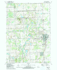
 1945 Rochester1945 Print · USGSOakland County was shifting from a quiet rural landscape to a suburban corridor in the mid-1940s. Genealogists can locate family landmarks like Snell Sch, the Oakland Cem, and old settlements like Goodison and Auburn Heights.2 unique versions available
 - 1945 Map of Romeo
 1945 Romeo1945 Print · USGSNorthern Macomb County comes into focus just after the war, centered on the village of Romeo. Researchers can trace the rural schoolhouse system through Clifton Sch and Sikes Sch, or locate the Clifton Mill along the winding Stony Creek.2 unique versions available
 - 1945 Map of Lake Orion
 1945 Lake Orion1945 Print · USGSOakland County's lake district is captured here just after the war, showing the rural character of northern townships like Oxford and Addison. Genealogists can locate family-named landmarks and institutions like Rudds Mill, Kingsbury Sch, and Lakeville Cem.
 - 1946 Map of Utica
 1946 Utica1946 Print · USGSMacomb and Oakland counties are captured here just after the war as the township of Shelby begins its post-war transition. Genealogists and local historians can trace family roots through numerous country schools like Plain Sch and cemeteries such as Prestonville Cem or Stony Creek Cem.2 unique versions available
 - 1952 Map of Utica, 1954 Print
 1952 Utica1954 Print · USGSSoutheast Michigan was entering a period of rapid post-war growth when this survey recorded the rural townships and growing centers of Macomb and Oakland Counties. Researchers can trace family history at sites like Disco Sch and Utica Cem, or locate landmarks such as the large Proving Grounds.2 unique versions available
 - 1952 Map of Rochester, 1954 Print
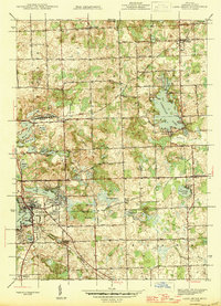
 1952 Rochester1954 Print · USGSOakland County was undergoing a period of rapid suburbanization in the early fifties as the rural townships of Avon and Oakland began to fill in. Local historians can trace family roots through numerous country schools and churches, including Five Points Ch, Howarth Sch, and The Haven Sanitarium.3 unique versions available
 - 1954 Map of Detroit
 1954 Detroit1954 Print · USGSThe Detroit metro and its Ontario neighbors are shown at the height of the mid-century industrial era, just as the suburbs were rapidly expanding. Researchers can trace the massive rail networks of the Wabash Railroad or locate landmarks like Grosse Ile and Selfridge Air Force Base.
 - 1961 Map of Detroit, 1973 Print
 1961 Detroit1973 Print · USGSThe international border between Michigan and Ontario was a bustling industrial corridor in the early sixties. Researchers can trace the transit networks and riverfront infrastructure connecting Detroit to Windsor via the Detroit-Windsor Tunnel and major air hubs like Willow Run Airport.2 unique versions available
 - 1965 Map of Detroit
 1965 Detroit1965 Print · USGSThe industrial corridor between Michigan and Ontario is captured here at mid-century, showing the dense rail and river networks of the Great Lakes. Local historians can trace the paths of the Grand Trunk Western RR and locate key landmarks like Selfridge Air Force Base and Grosse Ile.
 - 1968 Map of Lake Orion, 1970 Print
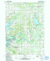
 1968 Lake Orion1970 Print · USGSNorthern Oakland County was a patchwork of quiet lakefront villages and glacial hills in the late sixties. Researchers can trace the layout of old settlements at Lakeville and Leonard, or locate family sites near Kingsbury Sch Cem and Rudds Mill.2 unique versions available
 - 1968 Map of Utica, 1970 Print
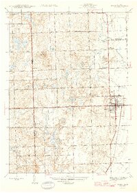
 1968 Utica1970 Print · USGSThe Macomb and Oakland county line comes alive in the late sixties, showing the suburban growth surrounding Rochester and Utica. Genealogists can trace family roots through numerous sites like Stony Creek Cem, Disco, and Washington.4 unique versions available
 - 1968 Map of Romeo, 1970 Print
 1968 Romeo1970 Print · USGSThe village of Romeo and its surrounding townships appear in the late sixties as a landscape of glacial lakes and growing parklands. Researchers can locate family burial plots at Brabb Cem, the historic Clifton Mill, and early municipal landmarks like the Grange Hall.2 unique versions available
 - 1968 Map of Rochester, 1971 Print
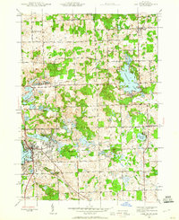
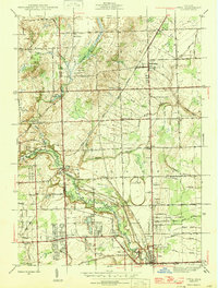
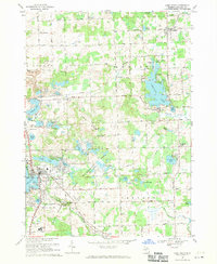
 1968 Rochester1971 Print · USGSRochester and its surroundings were transforming during the late sixties as suburban campuses and modern infrastructure met established rail lines. Genealogists and local historians can trace family roots at Mt Avon Cemetery or study the early campuses of Oakland University and Michigan Christian College.5 unique versions available
 - 1985 Map of Pontiac
 1985 Pontiac1985 Print · USGSSoutheast Michigan in the mid-1980s shows a landscape of growing suburban corridors and expansive public parklands. Genealogists and local historians can trace the footprint of rail lines like the Grand Trunk Western or locate family sites near Oakwood Cem and White Chapel Cem.2 unique versions available
 - 1991 Map of Romeo
 1991 Romeo1991 Print · USGSRomeo and the surrounding townships are shown here in the early nineties as the area balanced its village character with large-scale industrial research and parklands. Genealogists and local historians can locate family plots at Bruce Cem and McCafferty Cem or trace the early settlement at Clifton Mill.
 - 1991 Map of Lake Orion
 1991 Lake Orion1991 Print · USGSOakland County's lake country is captured here in the early 1990s as classic village centers and recreation areas began to merge. Researchers can locate family landmarks such as Kingsbury Cem, the historic Rudds Mill (Site), and the route of the Grand Trunk Western Railroad.
 - 1996 Map of Lake Orion, 1999 Print
 1996 Lake Orion1999 Print · USGSMid-century Oakland County transitions from a rural lake district to a prominent recreation hub in the 1990s. Trace old community centers like Leonard and Oakwood, or locate local landmarks such as Rudds Mill, Lakeville Cem, and the St Benedict Monastery.
 - 1997 Map of Rochester, 2000 Print
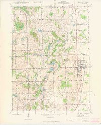
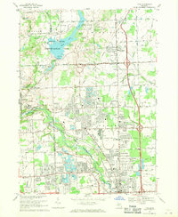
 1997 Rochester2000 Print · USGSOakland County at the turn of the millennium shows the dense suburban growth around Rochester and Rochester Hills. Researchers can trace local lineage through Mt Avon Cemetery or explore the institutional footprint of Michigan Christian College and Oakland Community College.
 - 2011 Map of Rochester, 2011 Print
 2011 Rochester2011 Print · USGSCovers Oakland Charter Township, including Rochester Hills, Pontiac, and other nearby areas
 - 2011 Map of Romeo, 2011 Print
 2011 Romeo2011 Print · USGSCovers Oakland Charter Township, including Washington Charter Township, Addison Township, and other nearby areas
Showing maps 1-25 of 43
Top cities near Oakland Charter Township
- Sterling Heights historical maps
- Warren historical maps
- Clinton Township historical maps
- Macomb Township historical maps
- Troy historical maps
- Shelby Charter Township historical maps
See more
Top neighborhoods of Oakland Charter Township
Frequently asked questions
- What are the different types of historical maps available for Oakland Charter Township?
- What is the oldest map of Oakland Charter Township?
- Where can I purchase historical maps of Oakland Charter Township for my home or office?
- Where can I download high-res historical maps of Oakland Charter Township?
- Are there historical topographic maps available for Oakland Charter Township?
- Is there historical aerial imagery available for Oakland Charter Township?
- Where are historical maps of Oakland Charter Township sourced from?