1990s Maps of Carp Lake Township, Michigan
Explore 6 historic maps of Carp Lake Township from the 1990s. These maps offer a rare glimpse into what life looked like during the 1990s — showing old roads, neighborhoods, homes, and landmarks that have changed or disappeared over time.
Whether you're researching your family's past, planning a metal detecting trip, or studying how Carp Lake Township's landscape evolved across the 1990s, these high-resolution maps are a powerful tool for exploring the history of this region.
- Focus on a specific era: All maps on this page are from the 1990s, giving you a focused view of this time period.
- See what’s changed: Compare century-old streets, trails, and buildings to today's modern landscape using overlays and satellite layers.
- Research with precision: Use these maps for genealogy, historical research, land use analysis, or educational projects.
- View, download, or print: Maps are fully viewable online in high resolution, and can be downloaded or printed for your own records.
Start exploring Carp Lake Township's history through authentic maps from the 1990s. This is your window into the past.
Carp Lake Township, MI maps
(6)- 1994 Map of Carp River, 2000 Print
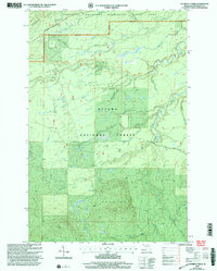
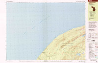 1994 Carp River2000 Print · USGSThe Lake Superior shoreline and the high ridges of the Ontonagon wilderness are documented here in the mid-nineties. Researchers can locate remote industrial sites like the Old LaFayette Mine or trace the backcountry paths to Traders Falls and Mirror Lake.
 - 1998 Map of Government Peak, 2001 Print
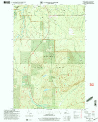
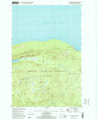 1998 Government Peak2001 Print · USGSThe southern shore of Lake Superior and the high ridges of the Porcupine Mountains are shown here in the late twentieth century. Researchers can locate legacy mining sites like Carp Lake Mine and Union Mine or trace the Overlook Trail past Lake of the Clouds.
 - 1999 Map of Tula, 2004 Print
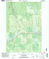 1999 Tula2004 Print · USGSThe Upper Peninsula wilderness comes into focus at the close of the twentieth century, highlighting the dense timberlands and river systems of the western region. Genealogists and researchers can trace local landmarks like Tula, Jack Spur, and the waters of the Presque Isle River.
 - 1999 Map of Merriweather, 2004 Print
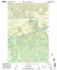 1999 Merriweather2004 Print · USGSThe western shores of Lake Gogebic are captured here in the late 1990s as they transition into the deep woods of the Ottawa National Forest. Researchers can trace the layout of Merriweather, locate a Mobile Home Park near the water, and follow the paths of Pony Creek and Warbler Creek.
 - 1999 Map of Aldridge Creek, 2004 Print
 1999 Aldridge Creek2004 Print · USGSOntonagon County at the end of the twentieth century is captured here as a wild corridor of protected forest and rugged river drainage. Researchers can trace the path of the North Country National Scenic Trail or locate the White Pine Extension Mine and Deer Creek Falls.
 - 1999 Map of Bergland NE, 2004 Print
 1999 Bergland NE2004 Print · USGSThe northern Trap Hills and Michigan's copper-rich interior come into focus during the late 1990s as mining and wilderness conservation meet. Researchers can trace the legacy of the White Pine Mine, locate the isolated Krobath Cabin, and follow the National Scenic Trail through the forest.
End of results
Showing maps 1-6 of 6
Top cities near Carp Lake Township
Top neighborhoods of Carp Lake Township
Frequently asked questions
- What are the different types of historical maps available for Carp Lake Township?
- What is the oldest map of Carp Lake Township?
- Where can I purchase historical maps of Carp Lake Township for my home or office?
- Where can I download high-res historical maps of Carp Lake Township?
- Are there historical topographic maps available for Carp Lake Township?
- Is there historical aerial imagery available for Carp Lake Township?
- Where are historical maps of Carp Lake Township sourced from?