Old Maps of Port Huron Charter Township, Michigan for Hiking & Exploration
Hike through history with 41 historic maps of Port Huron Charter Township. Explore old trails, ghost towns, and forgotten backroads — perfect for outdoor adventurers and local explorers.
- Rediscover forgotten places: Map out old mining camps, roads, and footpaths that no longer exist on modern maps.
- Layer with modern tools: Combine with LiDAR or satellite views to plan hikes through historical terrain.
- Made for exploration: Popular among hikers, overlanders, and local history lovers.
Use these maps to find adventure and explore the hidden past of Port Huron Charter Township.
Port Huron Charter Township, MI maps
(41)- 1912 Map of Port Huron
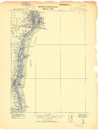 1912 Port Huron1912 Print · USGSThe St. Clair River border was a hive of rail and river activity just before the Great War. Genealogists and historians can trace early station stops and post offices like Harts Sta., Rankin Sta., and Bickford P.O. across both Michigan and Ontario shores.
 - 1928 Map of Hicky
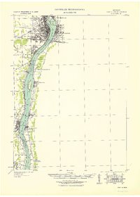
 1928 Hicky1928 Print · USGSSt. Clair County's rural townships and railway hubs are captured here in the years following the Great War. Researchers can locate vanished landmarks and post offices like Lambs P.O. or trace the early paths of the Fort Gratiot Turnpike and Grand Trunk R. R.
 - 1929 Map of Port Huron
 1929 Port Huron1929 Print · USGSThe international border along the St Clair River is captured here during the late 1920s, highlighting the industrial ties between Michigan and Ontario. Genealogists and historians can trace rail stops and post offices like Bickford P O, Recors Pt Sta, and the Grand Trunk corridor.
 - 1939 Map of Port Huron
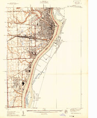 1939 Port Huron1939 Print · USGSPort Huron and Marysville are shown at the height of their industrial development just before World War II. Local historians can trace the intricate rail network of the Grand Trunk Western and locate neighborhood landmarks like Pine Grove Park and Roosevelt Sch.
 - 1939 Map of Smiths Creek
 1939 Smiths Creek1939 Print · USGSSt. Clair County is shown in the late 1930s as a landscape of rural schools and heavy rail lines. Researchers can trace the heritage of vanished school districts and family cemeteries like Caswell Cem and the Canada Settlement Sch alongside the Grand Trunk Western tracks.
 - 1949 Map of Port Huron
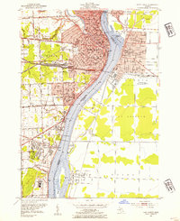
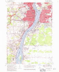
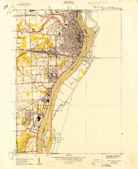 1949 Port Huron1949 Print · USGSPort Huron and the St. Clair River border come to life in the late 1940s, showing a bustling international port and rail hub. Genealogists and local historians can trace city neighborhoods near Roosevelt Sch, the industrial waterfront of Marysville, and the sprawling Woodland Cem.
 - 1952 Map of Smiths Creek, 1954 Print
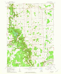
 1952 Smiths Creek1954 Print · USGSSt. Clair County's rural townships are captured here in the early fifties, showing a landscape defined by the intersection of the Grand Trunk RR and the Black River. Local historians can trace family-named schools and early landmarks like the Canada Settlement Sch and Smiths Creek.2 unique versions available
 - 1952 Map of Port Huron, 1954 Print
 1952 Port Huron1954 Print · USGSThe international border at Port Huron and Sarnia comes alive in this mid-century survey, revealing a landscape defined by heavy rail and river commerce. Genealogists and historians can locate dozens of neighborhood landmarks, from Woodlawn Cem to the St Clair Tunnel.2 unique versions available
 - 1954 Map of Detroit
 1954 Detroit1954 Print · USGSThe Detroit metro and its Ontario neighbors are shown at the height of the mid-century industrial era, just as the suburbs were rapidly expanding. Researchers can trace the massive rail networks of the Wabash Railroad or locate landmarks like Grosse Ile and Selfridge Air Force Base.
 - 1954 Map of Flint, 1968 Print
 1954 Flint1968 Print · USGSThe industrial corridor and fertile Thumb region of Michigan come alive in this mid-century survey. Genealogists and historians can trace the rail networks of the Grand Trunk, locate established settlements like Bad Axe and Sandusky, or explore the 1950s shoreline along Saginaw Bay.4 unique versions available
 - 1958 Map of Flint
 1958 Flint1958 Print · USGSThe Michigan Thumb and the Saginaw Valley are captured here during the height of the post-war industrial era. Researchers can trace the complex rail networks of the Grand Trunk Western or locate mid-century landmarks like Lakeport State Park and the port at Bay City.2 unique versions available
 - 1961 Map of Ruby, 1963 Print
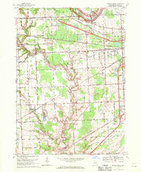
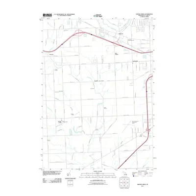
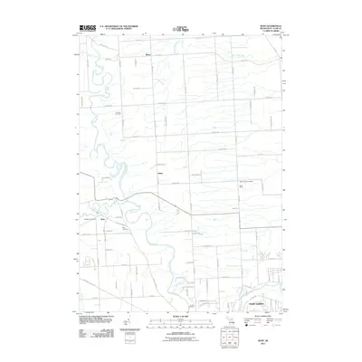
 1961 Ruby1963 Print · USGSSt. Clair County in the early sixties shows a landscape of winding river valleys and rural rail corridors. Genealogists and historians can trace family locations near Ruby and Blaine, or locate old landmarks like Central Ch and the Kinney Cem.3 unique versions available
 - 1961 Map of Lakeport, 1963 Print
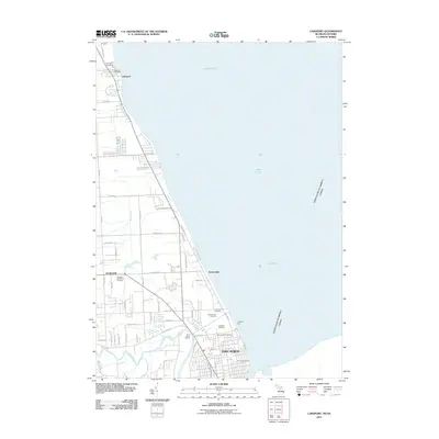
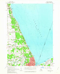 1961 Lakeport1963 Print · USGSCoastal St. Clair County meets the Ontario shoreline in the early sixties, documenting the bustling international border along the St Clair River. Researchers can trace the layout of Port Huron, locate the historic Mt Hope Cemetery, and find the early footprint of Baker Airport.2 unique versions available
 - 1961 Map of Detroit, 1973 Print
 1961 Detroit1973 Print · USGSThe international border between Michigan and Ontario was a bustling industrial corridor in the early sixties. Researchers can trace the transit networks and riverfront infrastructure connecting Detroit to Windsor via the Detroit-Windsor Tunnel and major air hubs like Willow Run Airport.2 unique versions available
 - 1965 Map of Detroit
 1965 Detroit1965 Print · USGSThe industrial corridor between Michigan and Ontario is captured here at mid-century, showing the dense rail and river networks of the Great Lakes. Local historians can trace the paths of the Grand Trunk Western RR and locate key landmarks like Selfridge Air Force Base and Grosse Ile.
 - 1968 Map of Smiths Creek, 1970 Print
 1968 Smiths Creek1970 Print · USGSSt. Clair County in the late sixties shows a landscape of growing townships and critical infrastructure along the BLACK RIVER. Researchers can trace local heritage through sites like St Marys Cem, the community at Smiths Creek, and the Sparlingville Sch grounds.2 unique versions available
 - 1968 Map of Port Huron, 1971 Print
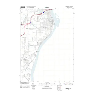
 1968 Port Huron1971 Print · USGSThe international border along the St. Clair River thrived in the late sixties as a hub of industry and transport. Genealogists and historians can trace the neighborhoods of Sarnia and Port Huron, locating family landmarks like Riverlawn Cem and St Stephen Sch.3 unique versions available
 - 1981 Map of Lake St. Clair North
 1981 Lake St. Clair North1981 Print · USGSThe Michigan-Ontario borderlands come alive in the early eighties, showcasing the busy international corridor from the St Clair River down to the delta. Trace the intricate channels around Harsens Island or locate regional hubs like Selfridge Air Force Base and Sarnia.
 - 1984 Map of Croswell, 1985 Print
 1984 Croswell1985 Print · USGSThe Michigan Thumb region and the Lake Huron shoreline appear here in the mid-1980s, showcasing a landscape of drainage-fed farmland and coastal retreats. Researchers can trace the Chesapeake rail route and explore shoreline communities from Lexington Heights to Keewahdin.2 unique versions available
 - 1991 Map of Smiths Creek
 1991 Smiths Creek1991 Print · USGSSt. Clair County's mix of rural townships and expanding aviation infrastructure is captured here in the early nineties. Researchers can trace family sites like St Marys Cem and Caswell Cem or explore the corridor between Smiths Creek and the Port Huron State Game Area.
 - 1991 Map of Port Huron, 1992 Print
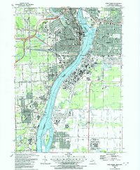 1991 Port Huron1992 Print · USGSThe international border at the St Clair River is captured here during a period of steady industrial and civic growth. Genealogists and historians can trace neighborhood developments near Woodlawn Cem or locate local landmarks like the St Clair Tunnel and Mercy Hospital.
 - 2011 Map of Smiths Creek, 2011 Print
 2011 Smiths Creek2011 Print · USGSCovers Port Huron Charter Township, including Marysville, Kimball, and other nearby areas
 - 2011 Map of Ruby, 2011 Print
 2011 Ruby2011 Print · USGSCovers Port Huron Charter Township, including Atkins, Grant Township, and other nearby areas
 - 2011 Map of Lakeport, 2011 Print
 2011 Lakeport2011 Print · USGSCovers Port Huron Charter Township, including Sarnia, Port Huron, and other nearby areas
 - 2011 Map of Port Huron, 2011 Print
 2011 Port Huron2011 Print · USGSCovers Port Huron Charter Township, including Sarnia, Port Huron, and other nearby areas
Showing maps 1-25 of 41
Top cities near Port Huron Charter Township
- Port Huron historical maps
- Marysville historical maps
- Kimball historical maps
- West Tappan historical maps
- Saint Clair historical maps
- Casco historical maps
See more
Top neighborhoods of Port Huron Charter Township
Frequently asked questions
- What are the different types of historical maps available for Port Huron Charter Township?
- What is the oldest map of Port Huron Charter Township?
- Where can I purchase historical maps of Port Huron Charter Township for my home or office?
- Where can I download high-res historical maps of Port Huron Charter Township?
- Are there historical topographic maps available for Port Huron Charter Township?
- Is there historical aerial imagery available for Port Huron Charter Township?
- Where are historical maps of Port Huron Charter Township sourced from?