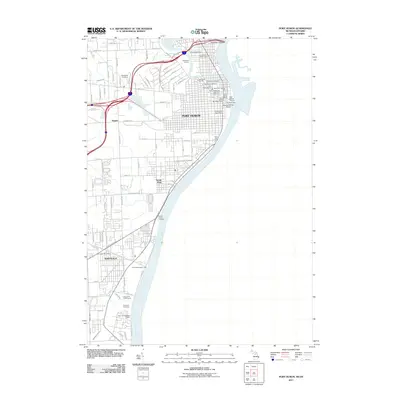
2011 Map of Port Huron
USGS Topo · Published 2011About this map
Port Huron and the surrounding industrial corridor along the Saint Clair River are captured here during a period of modern maritime and transit operations. The map documents the critical international border infrastructure, including the Blue Water Bridge and the Saint Clair Tunnel, which facilitate passage to Ontario. Industrial and municipal assets line the riverfront, from the Detroit Edison Company to a dense network of docks such as the Huron Municipal Dock and Eds Shell Dock.
Find a feature on this map
89 named features on this map. Tap any name to fly to it.
Don’t see what you’re looking for? This feature index may not catch every label — zoom into the map to look around manually.
Map Details
Editions of this 2011 Port Huron Map
This is the sole edition of this map. No revisions or reprints were ever made.
Other maps of this area

1912 · Port Huron
USGS Topo · 1:62,500

1928 · Hicky
USGS Topo · 1:62,500

1929 · Port Huron
USGS Topo · 1:62,500

1936 · St. Clair
USGS Topo · 1:31,680

1936 · Rattle Run
USGS Topo · 1:31,680

1939 · Port Huron
USGS Topo · 1:24,000

1939 · St. Clair
USGS Topo · 1:24,000

1939 · Smiths Creek
USGS Topo · 1:24,000

1942 · Rattle Run
USGS Topo · 1:24,000
1949 · Port Huron
USGS Topo · 1:24,000