Old Maps of Saint Joseph County, Michigan for Hiking & Exploration
Hike through history with 111 historic maps of Saint Joseph County. Explore old trails, ghost towns, and forgotten backroads — perfect for outdoor adventurers and local explorers.
- Rediscover forgotten places: Map out old mining camps, roads, and footpaths that no longer exist on modern maps.
- Layer with modern tools: Combine with LiDAR or satellite views to plan hikes through historical terrain.
- Made for exploration: Popular among hikers, overlanders, and local history lovers.
Use these maps to find adventure and explore the hidden past of Saint Joseph County.
Saint Joseph County, MI maps
(111)- 1914 Map of Three Rivers, 1966 Print
 1914 Three Rivers1966 Print · USGSSt. Joseph County's river-driven economy is on full display in the early 1900s, centered on the busy rail junction at Three Rivers. Genealogists can locate dozens of country schools and churches, from Peck Academy to the remote Quail Trap School.
 - 1916 Map of Three Rivers
 1916 Three Rivers1916 Print · USGSThe river-driven industry and rural school networks of St. Joseph County are in full view during the mid-nineteen-teens. Genealogists and historians can locate old homesteads near Johnnycake School, trace the Chicago Road, or find the early power structures at Sturgis Power Dam.3 unique versions available
 - 1918 Map of Leonidas
 1918 Leonidas1918 Print · USGSSouthern Michigan at the close of the Great War reveals a landscape of tight-knit farming townships connected by the GRAND RAPIDS AND INDIANA RR. Genealogists can trace family roots through numerous district schools and landmarks like Beard Church, Dutton Cemetery, and Kings Mill.3 unique versions available
 - 1922 Map of Schoolcraft
 1922 Schoolcraft1922 Print · USGSSouthern Kalamazoo and northern St. Joseph counties are captured here in the early 1920s as a thriving hub of rail transport and rural education. Genealogists can trace family footprints through dozens of local sites, from the rail junction at Schoolcraft to the lakeside Ramona Park and the Flowerfield Sta.5 unique versions available
 - 1943 Map of Three Rivers
 1943 Three Rivers1943 Print · USGSSt. Joseph County and the northern Indiana borderlands appear here in the 1940s at the height of the steam-rail era. Genealogists can trace dozens of rural school sites like Johnnycake Sch and family landmarks near White Pigeon, Constantine, and Klinger Lake.
 - 1943 Map of Schoolcraft
 1943 Schoolcraft1943 Print · USGSKalamazoo and St. Joseph counties are shown here during the early 1940s, a landscape defined by glacial lakes and the expansive Schoolcraft Prairie. Trace family roots at Vicksburg or locate historic rural schools like Lost Island Sch and Brick Sch.
 - 1944 Map of Leonidas
 1944 Leonidas1944 Print · USGSThe rural borderlands of Kalamazoo and St. Joseph counties are shown here as the region's agricultural and rail networks reached their mid-century peak. Genealogists can trace family locations near dozens of named schools and landmarks like Dutton Cemetery, Kings Mill, and Beard Ch.
 - 1944 Map of Marcellus, 1965 Print
 1944 Marcellus1965 Print · USGSSouthwest Michigan townships in Van Buren and Cass counties are documented here during the mid-1940s as a landscape of interconnected glacial lakes and rail lines. Researchers can trace old rural schools like Durkee Sch, the Pere Marquette rail corridor, and family burial grounds such as Wildey Cem.3 unique versions available
 - 1946 Map of Marcellus
 1946 Marcellus1946 Print · USGSThe rural landscape of Cass and Van Buren counties comes alive in the mid-1940s, showing a transition between railroad hubs and quiet farming hamlets. Genealogists can locate family-named landmarks such as Chamberlain Cem and historic schools like Porter Center Sch or Shannon Sch.2 unique versions available
 - 1947 Map of Leonidas, 1976 Print
 1947 Leonidas1976 Print · USGSSouthern Michigan rural life is captured here in the late 1940s, showing a landscape defined by small crossroads settlements and the family-run farms between them. Researchers can trace the exact locations of vanished country schools like Hull Sch and rural landmarks such as Kings Mill and Wakeshma Tabernacle.
 - 1948 Map of Vandalia
 1948 Vandalia1948 Print · USGSCass County's lake-studded landscape is captured here in the mid-1940s, showing a vibrant network of rural schoolhouses and lakeside retreats. Genealogists and local historians can trace early school districts like Allegheny Sch, locate the Moon Cem, and see the rail economy of Vandalia along the Grand Trunk.5 unique versions available
 - 1949 Map of Vandalia
 1949 Vandalia1949 Print · USGSIn the late 1940s, this pocket of Cass County was a hub of rural life and summer lakeside recreation. Genealogists can locate family landmarks like the Shavehead Cem or Chain Lake Ch, and trace old rail stops along the Grand Trunk.2 unique versions available
 - 1950 Map of Leonidas
 1950 Leonidas1950 Print · USGSSouthern Michigan’s borderlands at mid-century are defined by the winding St Joseph River and a patchwork of rural school districts. Genealogists can trace family roots through landmarks like Gilson Cem, Dutton Cem, and the numerous rural schools including Factoryville Sch.2 unique versions available
 - 1953 Map of Fort Wayne, 1963 Print
 1953 Fort Wayne1963 Print · USGSNortheast Indiana and its neighboring borderlands in Michigan and Ohio appear here during a peak era of rail and road expansion. Researchers can trace the massive rail networks of the Nickel Plate Road and Wabash or locate lakeside landmarks like Lake Wawasee and Clear Lake.4 unique versions available
 - 1956 Map of Fort Wayne
 1956 Fort Wayne1956 Print · USGSThe tri-state borderlands of Indiana, Michigan, and Ohio are captured here in the mid-fifties, centered on the growing industrial hub of Fort Wayne. Researchers can trace the heavy rail lines of the New York Central and Pennsylvania alongside prominent water features like Lake Wawasee and the Maumee River.2 unique versions available
 - 1958 Map of Grand Rapids, 1973 Print
 1958 Grand Rapids1973 Print · USGSSouthern Michigan at the peak of the postwar era shows a landscape of burgeoning cities and new interstate highways. Trace family roots and regional growth in Grand Rapids, Battle Creek, and the glacial lake country around Gun Lake or Gull Lake.2 unique versions available
 - 1961 Map of Grand Rapids
 1961 Grand Rapids1961 Print · USGSSouthern Michigan at the dawn of the 1960s reveals a region shaped by major river systems and a robust rail network. Trace mid-century industrial growth and land use from Grand Rapids to the Fort Custer Military Reservation and Gun Lake.
 - 1961 Map of Sturgis, 1962 Print
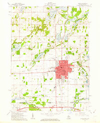 1961 Sturgis1962 Print · USGSSturgis and the Michigan-Indiana border are captured here at a moment of mid-century growth. Genealogists and historians can trace neighborhood schools like Holy Angels Sch, old burial grounds at Tobey Cem, and the path of the New York Central railroad.2 unique versions available
 - 1961 Map of Nottawa, 1962 Print
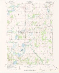 1961 Nottawa1962 Print · USGSSt. Joseph County at the start of the 1960s is a landscape of glacial lakes and intersecting rail lines. Researchers can trace the routes of the New York Central railroad and locate local landmarks like the Community Sch and Nottawa Cem.3 unique versions available
 - 1961 Map of Colon, 1962 Print
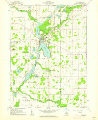 1961 Colon1962 Print · USGSSt. Joseph County at the start of the 1960s reveals a landscape of interconnected glacial lakes and small agricultural hubs. Researchers can trace family roots at Lakeside Cem, locate the Mennonite Ch, or follow the New York Central rail line.2 unique versions available
 - 1961 Map of Burr Oak, 1962 Print
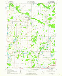 1961 Burr Oak1962 Print · USGSThe Michigan-Indiana borderlands are captured here in the early sixties, showing the agricultural and rail-oriented life of the region. Researchers can locate many family-history sites like Dutch Settlement Cem, Burr Oak, and the Fawn River Sch.2 unique versions available
 - 1962 Map of Grand Rapids
 1962 Grand Rapids1962 Print · USGSMid-century Southern Michigan is mapped here at a time of massive growth, showing the expanding urban footprints of Grand Rapids and Lansing. Researchers can trace the legacy of the Grand Trunk Western RR, find historic boundaries of the Fort Custer Military Reservation, or locate sporting camps around Gun Lake.2 unique versions available
 - 1967 Map of Schoolcraft, 1969 Print
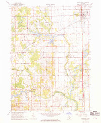 1967 Schoolcraft1969 Print · USGSSouthwest Michigan's agricultural heartland is documented here in the late 1960s, showing the intersection of rail and rural life. Genealogists can locate family-named routes and community landmarks like Upper Flatbush Cem, Edwards Corners, and the Grange Hall.3 unique versions available
 - 1967 Map of Vicksburg, 1969 Print
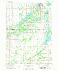 1967 Vicksburg1969 Print · USGSThe village of Vicksburg and the winding Portage River valley are captured here in the late sixties as agricultural and industrial life intersected. Genealogists can locate family sites like Parkville Cem, Scott Cem, and the West Mendon Ch.3 unique versions available
 - 1972 Map of Three Rivers East, 1974 Print
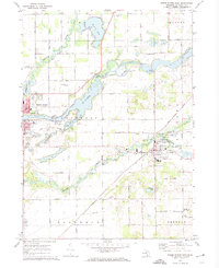 1972 Three Rivers East1974 Print · USGSSt. Joseph County in the early seventies shows a landscape where historic river routes meet the modern rail-and-road network. Researchers can trace family sites at South Park Cem or locate industrial landmarks like the Langley Covered Bridge and Sturgis Dam.2 unique versions available
Showing maps 1-25 of 111
Top cities of Saint Joseph County
Frequently asked questions
- What are the different types of historical maps available for Saint Joseph County?
- What is the oldest map of Saint Joseph County?
- Where can I purchase historical maps of Saint Joseph County for my home or office?
- Where can I download high-res historical maps of Saint Joseph County?
- Are there historical topographic maps available for Saint Joseph County?
- Is there historical aerial imagery available for Saint Joseph County?
- Where are historical maps of Saint Joseph County sourced from?