Old Maps of Manistique Township, Michigan for Academic Research
Study the evolution of Manistique Township with 63 high-resolution historic maps. Whether you're teaching, researching, or modeling changes in land use, these maps provide essential visual documentation of urban, environmental, and geographic change.
- Analyze long-term change: Track patterns in development, transportation, and natural features.
- Ideal for environmental or urban studies: Support academic projects with primary historical map data.
- Use in the classroom or lab: Educators and researchers rely on these maps to bring historical context to life.
These maps are a powerful tool for teaching, research, and visualizing how Manistique Township has changed over the decades.
Manistique Township, MI maps
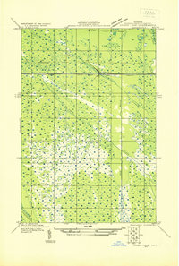
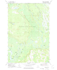
(63)- 1931 Map of Manistique River NE
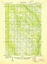 1931 Manistique River NE1931 Print · USGSSchoolcraft County’s hydrologic network is captured in the early 1930s as the U.S. Army Air Corps began utilizing aerial photography for land surveys. This sheet allows you to trace the intricate meanders of the Manistique River and Driggs River through Doyle and across vast Marsh lands.
 - 1931 Map of Manistique River SE
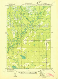 1931 Manistique River SE1931 Print · USGSThe northern Michigan wilderness of the early 1930s is revealed here through its complex river systems and isolated pioneer outposts. Genealogists can locate rural education centers like the Swede Settlement Sch and Wood Sch among the bends of the Manistique River.
 - 1931 Map of Manistique River NW
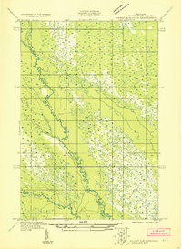 1931 Manistique River NW1931 Print · USGSUpper Peninsula wetlands dominate this Depression-era wilderness survey in Schoolcraft County. You can trace the intricate meanders of the West Branch Manistique River and its tributaries like Stutts Creek and Hickey Creek.
 - 1931 Map of Manistique River SW
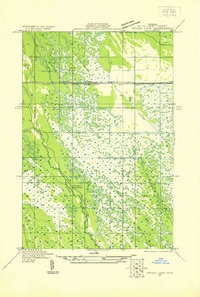
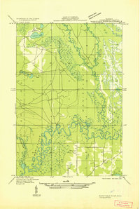 1931 Manistique River SW1931 Print · USGSSchoolcraft County in the early 1930s is defined by the winding Manistique River and its intricate marshland tributaries. Genealogists and local historians can trace rural landmarks like the Brick Sch and the Manistique Fire Tower.
 - 1931 Map of Driggs Lake SW
 1931 Driggs Lake SW1931 Print · USGSUpper Peninsula wetlands and rail infrastructure are captured here in the early 1930s, showing the intersection of transport and terrain. Trace the early corridor of the Duluth South Shore and Atlantic railroad and the settlement of Walsh near the Driggs River.
 - 1931 Map of Driggs Lake SE
 1931 Driggs Lake SE1931 Print · USGSThe wetlands of the Seney area are captured here in the early 1930s, showing a landscape of remote camps and complex drainage. Genealogists and researchers can trace early transit routes like the Duluth South Shore and Atlantic railway and locate the isolated Cookson Camp.
 - 1954 Map of Escanaba, 1967 Print
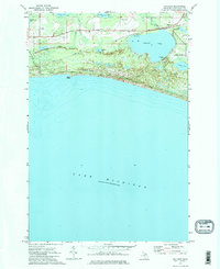
 1954 Escanaba1967 Print · USGSThe Upper Peninsula and Door County shorelines meet here in the mid-fifties, showing the vital maritime and timber networks of the Great Lakes. Researchers can trace historic rail lines, old fire lookouts like the Stonington Fire Tower, and island settlements such as Washington Island.2 unique versions available
 - 1957 Map of Escanaba
 1957 Escanaba1957 Print · USGSThe Upper Peninsula and Door County shorelines meet in the mid-fifties, capturing a landscape of timber, iron, and maritime trade. Genealogists and local historians can trace the Chicago & North Western RR through settlements like Hermansville or locate St Vitals Church and the Potawatome Indian Reservation.
 - 1958 Map of Escanaba
 1958 Escanaba1958 Print · USGSNorthern Lake Michigan maritime commerce and timberlands are captured here in the mid-fifties. Genealogists and historians can trace rail networks like the Escanaba and Lake Superior or locate island settlements such as Detroit Harbor and Fish Creek.
 - 1958 Map of Marquette, 1968 Print
 1958 Marquette1968 Print · USGSThe Upper Peninsula’s central corridor is captured here in the mid-twentieth century as mining and timber industries thrived alongside new military installations. Genealogists and historians can trace the rail lines of the Soo Line Railroad through settlements like Gwinn, Turin, and Chatham.2 unique versions available
 - 1960 Map of Marquette
 1960 Marquette1960 Print · USGSUpper Peninsula mining and maritime commerce reach their peak in the late fifties across the Lake Superior shoreline. Genealogists and historians can locate remote settlements like Big Bay and Dukes, while tracing the Cyr Mine and the active rail lines of the Lake Superior and Ishpeming railroad.
 - 1961 Map of Marquette
 1961 Marquette1961 Print · USGSUpper Peninsula life in the early sixties centered on the iron docks and timber stands of the Lake Superior shore. Genealogists and historians can trace rail-to-port connections via the Lake Superior and Ishpeming Railroad and locate active sites like Republic Mine or the K.I. Sawyer Air Force Base.
 - 1968 Map of Marquette, 1977 Print
 1968 Marquette1977 Print · USGSThe Upper Peninsula iron range and Lake Superior coastline are captured here in the late sixties. Genealogists and historians can trace the rail-to-port infrastructure and the Cold War presence of K I Sawyer Air Force Base alongside towns like Ishpeming and Munising.
 - 1972 Map of Merwin Lake, 1975 Print
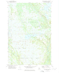
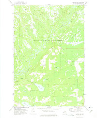 1972 Merwin Lake1975 Print · USGSThe Manistique River floodplain in Schoolcraft County is shown in the early seventies, dominated by the state forest and winding river oxbows. Genealogists and local historians can locate the Woods Sch, Woods Cem, and traces of the Riverside Truck Trail.
 - 1972 Map of Driggs Lake SE, 1975 Print
 1972 Driggs Lake SE1975 Print · USGSSchoolcraft County’s managed wetlands and timberlands are captured here in the early 1970s. Trace the complex water diversions through the Seney National Wildlife Refuge and follow the route of the Soo Line across the Grand Sable State Forest.
 - 1972 Map of Manistique East, 1975 Print
 1972 Manistique East1975 Print · USGSManistique and its northern Lake Michigan harbor are captured here in the early 1970s, showcasing the intersection of the Upper Peninsula's timber and maritime industries. Genealogists and local historians can locate the Fairview Sch, trace the Soo Line tracks, and find the Fairview Cemetery near the city center.
 - 1972 Map of Marsh Creek Pool, 1975 Print
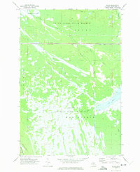
 1972 Marsh Creek Pool1975 Print · USGSIn the early seventies, the central Upper Peninsula was a landscape of managed wetlands and vast conservation tracts. Researchers can trace the hydraulic engineering of the Seney National Wildlife Refuge and the winding course of the Manistique River.
 - 1972 Map of Walsh, 1975 Print
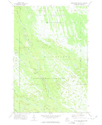
 1972 Walsh1975 Print · USGSSchoolcraft County’s wild interior is captured here in the early seventies, where the massive Seney wetlands meet the state forest. Track the industrial footprint of the Soo Line railroad and discover managed water features like Pool C-3 and the Walsh Ditch.
 - 1972 Map of Marsh Creek Pool NW, 1975 Print
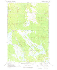
 1972 Marsh Creek Pool NW1975 Print · USGSSchoolcraft County's marshlands and river systems are captured in the early seventies during a period of active conservation. Researchers can trace the winding West Branch Manistique River and locate backcountry landmarks like West Branch Campground and Tucker Lake.2 unique versions available
 - 1972 Map of Smith Lake, 1975 Print
 1972 Smith Lake1975 Print · USGSUpper Peninsula wetlands and timberlands are captured here in the early seventies, showing the vast Manistique River State Forest. Researchers can trace old logging routes like the Truck Trail and find landmarks such as the Mennonite Ch and Kleystads Slough.
 - 1972 Map of Gulliver, 1975 Print
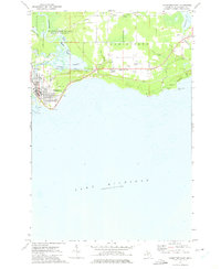
 1972 Gulliver1975 Print · USGSThe Lake Michigan shoreline and the village of Gulliver are documented in the early seventies, showing a landscape shaped by the SOO LINE railroad and local gravel industry. Researchers can trace the Emergency Landing Field in Doyle Township and family recreation spots like Township Park.2 unique versions available
 - 1983 Map of Manistique
 1983 Manistique1983 Print · USGSThe northern shores of Lake Michigan and the Garden Peninsula appear here in the early eighties. Historians can trace the Soo Line rail corridor and explore coastal settlements like Nahma, Fayette, and the harbor town of Manistique.
 - 1983 Map of Munising
 1983 Munising1983 Print · USGSThe Upper Peninsula lakefront and deep timberlands are documented here in the early eighties, centered on the Munising harbor. Genealogists and historians can trace rail stops along the Soo Line and remote outposts like Shingleton, Eben Junction, and Traunik.2 unique versions available
 - 2011 Map of Gulliver, 2011 Print
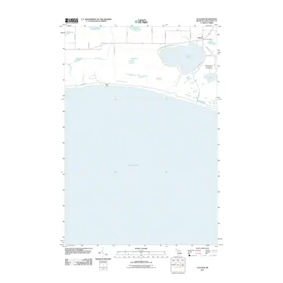 2011 Gulliver2011 Print · USGSCovers Manistique Township, including Gulliver, Doyle Township, and other nearby areas
 - 2011 Map of Manistique East, 2011 Print
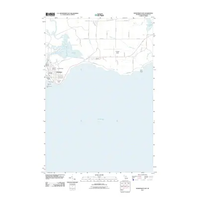 2011 Manistique East2011 Print · USGSCovers Manistique Township, including Manistique, Hiawatha Township, and other nearby areas
Showing maps 1-25 of 63
Top cities near Manistique Township
Frequently asked questions
- What are the different types of historical maps available for Manistique Township?
- What is the oldest map of Manistique Township?
- Where can I purchase historical maps of Manistique Township for my home or office?
- Where can I download high-res historical maps of Manistique Township?
- Are there historical topographic maps available for Manistique Township?
- Is there historical aerial imagery available for Manistique Township?
- Where are historical maps of Manistique Township sourced from?