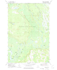
1972 Map of Smith Lake
USGS Topo · Published 1975About this map
Manistique River State Forest dominates this Schoolcraft County landscape, defined by the intricate meanders and oxbows of the Manistique River and its West Branch. The 1970s terrain reveals a complex wetland environment where numerous named sloughs, such as Kleystads Slough, Bear Town Slough, and Brassel Slough, indicate a dynamic floodplain. Higher ground is marked by the High Rollways overlooking Brace Creek, while the presence of a Gaging Station and various Gravel Pits points to active resource management and infrastructure during this period.
Find a feature on this map
33 named features on this map. Tap any name to fly to it.
Don’t see what you’re looking for? This feature index may not catch every label — zoom into the map to look around manually.
Map Details
Editions of this 1972 Smith Lake Map
This is the sole edition of this map. No revisions or reprints were ever made.
Other maps of this area

1931 · Cooks NE
USGS Topo · 1:31,680

1931 · Steuben SE
USGS Topo · 1:31,680

1931 · Manistique River NE
USGS Topo · 1:31,680

1931 · Steuben NE
USGS Topo · 1:31,680

1931 · Manistique River SE
USGS Topo · 1:31,680

1931 · Manistique River NW
USGS Topo · 1:31,680

1931 · Manistique River SW
USGS Topo · 1:31,680

1954 · Escanaba
USGS Topo · 1:250,000

1957 · Escanaba
USGS Topo · 1:250,000

1958 · Escanaba
USGS Topo · 1:250,000