1960s Maps of Tuscola County, Michigan
Explore 27 historic maps of Tuscola County from the 1960s. These maps offer a rare glimpse into what life looked like during the 1960s — showing old roads, neighborhoods, homes, and landmarks that have changed or disappeared over time.
Whether you're researching your family's past, planning a metal detecting trip, or studying how Tuscola County's landscape evolved across the 1960s, these high-resolution maps are a powerful tool for exploring the history of this region.
- Focus on a specific era: All maps on this page are from the 1960s, giving you a focused view of this time period.
- See what’s changed: Compare century-old streets, trails, and buildings to today's modern landscape using overlays and satellite layers.
- Research with precision: Use these maps for genealogy, historical research, land use analysis, or educational projects.
- View, download, or print: Maps are fully viewable online in high resolution, and can be downloaded or printed for your own records.
Start exploring Tuscola County's history through authentic maps from the 1960s. This is your window into the past.
Tuscola County, MI maps
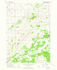
(27)- 1963 Map of Quanicassee, 1964 Print
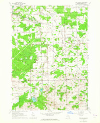
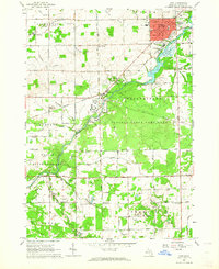
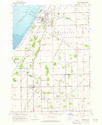
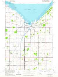 1963 Quanicassee1964 Print · USGSThe southern shores of Saginaw Bay come into focus in the early sixties, showing a landscape shaped by coastal marshes and a grid of rural roads. Genealogists and local historians can locate the Van Buren Sch, Mitchell Sch, and the community of Quanicassee at the river's mouth.2 unique versions available
 - 1963 Map of Fish Point, 1964 Print
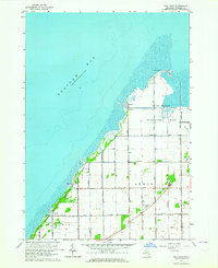 1963 Fish Point1964 Print · USGSSaginaw Bay’s southeastern shoreline is captured here in the early 1960s, showing a landscape of reclaimed marshlands and coastal hamlets. Genealogists and local historians can trace family locations near Hickory Highland Cem, the small settlement of Thomas, or the Townhall in the township of Wisner.3 unique versions available
 - 1963 Map of Clifford, 1964 Print
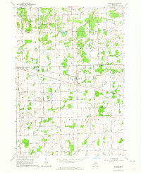 1963 Clifford1964 Print · USGSLife on the Tuscola and Lapeer county line in the early sixties centered on rail-connected villages and a network of rural schools. Genealogists and historians can trace the foundations of Silverwood, Clifford, and landmarks like St Patricks Cem or the Maple Grove Sch.
 - 1963 Map of New Greenleaf, 1964 Print
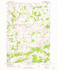 1963 New Greenleaf1964 Print · USGSAgricultural life in Michigan's Thumb is captured here during the early sixties, as drainage and rail networks sustained the rural economy. Genealogists can locate family landmarks like McTaggart Cemetery, the Stoner School, and St Columbkille Church.
 - 1963 Map of East Dayton, 1964 Print
 1963 East Dayton1964 Print · USGSTuscola County is shown in the early sixties as a mosaic of managed game areas and productive farmland. Genealogists and local historians can trace rural roots through landmarks like Bethel Ch, Frankfort Sch, and the quiet crossroads of East Dayton.
 - 1963 Map of Mayville, 1964 Print
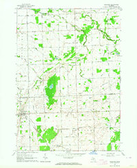
 1963 Mayville1964 Print · USGSThe rural borderlands of Tuscola and Lapeer counties are captured here in the early sixties, centered on the village of Mayville. Researchers can trace old family sites and rural landmarks like the Rich Ch, Frenzel Sch, and several historic burying grounds including Rich Cem.
 - 1963 Map of Marlette, 1964 Print
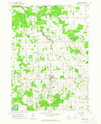
 1963 Marlette1964 Print · USGSMarlette and the surrounding farm country are captured here in the early sixties as the regional rail and drainage networks were fully matured. Genealogists and local historians can trace rural school districts like Brown School and Montgomery Sch or locate family sites near French Line Presbyterian Ch.2 unique versions available
 - 1963 Map of Fairgrove, 1964 Print
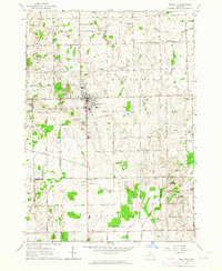
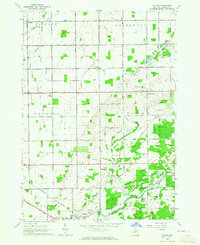
 1963 Fairgrove1964 Print · USGSThe agricultural heart of Tuscola County is captured here in the early sixties as the sugar beet and bean fields prospered. Genealogists and local historians can locate rural landmarks like Battelle Sch, the Wisner Cem, and the village of Akron.2 unique versions available
 - 1963 Map of Reese, 1964 Print
 1963 Reese1964 Print · USGSMid-Michigan's agricultural heartland is documented here in the early sixties at the intersection of the New York Central and Chesapeake and Ohio railroads. Genealogists and historians can trace local landmarks from Blumfield Corners to Richville, including family-named drains and the St Elizabeth Cem.2 unique versions available
 - 1963 Map of Kingston, 1964 Print
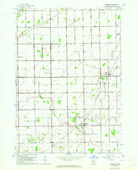
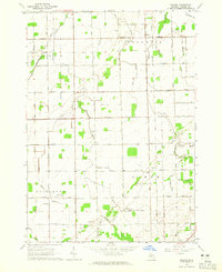
 1963 Kingston1964 Print · USGSMid-century Tuscola County is captured here during a period of steady agricultural drainage and community development. Genealogists and local historians can trace the Old Railroad Grade and locate family landmarks like Wilmot Sch, St Michaels Ch, and the Kingston Cem.2 unique versions available
 - 1963 Map of Cass City, 1964 Print
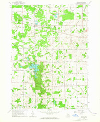
 1963 Cass City1964 Print · USGSTuscola County farming and river life are captured here in the early sixties, centered on the rail-and-river hub of Cass City. Genealogists and local historians can trace family roots through rural landmarks like Novesta Ch, Dillman Sch, and the small settlement of Deford.
 - 1963 Map of Columbiaville, 1964 Print
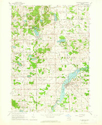 1963 Columbiaville1964 Print · USGSColumbiaville and Otter Lake appear here during the early sixties, a landscape of fertile farmland and managed waterways at the borders of three counties. Researchers can trace the New York Central Railroad corridor and locate local landmarks like Woodlawn Cem and Lakeville High Sch.2 unique versions available
 - 1963 Map of Ellington, 1964 Print
 1963 Ellington1964 Print · USGSTuscola County farmland and the river valleys of the Cass are captured here in the early sixties. Genealogists can locate family landmarks such as Colwood Ch, the Elmwood Cem, and rural schoolhouses like the George Sch or Humes Sch.
 - 1963 Map of Shabbona, 1964 Print
 1963 Shabbona1964 Print · USGSSanilac and Tuscola Counties are shown here in the early 1960s, documenting a landscape of rural townships and winding river branches. Researchers can trace family sites near Shabbona, Evergreen Cem, and country churches like Mizpah Ch.
 - 1963 Map of Gilford, 1964 Print
 1963 Gilford1964 Print · USGSTuscola County agricultural and game lands are captured here in the early sixties, showing the transition from river bottoms to structured farm sections. Researchers can locate the Watrousville Cem, the Tappan Sch, and the old rail siding at Gilford.2 unique versions available
 - 1963 Map of Gagetown, 1964 Print
 1963 Gagetown1964 Print · USGSThe borderlands of Tuscola and Huron counties are captured here in the early sixties, showing a landscape of productive farmland and small rail towns. Genealogists can trace family names through landmarks like Grant Cem, Canboro Sch, and the Grand Trunk Western RR station in Gagetown.
 - 1963 Map of Caro, 1964 Print
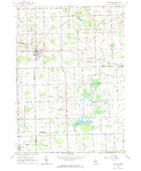
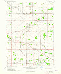
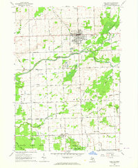
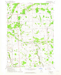
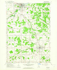
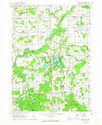
 1963 Caro1964 Print · USGSTuscola County centered on the village of Caro in the early sixties shows a landscape of river-fed industry and state institutions. Researchers can locate the Caro State Hospital, the tracks of the New York Central railroad, and local landmarks like Indianfields Cemetery.3 unique versions available
 - 1963 Map of Owendale, 1964 Print
 1963 Owendale1964 Print · USGSThe Michigan Thumb’s rural heartland is captured in the early sixties as a structured grid of farmsteads and drainage canals. Researchers can trace family ties and township history through landmarks like Owendale, St Peters Sch, and the New York Central rail line.
 - 1963 Map of Frankenmuth, 1964 Print
 1963 Frankenmuth1964 Print · USGSThe Saginaw Valley during the mid-1960s reveals a landscape of tidy farmsteads and an extensive network of drainage canals. Genealogists can trace family footprints near St Lorenz Sch, Tuscola Cem, and along the banks of the Cass River.2 unique versions available
 - 1963 Map of Vassar, 1964 Print
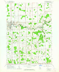
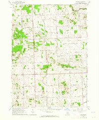
 1963 Vassar1964 Print · USGSThe Tuscola County countryside around Vassar and Millington is shown here in the early sixties as a thriving landscape of rail lines and drainage canals. Genealogists can trace family footprints near Riverside Cem, the Mennonite Mission, and several local schools like Pinkerton Sch.2 unique versions available
 - 1963 Map of Juniata, 1964 Print
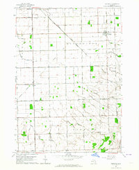
 1963 Juniata1964 Print · USGSTuscola County's rural landscape is captured here in the early sixties, showing a world of small-scale agriculture and aggregate mining. Genealogists and local historians can locate the Watertown Center Sch and trace the original Chesapeake and Ohio rail line past Juniata.2 unique versions available
 - 1963 Map of Decker, 1964 Print
 1963 Decker1964 Print · USGSIn the early 1960s, this Sanilac County landscape was a busy agricultural hub defined by its rail history and rural institutions. Researchers can locate the Old Railroad Grade passing through Hemans, the Moshier Cemetery, and several one-room schoolhouses including the Parker School.
 - 1963 Map of Barnes Lake, 1964 Print
 1963 Barnes Lake1964 Print · USGSThe Lapeer and Tuscola county line area is captured here during the early sixties, a landscape of extensive state game lands and winding river branches. Local historians can trace family roots at West Deerfield Ch or locate mid-century landmarks like Sweet Sch and Millers Lake.2 unique versions available
 - 1963 Map of Colling, 1965 Print
 1963 Colling1965 Print · USGSTuscola County farm country is mapped here in the early sixties, showing the vital drainage systems and rail lines that powered the local economy. Genealogists can trace family roots through sites like St Peters Cem, Columbia Corners, and the Almer Center Sch.2 unique versions available
 - 1963 Map of Sebewaing, 1965 Print
 1963 Sebewaing1965 Print · USGSThe Saginaw Bay shoreline and the Thumb's fertile farm country are captured here in the early sixties. Genealogists and local historians can trace the rail lines of the Chesapeake and Ohio and locate landmarks like New Salem Cem and Unionville.2 unique versions available
Showing maps 1-25 of 27
Top cities of Tuscola County
Frequently asked questions
- What are the different types of historical maps available for Tuscola County?
- What is the oldest map of Tuscola County?
- Where can I purchase historical maps of Tuscola County for my home or office?
- Where can I download high-res historical maps of Tuscola County?
- Are there historical topographic maps available for Tuscola County?
- Is there historical aerial imagery available for Tuscola County?
- Where are historical maps of Tuscola County sourced from?