1930s Maps of Washtenaw County, Michigan
Explore 4 historic maps of Washtenaw County from the 1930s. These maps offer a rare glimpse into what life looked like during the 1930s — showing old roads, neighborhoods, homes, and landmarks that have changed or disappeared over time.
Whether you're researching your family's past, planning a metal detecting trip, or studying how Washtenaw County's landscape evolved across the 1930s, these high-resolution maps are a powerful tool for exploring the history of this region.
- Focus on a specific era: All maps on this page are from the 1930s, giving you a focused view of this time period.
- See what’s changed: Compare century-old streets, trails, and buildings to today's modern landscape using overlays and satellite layers.
- Research with precision: Use these maps for genealogy, historical research, land use analysis, or educational projects.
- View, download, or print: Maps are fully viewable online in high resolution, and can be downloaded or printed for your own records.
Start exploring Washtenaw County's history through authentic maps from the 1930s. This is your window into the past.
Washtenaw County, MI maps
(4)- 1936 Map of Denton
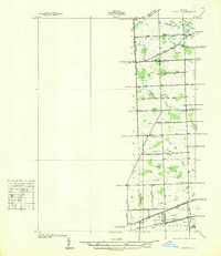 1936 Denton1936 Print · USGSThe borderlands of Washtenaw and Wayne counties come into focus during the mid-1930s, showing a landscape of small schools and intricate creek systems. Genealogists can locate family landmarks like Kinyon Cem and trace the paths of the Michigan Central Railroad through Denton.
 - 1936 Map of Maybee
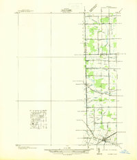 1936 Maybee1936 Print · USGSThe Monroe and Wayne County borderlands are captured here in the mid-1930s, showing a rural landscape defined by rail and drainage. Trace the Detroit Toledo & Ironton RR through Maybee or locate family sites like Palmer Sch and Sandy Hill Cem.
 - 1936 Map of Salem
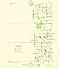 1936 Salem1936 Print · USGSNorthwestern Wayne County and southern Oakland County are captured in the mid-1930s before postwar suburbanization. Genealogists and local researchers can trace old family section lines and find landmark institutions like the Maybury Sanitarium and West Novi Sch.
 - 1936 Map of Ypsilanti East
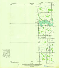 1936 Ypsilanti East1936 Print · USGSThe Washtenaw and Wayne County line in the mid-1930s is defined by the winding waters of Belleville Lake and a complex system of agricultural drains. Genealogists and local historians can locate early landmarks like Soop Cem, Willow Run Sch, and the settlement at Rawsonville.
End of results
Showing maps 1-4 of 4
Top cities of Washtenaw County
- Ann Arbor historical maps
- Ypsilanti Charter Township historical maps
- Pittsfield Charter Township historical maps
- Ypsilanti historical maps
- Scio Township historical maps
- Superior Charter Township historical maps
See more
Frequently asked questions
- What are the different types of historical maps available for Washtenaw County?
- What is the oldest map of Washtenaw County?
- Where can I purchase historical maps of Washtenaw County for my home or office?
- Where can I download high-res historical maps of Washtenaw County?
- Are there historical topographic maps available for Washtenaw County?
- Is there historical aerial imagery available for Washtenaw County?
- Where are historical maps of Washtenaw County sourced from?