Old Maps of Washtenaw County, Michigan for Hiking & Exploration
Hike through history with 185 historic maps of Washtenaw County. Explore old trails, ghost towns, and forgotten backroads — perfect for outdoor adventurers and local explorers.
- Rediscover forgotten places: Map out old mining camps, roads, and footpaths that no longer exist on modern maps.
- Layer with modern tools: Combine with LiDAR or satellite views to plan hikes through historical terrain.
- Made for exploration: Popular among hikers, overlanders, and local history lovers.
Use these maps to find adventure and explore the hidden past of Washtenaw County.
Washtenaw County, MI maps
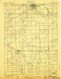
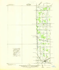
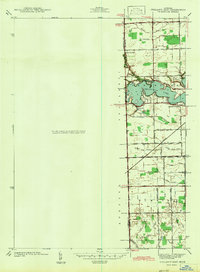
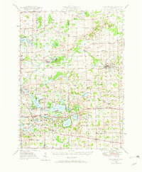
(185)- 1902 Map of South Lyon, 1954 Print
 1902 South Lyon1954 Print · USGSSoutheast Michigan at the turn of the century reveals a landscape of thriving rail junctions and rural townships across Oakland and Washtenaw counties. Trace the early footprints of Ann Arbor and South Lyon alongside historic whistle-stops like Emery and Geddes.
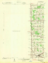
 - 1902 Map of Ypsilanti, 1958 Print
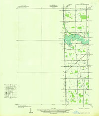
 1902 Ypsilanti1958 Print · USGSSoutheast Michigan at the turn of the century shows a landscape defined by thriving rail towns and winding river valleys. Genealogists and historians can trace the early footprints of Ypsilanti or find smaller locales like Rawsonville and Azalia along the Huron River and Michigan Central RR.
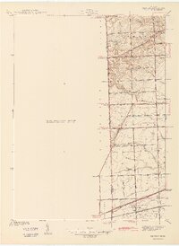
 - 1902 Map of Dexter, 1962 Print
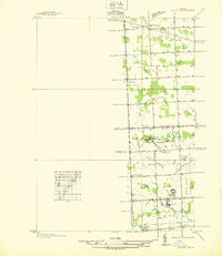
 1902 Dexter1962 Print · USGSWashtenaw and Livingston counties are captured here at the start of the 1900s, as a dense network of steam and electric railroads connected riverside mill towns. Researchers can trace the vanished industrial sites at Hudson Mills, the rail junctions at Lakeland, and the early layout of Pinckney.
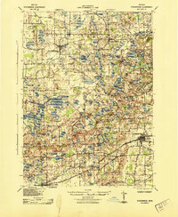
 - 1904 Map of Ann Arbor
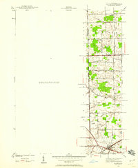
 1904 Ann Arbor1904 Print · USGSEarly twentieth-century Washtenaw County comes to life through its dense network of interurban electric lines and steam railroads. Researchers can trace the layout of Ann Arbor, locate the Duck Lake School, or find vanished stops along the Michigan Central R. R. and Ann Arbor R. R..2 unique versions available
 - 1906 Map of Ypsilanti
 1906 Ypsilanti1906 Print · USGSSoutheast Michigan at the dawn of the century reveals a landscape defined by its bustling river towns and burgeoning rail networks. Trace the early development of Ypsilanti and Milan or locate vanished stops along the Michigan Central RR and the Wabash RR.3 unique versions available
 - 1906 Map of Dexter
 1906 Dexter1906 Print · USGSSoutheast Michigan at the turn of the century shows a landscape defined by riverside mills and a dense network of glacial lakes. Genealogists and historians can trace the early rail corridors through Dexter, the mill sites at Delhi Mills, and the small villages of Pinckney and Pettysville.4 unique versions available
 - 1906 Map of Saline
 1906 Saline1906 Print · USGSSoutheastern Michigan at the start of the century was a landscape of thriving rail hubs and productive farm country. Trace the early tracks of the Lake Shore and Michigan Southern R R through the streets of Saline, Tecumseh, and the village of Clinton.4 unique versions available
 - 1906 Map of South Lyon
 1906 South Lyon1906 Print · USGSSoutheast Michigan at the turn of the century shows a landscape defined by an intricate web of steam and electric railways. Researchers can trace the early layouts of Ann Arbor and South Lyon, or locate smaller depots like Whitmore Lake Station and Rushton.5 unique versions available
 - 1908 Map of Ann Arbor
 1908 Ann Arbor1908 Print · USGSSoutheast Michigan at the turn of the century shows a landscape transitioning through the arrival of electric rail and the growth of the Huron River valley. Genealogists and researchers can trace old family lands near Saline, Ypsilanti, and Whitmore Lake, or follow the path of the Michigan Central RR.
 - 1919 Map of Stockbridge, 1958 Print
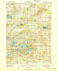
 1919 Stockbridge1958 Print · USGSSouthern Michigan at the end of the Great War is a landscape of rural school districts and expanding rail lines. Genealogists and local historians can locate dozens of country schools like Stilson School, family-named landmarks such as Sackrider Hill, and the rail junction at Bullis Crossing.2 unique versions available
 - 1922 Map of Stockbridge
 1922 Stockbridge1922 Print · USGSSoutheastern Michigan at the start of the twenties is a land of rail-connected hamlets and countless country schools. Genealogists can trace family footprints near Stockbridge and Unadilla, or locate rural landmarks like Strobel School and Sylvan Sta.3 unique versions available
 - 1936 Map of Denton
 1936 Denton1936 Print · USGSThe borderlands of Washtenaw and Wayne counties come into focus during the mid-1930s, showing a landscape of small schools and intricate creek systems. Genealogists can locate family landmarks like Kinyon Cem and trace the paths of the Michigan Central Railroad through Denton.
 - 1936 Map of Maybee
 1936 Maybee1936 Print · USGSThe Monroe and Wayne County borderlands are captured here in the mid-1930s, showing a rural landscape defined by rail and drainage. Trace the Detroit Toledo & Ironton RR through Maybee or locate family sites like Palmer Sch and Sandy Hill Cem.
 - 1936 Map of Salem
 1936 Salem1936 Print · USGSNorthwestern Wayne County and southern Oakland County are captured in the mid-1930s before postwar suburbanization. Genealogists and local researchers can trace old family section lines and find landmark institutions like the Maybury Sanitarium and West Novi Sch.
 - 1936 Map of Ypsilanti East
 1936 Ypsilanti East1936 Print · USGSThe Washtenaw and Wayne County line in the mid-1930s is defined by the winding waters of Belleville Lake and a complex system of agricultural drains. Genealogists and local historians can locate early landmarks like Soop Cem, Willow Run Sch, and the settlement at Rawsonville.
 - 1940 Map of Maybee
 1940 Maybee1940 Print · USGSSoutheast Michigan's rural townships are documented here in the early 1940s as the railroad fueled local growth. You can trace early family homesteads near the Stony Creek Cem or locate old school sites like Clayton Sch and Columbia Sch.
 - 1942 Map of Ypsilanti East
 1942 Ypsilanti East1942 Print · USGSThe Washtenaw and Wayne County border comes alive in this early wartime survey, centered on the newly created Belleville Lake. Genealogists can locate family landmarks like the Soor Cem, Willow Run Sch, and the riverside settlement of Rawsonville.
 - 1942 Map of Maybee
 1942 Maybee1942 Print · USGSSoutheastern Michigan farmlands near the Monroe and Wayne county lines are documented here in the early 1940s. Genealogists can trace family landmarks like the Sandy Hill Cem and old school sites including Palmer Sch and Clayton Sch.
 - 1942 Map of Denton
 1942 Denton1942 Print · USGSThe rural borders of Washtenaw and Wayne Counties are captured here in the early 1940s, showing a landscape of family farms and emerging crossroads. Researchers can locate the Kenyon Cem, trace the Michigan Central tracks, and find old school sites like Hanford Sch and Palmer Sch.2 unique versions available
 - 1942 Map of Stockbridge, 1943 Print
 1942 Stockbridge1943 Print · USGSSouth-central Michigan during the early Forties is revealed here as a landscape of interconnected rail towns and scattered country schoolhouses. Genealogists can locate family landmarks like Livermore School, Mausbach School, and the remote Bullis Crossing Cem near the Grand Trunk line.
 - 1945 Map of Salem
 1945 Salem1945 Print · USGSNorthwest of Detroit in the mid-1940s, this area shows a landscape transitioning between rural townships and large-scale institutions. Researchers can trace historic school sites like Putman Sch and the grounds of the Maybury Sanitarium.2 unique versions available
 - 1948 Map of Manchester, 1972 Print
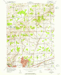
 1948 Manchester1972 Print · USGSManchester and the Irish Hills region are shown here just after the war, when the New York Central rail line still connected these rural townships. Genealogists can trace dozens of local schoolhouses and churches, such as Sharon Hill Sch and North Sharon Ch.2 unique versions available
 - 1949 Map of Manchester
 1949 Manchester1949 Print · USGSSoutheast Michigan in the late 1940s reveals a patchwork of small-town centers and lakeside retreats connected by the New York Central rail line. Genealogists can trace family roots through dozens of local sites like Raymond Cem, Iron Creek Ch, and the McMahon Sch.3 unique versions available
 - 1953 Map of Ypsilanti East, 1955 Print
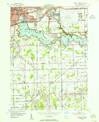 1953 Ypsilanti East1955 Print · USGSEastern Washtenaw County underwent significant industrial and aviation expansion in the 1950s, centered around the Huron River valley. Researchers can trace the development of the Willow Run Airport and locate local landmarks like the Friends Ch and Lincoln Sch.
 - 1953 Map of Denton, 1955 Print
 1953 Denton1955 Print · USGSWashtenaw County transitions from rural farmland to industrial suburban hubs during the mid-fifties. Genealogists and historians can trace the numerous local schoolhouses and rural crossroads, from Cherry Hill and Denton to the Leland Sanatorium.2 unique versions available
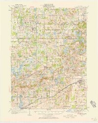
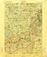
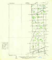
Showing maps 1-25 of 185
Top cities of Washtenaw County
- Ann Arbor historical maps
- Ypsilanti Charter Township historical maps
- Pittsfield Charter Township historical maps
- Ypsilanti historical maps
- Scio Township historical maps
- Superior Charter Township historical maps
See more
Frequently asked questions
- What are the different types of historical maps available for Washtenaw County?
- What is the oldest map of Washtenaw County?
- Where can I purchase historical maps of Washtenaw County for my home or office?
- Where can I download high-res historical maps of Washtenaw County?
- Are there historical topographic maps available for Washtenaw County?
- Is there historical aerial imagery available for Washtenaw County?
- Where are historical maps of Washtenaw County sourced from?