1980s Maps of Washtenaw County, Michigan
Explore 7 historic maps of Washtenaw County from the 1980s. These maps offer a rare glimpse into what life looked like during the 1980s — showing old roads, neighborhoods, homes, and landmarks that have changed or disappeared over time.
Whether you're researching your family's past, planning a metal detecting trip, or studying how Washtenaw County's landscape evolved across the 1980s, these high-resolution maps are a powerful tool for exploring the history of this region.
- Focus on a specific era: All maps on this page are from the 1980s, giving you a focused view of this time period.
- See what’s changed: Compare century-old streets, trails, and buildings to today's modern landscape using overlays and satellite layers.
- Research with precision: Use these maps for genealogy, historical research, land use analysis, or educational projects.
- View, download, or print: Maps are fully viewable online in high resolution, and can be downloaded or printed for your own records.
Start exploring Washtenaw County's history through authentic maps from the 1980s. This is your window into the past.
Washtenaw County, MI maps
(7)- 1980 Map of Norvell, 1981 Print
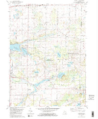 1980 Norvell1981 Print · USGSThe Jackson County countryside during the late seventies reveals a landscape of lakeside retreats and small-town junctions. Genealogists and local historians can trace family locations near Napoleon, Norvell, and rural landmarks like Long School and Maple Grove Cem.2 unique versions available
 - 1980 Map of Manchester, 1981 Print
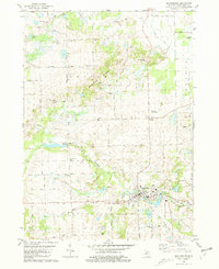 1980 Manchester1981 Print · USGSManchester and its rural surroundings in Washtenaw County are shown here in the early eighties, centered on the Raisin River and the village core. Genealogists and local historians can locate several family burial sites like Oak Grove Cem and community landmarks such as Rowes Corner and Sharon Ch.
 - 1980 Map of Tipton, 1981 Print
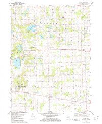 1980 Tipton1981 Print · USGSLenawee County and the Irish Hills region appear in the late 1970s as a landscape of glacial lakes and quiet crossroads. Genealogists and local historians can locate several family cemeteries like Franklin Cem and trace the path of the Old Railroad Grade near Tipton.
 - 1980 Map of Onsted, 1981 Print
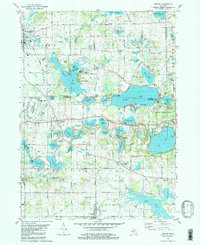 1980 Onsted1981 Print · USGSThe Irish Hills region in the early eighties was a bustling hub of lakefront recreation and automotive racing. Genealogists and local historians can locate Maple Shade Cem, the landmark St Joseph Shrine, and old routes through Brooklyn and Onsted.2 unique versions available
 - 1983 Map of Jackson, 1984 Print
 1983 Jackson1984 Print · USGSJackson and the surrounding lake country are shown in the early eighties as a hub of rail transit and outdoor recreation. Local historians can trace institutional footprints like the State Prison Farm or explore the landscape of Minards Mill and Olivet College.
 - 1985 Map of Detroit
 1985 Detroit1985 Print · USGSSoutheast Michigan in the mid-eighties shows a landscape defined by industrial power and suburban reach from the Detroit River to the Huron Valley. Researchers can trace the rail lines of the Conrail, explore the grounds of the University of Michigan, and locate numerous sites like Mt Olivet Cem.
 - 1989 Map of Detroit, 1991 Print
 1989 Detroit1991 Print · USGSSoutheast Michigan and across the river into Ontario reached a point of peak metropolitan density at the end of the 1980s. Local researchers can trace the footprint of the University of Michigan campus, the industrial waterfronts of Wyandotte, and the extensive grounds of Glen Eden Cem.
End of results
Showing maps 1-7 of 7
Top cities of Washtenaw County
- Ann Arbor historical maps
- Ypsilanti Charter Township historical maps
- Pittsfield Charter Township historical maps
- Ypsilanti historical maps
- Scio Township historical maps
- Superior Charter Township historical maps
See more
Frequently asked questions
- What are the different types of historical maps available for Washtenaw County?
- What is the oldest map of Washtenaw County?
- Where can I purchase historical maps of Washtenaw County for my home or office?
- Where can I download high-res historical maps of Washtenaw County?
- Are there historical topographic maps available for Washtenaw County?
- Is there historical aerial imagery available for Washtenaw County?
- Where are historical maps of Washtenaw County sourced from?