Old Maps of Manchester Township, Michigan for Academic Research
Study the evolution of Manchester Township with 30 high-resolution historic maps. Whether you're teaching, researching, or modeling changes in land use, these maps provide essential visual documentation of urban, environmental, and geographic change.
- Analyze long-term change: Track patterns in development, transportation, and natural features.
- Ideal for environmental or urban studies: Support academic projects with primary historical map data.
- Use in the classroom or lab: Educators and researchers rely on these maps to bring historical context to life.
These maps are a powerful tool for teaching, research, and visualizing how Manchester Township has changed over the decades.
Manchester Township, MI maps
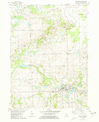
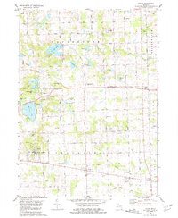
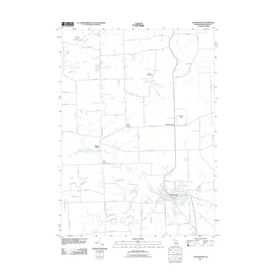
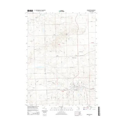
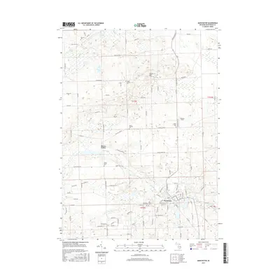
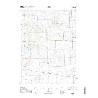
(30)- 1948 Map of Manchester, 1972 Print
 1948 Manchester1972 Print · USGSManchester and the Irish Hills region are shown here just after the war, when the New York Central rail line still connected these rural townships. Genealogists can trace dozens of local schoolhouses and churches, such as Sharon Hill Sch and North Sharon Ch.2 unique versions available
 - 1949 Map of Manchester
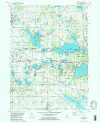
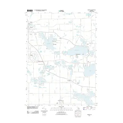
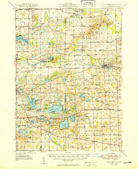 1949 Manchester1949 Print · USGSSoutheast Michigan in the late 1940s reveals a patchwork of small-town centers and lakeside retreats connected by the New York Central rail line. Genealogists can trace family roots through dozens of local sites like Raymond Cem, Iron Creek Ch, and the McMahon Sch.3 unique versions available
 - 1958 Map of Grand Rapids, 1973 Print
 1958 Grand Rapids1973 Print · USGSSouthern Michigan at the peak of the postwar era shows a landscape of burgeoning cities and new interstate highways. Trace family roots and regional growth in Grand Rapids, Battle Creek, and the glacial lake country around Gun Lake or Gull Lake.2 unique versions available
 - 1961 Map of Grand Rapids
 1961 Grand Rapids1961 Print · USGSSouthern Michigan at the dawn of the 1960s reveals a region shaped by major river systems and a robust rail network. Trace mid-century industrial growth and land use from Grand Rapids to the Fort Custer Military Reservation and Gun Lake.
 - 1962 Map of Grand Rapids
 1962 Grand Rapids1962 Print · USGSMid-century Southern Michigan is mapped here at a time of massive growth, showing the expanding urban footprints of Grand Rapids and Lansing. Researchers can trace the legacy of the Grand Trunk Western RR, find historic boundaries of the Fort Custer Military Reservation, or locate sporting camps around Gun Lake.2 unique versions available
 - 1980 Map of Norvell, 1981 Print
 1980 Norvell1981 Print · USGSThe Jackson County countryside during the late seventies reveals a landscape of lakeside retreats and small-town junctions. Genealogists and local historians can trace family locations near Napoleon, Norvell, and rural landmarks like Long School and Maple Grove Cem.2 unique versions available
 - 1980 Map of Manchester, 1981 Print
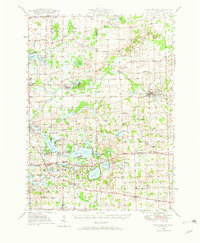
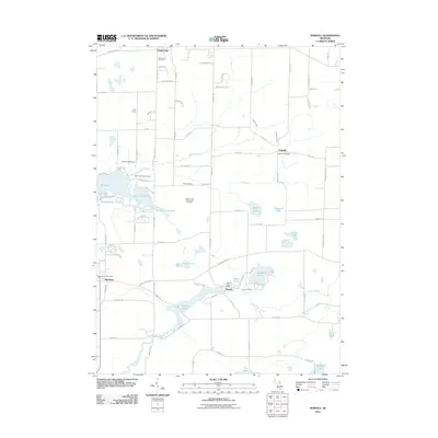
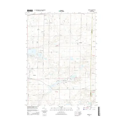
 1980 Manchester1981 Print · USGSManchester and its rural surroundings in Washtenaw County are shown here in the early eighties, centered on the Raisin River and the village core. Genealogists and local historians can locate several family burial sites like Oak Grove Cem and community landmarks such as Rowes Corner and Sharon Ch.
 - 1980 Map of Tipton, 1981 Print
 1980 Tipton1981 Print · USGSLenawee County and the Irish Hills region appear in the late 1970s as a landscape of glacial lakes and quiet crossroads. Genealogists and local historians can locate several family cemeteries like Franklin Cem and trace the path of the Old Railroad Grade near Tipton.
 - 1980 Map of Onsted, 1981 Print
 1980 Onsted1981 Print · USGSThe Irish Hills region in the early eighties was a bustling hub of lakefront recreation and automotive racing. Genealogists and local historians can locate Maple Shade Cem, the landmark St Joseph Shrine, and old routes through Brooklyn and Onsted.2 unique versions available
 - 1983 Map of Jackson, 1984 Print
 1983 Jackson1984 Print · USGSJackson and the surrounding lake country are shown in the early eighties as a hub of rail transit and outdoor recreation. Local historians can trace institutional footprints like the State Prison Farm or explore the landscape of Minards Mill and Olivet College.
 - 2011 Map of Tipton, 2011 Print
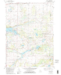
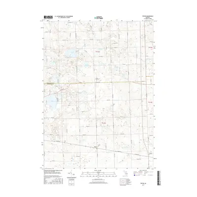
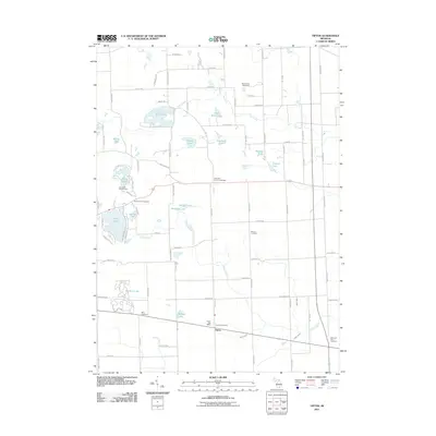 2011 Tipton2011 Print · USGSCovers Manchester Township, including Bridgewater Township, Franklin Township, and other nearby areas
 - 2011 Map of Norvell, 2011 Print
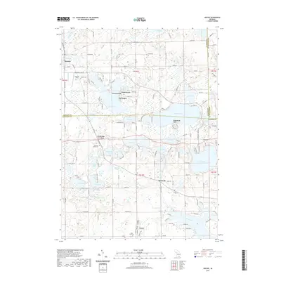
 2011 Norvell2011 Print · USGSCovers Manchester Township, including Napoleon, Norvell, and other nearby areas
 - 2011 Map of Manchester, 2011 Print
 2011 Manchester2011 Print · USGSCovers Manchester Township, including Sylvan Township, Manchester, and other nearby areas
 - 2011 Map of Onsted, 2011 Print
 2011 Onsted2011 Print · USGSCovers Manchester Township, including Brooklyn, Onsted, and other nearby areas
 - 2014 Map of Tipton, 2014 Print
 2014 Tipton2014 Print · USGSCovers Manchester Township, including Bridgewater Township, Franklin Township, and other nearby areas
 - 2014 Map of Onsted, 2014 Print
 2014 Onsted2014 Print · USGSCovers Manchester Township, including Brooklyn, Onsted, and other nearby areas
 - 2014 Map of Manchester, 2014 Print
 2014 Manchester2014 Print · USGSCovers Manchester Township, including Sylvan Township, Manchester, and other nearby areas
 - 2014 Map of Norvell, 2014 Print
 2014 Norvell2014 Print · USGSCovers Manchester Township, including Napoleon, Norvell, and other nearby areas
 - 2017 Map of Onsted, 2017 Print
 2017 Onsted2017 Print · USGSCovers Manchester Township, including Brooklyn, Onsted, and other nearby areas
 - 2017 Map of Norvell, 2017 Print
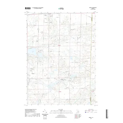
 2017 Norvell2017 Print · USGSCovers Manchester Township, including Napoleon, Norvell, and other nearby areas
 - 2017 Map of Manchester, 2017 Print
 2017 Manchester2017 Print · USGSCovers Manchester Township, including Sylvan Township, Manchester, and other nearby areas
 - 2017 Map of Tipton, 2017 Print
 2017 Tipton2017 Print · USGSCovers Manchester Township, including Bridgewater Township, Franklin Township, and other nearby areas
 - 2019 Map of Onsted, 2019 Print
 2019 Onsted2019 Print · USGSCovers Manchester Township, including Brooklyn, Onsted, and other nearby areas
 - 2019 Map of Norvell, 2019 Print
 2019 Norvell2019 Print · USGSCovers Manchester Township, including Napoleon, Norvell, and other nearby areas
 - 2019 Map of Tipton, 2019 Print
 2019 Tipton2019 Print · USGSCovers Manchester Township, including Bridgewater Township, Franklin Township, and other nearby areas
Showing maps 1-25 of 30
Top cities near Manchester Township
- Adrian historical maps
- Scio Township historical maps
- Leoni historical maps
- Tecumseh historical maps
- Napoleon historical maps
- Webster Township historical maps
See more
Top neighborhoods of Manchester Township
Frequently asked questions
- What are the different types of historical maps available for Manchester Township?
- What is the oldest map of Manchester Township?
- Where can I purchase historical maps of Manchester Township for my home or office?
- Where can I download high-res historical maps of Manchester Township?
- Are there historical topographic maps available for Manchester Township?
- Is there historical aerial imagery available for Manchester Township?
- Where are historical maps of Manchester Township sourced from?