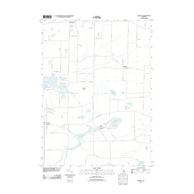
2011 Map of Norvell
USGS Topo · Published 2011About this map
The River Raisin meanders through this landscape in southern Michigan, anchoring a chain of glacial water bodies including Norvell Lake, Sweezy Lake, and Watkins Lake. The small community of Norvell sits at the confluence of the river and local roads, marked by the Norvell Post Office. To the west, the settlement of Napoleon is defined by a more structured grid, while Fishville remains a smaller cluster of homes to the east near the Fishville Cemetery.
Find a feature on this map
63 named features on this map. Tap any name to fly to it.
Don’t see what you’re looking for? This feature index may not catch every label — zoom into the map to look around manually.
Map Details
Editions of this 2011 Norvell Map
This is the sole edition of this map. No revisions or reprints were ever made.
Other maps of this area

1919 · Stockbridge
USGS Topo · 1:62,500

1919 · Rives Junction
USGS Topo · 1:62,500

1921 · Rives Junction
USGS Topo · 1:62,500

1922 · Stockbridge
USGS Topo · 1:62,500

1935 · Jackson
USGS Topo · 1:48,000

1939 · Jackson
USGS Topo · 1:62,500

1942 · Stockbridge
USGS Topo · 1:62,500

1948 · Manchester
USGS Topo · 1:62,500

1949 · Manchester
USGS Topo · 1:62,500

1958 · Grand Rapids
USGS Topo · 1:250,000