1960s Maps of Becker County, Minnesota
Explore 31 historic maps of Becker County from the 1960s. These maps offer a rare glimpse into what life looked like during the 1960s — showing old roads, neighborhoods, homes, and landmarks that have changed or disappeared over time.
Whether you're researching your family's past, planning a metal detecting trip, or studying how Becker County's landscape evolved across the 1960s, these high-resolution maps are a powerful tool for exploring the history of this region.
- Focus on a specific era: All maps on this page are from the 1960s, giving you a focused view of this time period.
- See what’s changed: Compare century-old streets, trails, and buildings to today's modern landscape using overlays and satellite layers.
- Research with precision: Use these maps for genealogy, historical research, land use analysis, or educational projects.
- View, download, or print: Maps are fully viewable online in high resolution, and can be downloaded or printed for your own records.
Start exploring Becker County's history through authentic maps from the 1960s. This is your window into the past.
Becker County, MN maps
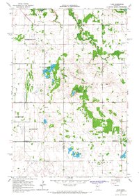
(31)- 1965 Map of Brainerd
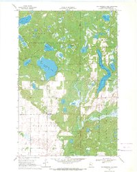
 1965 Brainerd1965 Print · USGSNorth-central Minnesota in the mid-fifties presents a complex landscape of sprawling lake systems and established rail corridors. Genealogists and historians can trace the growth of timber towns along the Northern Pacific RR and explore early borders of the White Earth Indian Reservation or Tamarac National Wildlife Refuge.
 - 1966 Map of Flom, 1963 Print
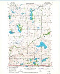
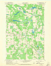
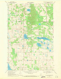
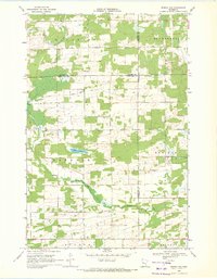
 1966 Flom1963 Print · USGSThe rural borderlands of Norman, Clay, and Becker counties are captured here in the mid-1960s. Genealogists and local historians can trace family roots through sites like Wild Rice Ch, Bethlehem Cem, and the old Townhall.2 unique versions available
 - 1966 Map of Grand Forks
 1966 Grand Forks1966 Print · USGSThe Red River Valley in the mid-sixties shows a landscape shaped by rail-line commerce and complex water management. Genealogists and historians can trace rail-side towns like Emerado and Hunter or locate rural landmarks like the Pleasant View Church.
 - 1966 Map of Tilde Lake, 1967 Print
 1966 Tilde Lake1967 Print · USGSThe borderlands of Clay and Becker counties come alive in the mid-1960s, showing a landscape of glacial lakes and prairie drainage. Researchers can trace rural life through the Atlanta Ch, the local Townhall, and the expansive Goose Prairie State Wildlife Management Area.
 - 1966 Map of Flom SE, 1967 Print
 1966 Flom SE1967 Print · USGSBecker County’s prairie-and-wetland landscape is captured here in the mid-1960s, divided by the White Earth Indian Reservation Boundary. Researchers can trace old township lines and find local landmarks like the Townhall, Cucumber Lake, and the Buffalo River.
 - 1966 Map of Flom NE, 1967 Print
 1966 Flom NE1967 Print · USGSNorthwestern Minnesota in the mid-sixties reveals a landscape of transition along the White Earth Indian Reservation Boundary. Genealogists and local historians can trace rural roads to a community Townhall or locate family lands near Apple Lake and Spring Creek.
 - 1966 Map of Big Cormorant Lake, 1967 Print
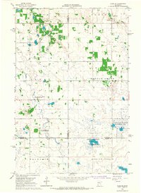
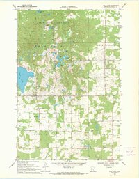
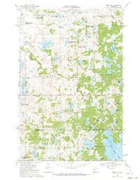
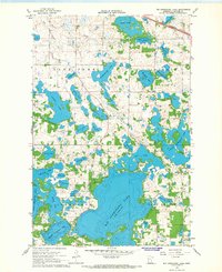 1966 Big Cormorant Lake1967 Print · USGSBecker County’s lake country is captured here in the mid-1960s, showing a complex network of glacial waters and early rural infrastructure. Genealogists and local historians can locate Strandvik Ch, the Audubon Cem, and the tracks of the Northern Pacific railroad.
 - 1966 Map of Dale, 1967 Print
 1966 Dale1967 Print · USGSRailroad hubs and prairie wetlands converge in Clay County during the mid-sixties, capturing the height of the regional rail network. Genealogists and historians can trace the foundations of local life at Manitoba Junction, Dale, and the Highland Grove Ch.
 - 1966 Map of Lake Park, 1967 Print
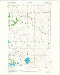
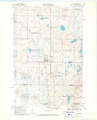
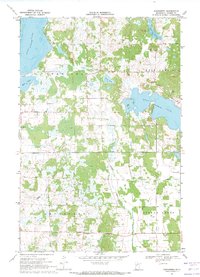
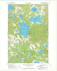
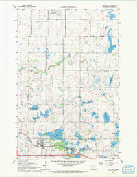 1966 Lake Park1967 Print · USGSThe Lake Park area of Becker County is shown here in the mid-1960s as a thriving rail town surrounded by numerous glacial lakes. Genealogists and local historians can trace family roots through Baarstad Cem, Saron Ch, and the rail-side growth of Lake Park.
 - 1966 Map of Lake Park SW, 1968 Print
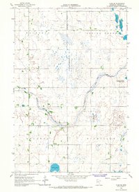
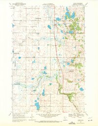
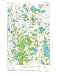 1966 Lake Park SW1968 Print · USGSThe lake-strewn border of Clay and Becker counties is captured here in the mid-1960s, showing a landscape shaped by Scandinavian heritage and glacial geology. Researchers can locate family landmarks like Solem Ch and Christ Olson Lake, or trace the development of rural roads past the Townhall and local Gravel Pits.
 - 1969 Map of Many Point Lake, 1971 Print
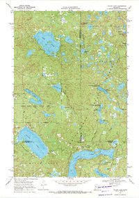
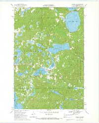
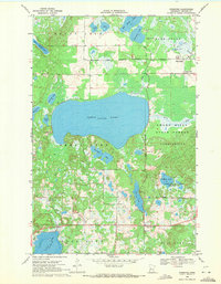
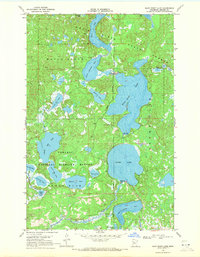 1969 Many Point Lake1971 Print · USGSBecker County’s glacial lake country is captured in the late sixties, showcasing the intersection of the White Earth State Forest and protected wetlands. Researchers can trace intricate water systems from Many Point Lake and Round Lake to the flow of the Otter Tail River.
 - 1969 Map of Wolf Lake, 1971 Print
 1969 Wolf Lake1971 Print · USGSBecker County’s glacial lake country and timberlands are captured here in the late sixties, showing the transition from forest to farmland. Trace family roots and local landmarks at Wolf Lake, Midway, and country churches like Spruce Grove Ch.
 - 1969 Map of Waubun, 1971 Print
 1969 Waubun1971 Print · USGSThe White Earth Indian Reservation in the late sixties reveals a landscape of prairie wetlands and township settlements. Local historians can locate St Anns Cem, trace the waters of Waubun Lake, and explore the grid of Waubun and its surrounding wildlife management areas.
 - 1969 Map of Ogema, 1971 Print
 1969 Ogema1971 Print · USGSIn the late 1960s, the village of Ogema served as a key railroad stop within the White Earth Indian Reservation. Genealogists and historians can trace the local landscape through landmarks like Most Holy Redeemer Ch, the Ogema Cem, and the path of the Soo Line rail.
 - 1969 Map of Tulaby Lake, 1971 Print
 1969 Tulaby Lake1971 Print · USGSThe White Earth Indian Reservation in the late sixties is a dense mosaic of glacial lakes and state-managed timberlands. Researchers can locate the small community at Elbow Lake Village or trace routes past St Frances Cabrini Ch and Strawberry Mountain.2 unique versions available
 - 1969 Map of Evergreen, 1971 Print
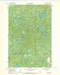
 1969 Evergreen1971 Print · USGSBecker County’s lake country is captured here in the late sixties, showing a landscape shaped by water and wood. Genealogists can trace local roots through the Evergreen settlement and landmarks like Zion Ch and Palm Cem.2 unique versions available
 - 1969 Map of Park Rapids SW, 1971 Print
 1969 Park Rapids SW1971 Print · USGSBecker, Hubbard, and Wadena Counties meet in this late 1960s landscape dominated by the Shell River and Straight River. Genealogists and local historians can trace family ties at Green Valley Cemetery or Alajoki Cemetery.
 - 1969 Map of Anchor Hill, 1971 Print
 1969 Anchor Hill1971 Print · USGSNorthern Minnesota wilderness and conservation lands are captured here in the late sixties. Researchers can trace the White Earth Indian Reservation Boundary, an Old Railroad Grade, and the Anchor Hill Lookout Tower.2 unique versions available
 - 1969 Map of New York Mills NW, 1971 Print
 1969 New York Mills NW1971 Print · USGSOtter Tail and Becker counties meet in this 1960s survey of Minnesota lake country, where state wildlife areas preserve significant wetland habitats. Researchers can locate rural landmarks like St Johns Ch, Townhall, and the Spruce Grove Cem.
 - 1969 Map of Ogema NE, 1971 Print
 1969 Ogema NE1971 Print · USGSMahnomen and Becker counties are captured in the late sixties within the White Earth Indian Reservation. Genealogists and local historians can trace family-named landmarks like Kersting Lake, find the Lake Grove Ch, and locate the community Townhall.
 - 1969 Map of Strawberry Lake, 1971 Print
 1969 Strawberry Lake1971 Print · USGSBecker County’s glacial lakelands are documented here in the late sixties, entirely contained within the White Earth Indian Reservation. Genealogists and historians can locate community landmarks such as Strawberry Lake Ch, the Strawberry Lake Sch, and the Egg Lake Lookout Tower.
 - 1969 Map of Snider Lake, 1971 Print
 1969 Snider Lake1971 Print · USGSThe White Earth Indian Reservation in the late sixties is shown here as a landscape of dense forest and deep glacial lakes. Researchers can locate the Tulaby Lookout Tower, a lakeside Cem, and forest trails near Snider Lake.2 unique versions available
 - 1969 Map of Big Basswood Lake, 1971 Print
 1969 Big Basswood Lake1971 Print · USGSBecker County’s glacial lake country is captured here in the late sixties, showing the intersection of state forests and reservation lands. Researchers can locate Lakeside Cemetery and trace old logging and recreation routes like Scenic Road near Big Basswood Lake.
 - 1969 Map of Sebeka NW, 1971 Print
 1969 Sebeka NW1971 Print · USGSThe tri-county borderlands of Minnesota are preserved here in the late sixties, showing a landscape of small townships and drainage networks. Genealogists can locate family-named landmarks and rural institutions like Runeberg Ch, White Oak Sch, and Grace Cem.
 - 1969 Map of Ponsford, 1971 Print
 1969 Ponsford1971 Print · USGSThe White Earth Indian Reservation and the Smoky Hills woods meet in this late-sixties record of Becker County. Genealogists and local historians can locate the Grand Medicine Cem, trace the community of Ponsford, and find rural landmarks like Emmanuel Ch.2 unique versions available
Showing maps 1-25 of 31
Top cities of Becker County
- Detroit Lakes historical maps
- Lake Eunice historical maps
- Frazee historical maps
- Cormorant historical maps
- White Earth historical maps
- Lake Park historical maps
See more
Frequently asked questions
- What are the different types of historical maps available for Becker County?
- What is the oldest map of Becker County?
- Where can I purchase historical maps of Becker County for my home or office?
- Where can I download high-res historical maps of Becker County?
- Are there historical topographic maps available for Becker County?
- Is there historical aerial imagery available for Becker County?
- Where are historical maps of Becker County sourced from?