
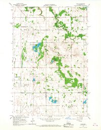
1966 Map of Flom
USGS Topo · Published 1963About this map
Fossum and Flom anchor this mid-1960s landscape where Norman, Clay, and Becker counties converge. The terrain is defined by the glacial legacy of the Wild Rice region, featuring the prominent elevation of Frenchmans Bluff and the waters of Home Lake. This area reflects a deeply rooted Lutheran heritage, evidenced by numerous rural sanctuaries including Wild Rice Ch, Immanuel Ch, Aspelund Ch, and Walworth Ch, alongside the Bethlehem Cem. Significant portions of the land are dedicated to conservation, with the Home Lake State Wildlife Management Area and Vangsness State Wildlife Management Area protecting the prairie and wetland habitats. The survey also documents the local infrastructure of the era, from the Townhall in Walworth to the network of drainage works such as County Ditch No 46.
Find a feature on this map
28 named features on this map. Tap any name to fly to it.
Don’t see what you’re looking for? This feature index may not catch every label — zoom into the map to look around manually.
Map Details
Editions of this 1966 Flom Map
2 editions found
Other maps of this area

1918 · Twin Valley
USGS Topo · 1:62,500

1918 · Flom
USGS Topo · 1:62,500

1918 · Ulen
USGS Topo · 1:62,500

1952 · Grand Forks
USGS Topo · 1:250,000

1956 · Grand Forks
USGS Topo · 1:250,000

1965 · Waukon
USGS Topo · 1:24,000

1965 · Twin Valley
USGS Topo · 1:24,000

1965 · Syre
USGS Topo · 1:24,000

1966 · Grand Forks
USGS Topo · 1:250,000
1966 · Tilde Lake
USGS Topo · 1:24,000