Old Maps of Bucks Mill, Minnesota for Hiking & Exploration
Hike through history with 13 historic maps of Bucks Mill. Explore old trails, ghost towns, and forgotten backroads — perfect for outdoor adventurers and local explorers.
- Rediscover forgotten places: Map out old mining camps, roads, and footpaths that no longer exist on modern maps.
- Layer with modern tools: Combine with LiDAR or satellite views to plan hikes through historical terrain.
- Made for exploration: Popular among hikers, overlanders, and local history lovers.
Use these maps to find adventure and explore the hidden past of Bucks Mill.
Bucks Mill, MN maps
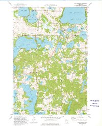
(13)- 1912 Map of Vergas, 1969 Print
 1912 Vergas1969 Print · USGSOtter Tail County was a patchwork of glaciated lakes and early rail lines in the years preceding the Great War. You can trace the path of the Winnipeg Line through Vergas and locate over twenty rural school sites including Jacobs School and School No 116.
 - 1915 Map of Vergas
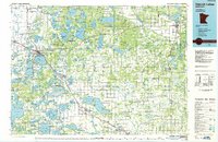
 1915 Vergas1915 Print · USGSThe lake country of Otter Tail and Becker counties is captured here in the early twentieth century as recreation began to meet rural industry. Researchers can find numerous country schoolhouses, early lodges like Pelican Inn, and the Fricke Mill site near Lake Melissa.6 unique versions available
 - 1953 Map of Brainerd, 1966 Print
 1953 Brainerd1966 Print · USGSCentral Minnesota's lake country and iron ranges are detailed in the mid-fifties, showing the intersection of industry and wilderness. Researchers can locate specific local landmarks like the Crow Wing County Courthouse or trace the early paths of the Soo Line Railroad and the Cuyuna Range Iron Mines.3 unique versions available
 - 1957 Map of Brainerd
 1957 Brainerd1957 Print · USGSNorth-central Minnesota's lake-rich landscape is captured in the mid-1950s as a crossroads of rail, river, and forest. Genealogists and historians can trace the paths of the Great Northern and Soo Line railroads through hubs like Brainerd, Wadena, and Detroit Lakes.
 - 1958 Map of Brainerd
 1958 Brainerd1958 Print · USGSCentral Minnesota in the late fifties is a landscape of dense lake chains, rail hubs, and sprawling state forests. Genealogists and local historians can trace old property alignments near the Mississippi River or locate family sites in Brainerd, Little Falls, and Detroit Lakes.
 - 1965 Map of Brainerd
 1965 Brainerd1965 Print · USGSNorth-central Minnesota in the mid-fifties presents a complex landscape of sprawling lake systems and established rail corridors. Genealogists and historians can trace the growth of timber towns along the Northern Pacific RR and explore early borders of the White Earth Indian Reservation or Tamarac National Wildlife Refuge.
 - 1973 Map of Lake Franklin, 1975 Print
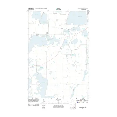
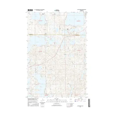
 1973 Lake Franklin1975 Print · USGSIn the lake-country of the early seventies, this survey traces the township lines of Dunn and Candor through a terrain of complex waterways. Genealogists and local historians can find family landmarks like Bucks Mill, Lake Eunice Cemetery, and Augustana Church.
 - 1986 Map of Detroit Lakes
 1986 Detroit Lakes1986 Print · USGSBecker and Otter Tail counties in the 1980s reveal a landscape of vast wildlife refuges and glacial lakes. Genealogists and historians can trace the rail corridor through Detroit Lakes and Perham or locate family sites near Sugar Bush Lake and Smoky Hill Lookout.2 unique versions available
 - 2010 Map of Lake Franklin, 2010 Print
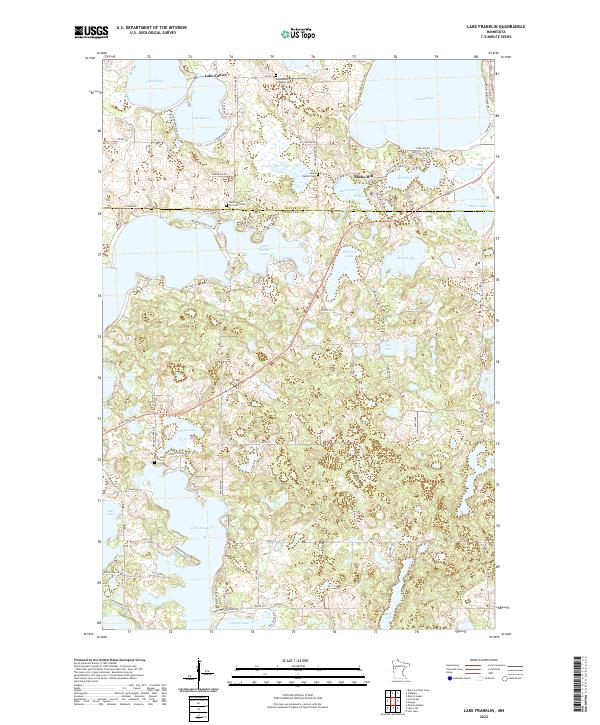
 2010 Lake Franklin2010 Print · USGSCovers Bucks Mill, including Lake Eunice, Otter Tail County, and other nearby areas
 - 2013 Map of Lake Franklin, 2013 Print
 2013 Lake Franklin2013 Print · USGSCovers Bucks Mill, including Lake Eunice, Otter Tail County, and other nearby areas
 - 2016 Map of Lake Franklin, 2016 Print
 2016 Lake Franklin2016 Print · USGSCovers Bucks Mill, including Lake Eunice, Otter Tail County, and other nearby areas
 - 2019 Map of Lake Franklin, 2019 Print
 2019 Lake Franklin2019 Print · USGSCovers Bucks Mill, including Lake Eunice, Otter Tail County, and other nearby areas
 - 2022 Map of Lake Franklin, 2022 Print
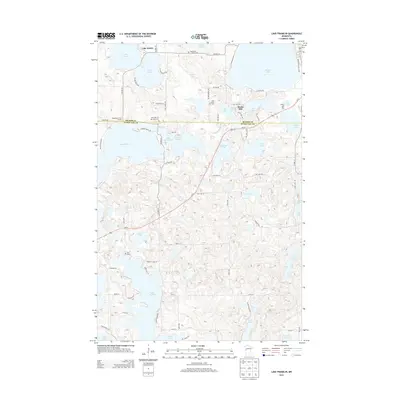
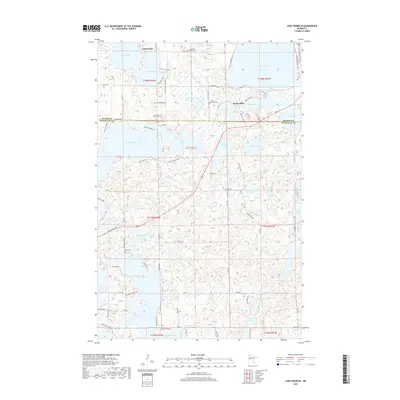
 2022 Lake Franklin2022 Print · USGSThe lake country of West-Central Minnesota is documented here in the early twenty-first century, spanning the border of Becker and Otter Tail counties. Researchers can trace local history through sites like Bucks Mill, Lake Eunice Cem, and Saint Mary of the Lakes.
End of results
Showing maps 1-13 of 13
Top cities near Bucks Mill
- Detroit Lakes historical maps
- Pelican Rapids historical maps
- Lake Eunice historical maps
- Frazee historical maps
- Cormorant historical maps
- Lake Park historical maps
See more
Frequently asked questions
- What are the different types of historical maps available for Bucks Mill?
- What is the oldest map of Bucks Mill?
- Where can I purchase historical maps of Bucks Mill for my home or office?
- Where can I download high-res historical maps of Bucks Mill?
- Are there historical topographic maps available for Bucks Mill?
- Is there historical aerial imagery available for Bucks Mill?
- Where are historical maps of Bucks Mill sourced from?