Old Maps of Frazee, Minnesota for Genealogy
Trace your family roots with 12 historic maps of Frazee. These high-res maps reveal old neighborhoods, homesites, landmarks, and streets — helping you uncover where your ancestors lived and how the area evolved over time.
- Explore historic neighborhoods: Identify where your relatives may have lived in the 1800s or 1900s.
- Compare maps over time: Trace the changes in streets, buildings, and landmarks for multi-generational research.
- Perfect for genealogy & ancestry research: Used by family historians and researchers to map out lineage and migration.
These maps are an incredible resource for exploring your personal connection to Frazee's past.
Frazee, MN maps
(12)- 1915 Map of Perham
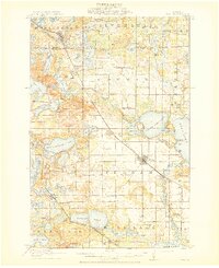 1915 Perham1915 Print · USGSOtter Tail County was a landscape of steam and water in the early twentieth century. Genealogists can trace family footprints through numerous rural school sites like School No 132 and settlements along the Northern Pacific including Perham and Frazee.3 unique versions available
 - 1953 Map of Brainerd, 1966 Print
 1953 Brainerd1966 Print · USGSCentral Minnesota's lake country and iron ranges are detailed in the mid-fifties, showing the intersection of industry and wilderness. Researchers can locate specific local landmarks like the Crow Wing County Courthouse or trace the early paths of the Soo Line Railroad and the Cuyuna Range Iron Mines.3 unique versions available
 - 1957 Map of Brainerd
 1957 Brainerd1957 Print · USGSNorth-central Minnesota's lake-rich landscape is captured in the mid-1950s as a crossroads of rail, river, and forest. Genealogists and historians can trace the paths of the Great Northern and Soo Line railroads through hubs like Brainerd, Wadena, and Detroit Lakes.
 - 1958 Map of Brainerd
 1958 Brainerd1958 Print · USGSCentral Minnesota in the late fifties is a landscape of dense lake chains, rail hubs, and sprawling state forests. Genealogists and local historians can trace old property alignments near the Mississippi River or locate family sites in Brainerd, Little Falls, and Detroit Lakes.
 - 1965 Map of Brainerd
 1965 Brainerd1965 Print · USGSNorth-central Minnesota in the mid-fifties presents a complex landscape of sprawling lake systems and established rail corridors. Genealogists and historians can trace the growth of timber towns along the Northern Pacific RR and explore early borders of the White Earth Indian Reservation or Tamarac National Wildlife Refuge.
 - 1973 Map of Frazee, 1976 Print
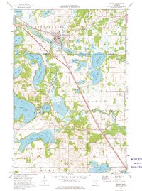 1973 Frazee1976 Print · USGSFrazee and its surrounding lake country are captured in the 1970s as the railroad and river define the region's geography. Genealogists and local historians can trace family locations near Sacred Heart Cem or the smaller settlement of Luce.
 - 1986 Map of Detroit Lakes
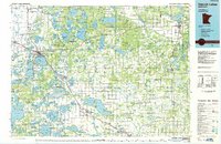 1986 Detroit Lakes1986 Print · USGSBecker and Otter Tail counties in the 1980s reveal a landscape of vast wildlife refuges and glacial lakes. Genealogists and historians can trace the rail corridor through Detroit Lakes and Perham or locate family sites near Sugar Bush Lake and Smoky Hill Lookout.2 unique versions available
 - 2010 Map of Frazee, 2010 Print
 2010 Frazee2010 Print · USGSCovers Frazee, including Luce, Otter Tail County, and other nearby areas
 - 2013 Map of Frazee, 2013 Print
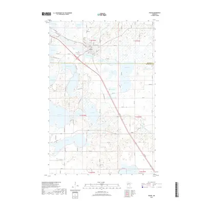
 2013 Frazee2013 Print · USGSCovers Frazee, including Luce, Otter Tail County, and other nearby areas
 - 2016 Map of Frazee, 2016 Print
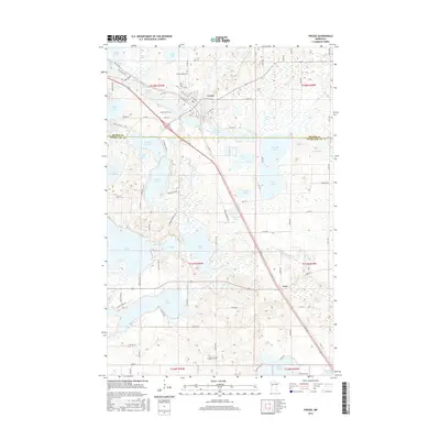 2016 Frazee2016 Print · USGSCovers Frazee, including Luce, Otter Tail County, and other nearby areas
 - 2019 Map of Frazee, 2019 Print
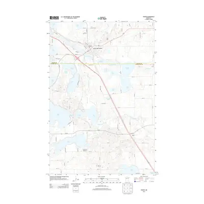
 2019 Frazee2019 Print · USGSCovers Frazee, including Luce, Otter Tail County, and other nearby areas
 - 2022 Map of Frazee, 2022 Print
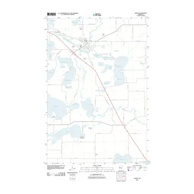
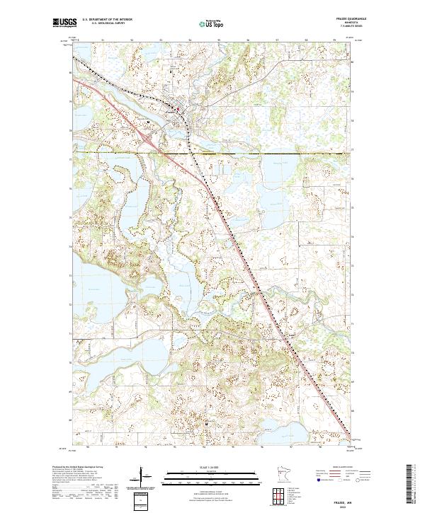 2022 Frazee2022 Print · USGSThe lakeside community of Frazee and the nearby settlement of Luce are shown in detail during the early 2020s. Genealogists can trace local roots through Lakeside Cem and Sacred Heart Cem or explore the many shorelines of Wimar Lake and the Otter Tail River.
End of results
Showing maps 1-12 of 12
Top cities near Frazee
- Detroit Lakes historical maps
- Perham historical maps
- Vergas historical maps
- Dent historical maps
- Richville historical maps
Frequently asked questions
- What are the different types of historical maps available for Frazee?
- What is the oldest map of Frazee?
- Where can I purchase historical maps of Frazee for my home or office?
- Where can I download high-res historical maps of Frazee?
- Are there historical topographic maps available for Frazee?
- Is there historical aerial imagery available for Frazee?
- Where are historical maps of Frazee sourced from?