
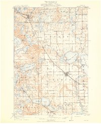
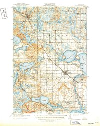
1915 Map of Perham
USGS Topo · Published 1915About this map
Glacial lakes and iron-horse transit corridors define the landscape of east-central Otter Tail County in this 1912 survey. The Northern Pacific railroad cuts a diagonal line through the village of Perham, connecting it to the smaller settlement of Luce and the resort-frontage of Grand View Heights. To the west, the Winnipeg Line serves the towns of Dent and Richville, winding between Dead Lake and the complex shoreline of Little McDonald Lake. This era shows a densely settled rural interior, evidenced by the high concentration of numbered school districts, such as School No 51 and School No 58, which supported the farming families working the land between Pine Lake and the many smaller basins like Paul Lake and Wolf Lake. The map documents a time when local transport still relied heavily on these primary rail arteries before the expansion of the modern highway system.
Find a feature on this map
91 named features on this map. Tap any name to fly to it.
Don’t see what you’re looking for? This feature index may not catch every label — zoom into the map to look around manually.
Map Details
Editions of this 1915 Perham Map
3 editions found
Other maps of this area

1912 · Vergas
USGS Topo · 1:62,500

1912 · Battle Lake
USGS Topo · 1:62,500

1914 · Battle Lake
USGS Topo · 1:62,500

1915 · Underwood
USGS Topo · 1:62,500

1915 · Vergas
USGS Topo · 1:62,500

1953 · Brainerd
USGS Topo · 1:250,000

1957 · Brainerd
USGS Topo · 1:250,000

1958 · Brainerd
USGS Topo · 1:250,000

1959 · Toad Mountain
USGS Topo · 1:24,000

1959 · Rochert
USGS Topo · 1:24,000