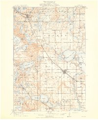
1915 Map of Perham
USGS Topo · Published 1915About this map
The Otter Tail River winds through this 1912 survey, connecting a vast network of glacial basins and early twentieth-century settlements. Perham serves as a central hub, situated along the Northern Pacific railroad where it passes between Little Pine Lake and Mud Lake. To the northwest, Frazee straddles the county line near the shores of Rice Lake. This era shows a landscape transitioning into an established agricultural and lakeside community, evidenced by the high density of rural schools such as Plateau School and School No 58.
Find a feature on this map
77 named features on this map. Tap any name to fly to it.
Don’t see what you’re looking for? This feature index may not catch every label — zoom into the map to look around manually.
Map Details
Editions of this 1915 Perham Map
3 editions found
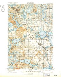
Other maps of this area

1912 · Vergas
USGS Topo · 1:62,500

1912 · Battle Lake
USGS Topo · 1:62,500

1914 · Battle Lake
USGS Topo · 1:62,500

1915 · Underwood
USGS Topo · 1:62,500

1915 · Perham
USGS Topo · 1:62,500

1915 · Vergas
USGS Topo · 1:62,500

1953 · Brainerd
USGS Topo · 1:250,000

1957 · Brainerd
USGS Topo · 1:250,000

1958 · Brainerd
USGS Topo · 1:250,000

1959 · Toad Mountain
USGS Topo · 1:24,000