Old Maps of Clearwater County, Minnesota for Hiking & Exploration
Hike through history with 207 historic maps of Clearwater County. Explore old trails, ghost towns, and forgotten backroads — perfect for outdoor adventurers and local explorers.
- Rediscover forgotten places: Map out old mining camps, roads, and footpaths that no longer exist on modern maps.
- Layer with modern tools: Combine with LiDAR or satellite views to plan hikes through historical terrain.
- Made for exploration: Popular among hikers, overlanders, and local history lovers.
Use these maps to find adventure and explore the hidden past of Clearwater County.
Clearwater County, MN maps
(207)- 1918 Map of Jelle
 1918 Jelle1918 Print · USGSNorthern Minnesota’s drainage projects and tribal lands are meticulously detailed in this survey from the late teens. Researchers can trace the early engineering of Main Judicial Ditch No 34 and locate the rural settlements of Jelle and Thorhult.
 - 1919 Map of Fosston
 1919 Fosston1919 Print · USGSNorthwest Minnesota at the end of the Great War shows a landscape being actively reshaped by drainage ditches and railroad expansion. Genealogists can trace family footprints in Fosston, Lengby, and Gonvick, or locate rural landmarks like Turtle Lake 30 and Cross Lake.
 - 1919 Map of Solway
 1919 Solway1919 Print · USGSNorthern Minnesota township life at the end of the Great War is captured here along the timbered ridges and lake basins of Beltrami County. Researchers can trace early railroad commerce through Solway and Pinewood, or locate rural landmarks like Bagley Dam and the Indian Reservation Boundary.
 - 1919 Map of Churnes
 1919 Churnes1919 Print · USGSNorthern Minnesota's timberlands and river valleys are captured here at the end of the Great War. Genealogists and researchers can trace early rural life through Berner, Churnes, and the Indian Farm, alongside the Red Lake Indian Reservation Boundary.
 - 1919 Map of Winsor
 1919 Winsor1919 Print · USGSNorthern Minnesota's prairie and marshland appear here just after the Great War, during a period of massive drainage and rail expansion. Researchers can trace early rural life through labels for Winsor, the Red Lake Indian Reservation Trail, and the Minneapolis St. Paul and Sault Saint Marie railroad.2 unique versions available
 - 1943 Map of Solway
 1943 Solway1943 Print · USGSBeltrami County's timber and rail landscape is meticulously detailed here in the years following the first World War. Genealogists and researchers can trace family roots through rural stops like Solway, Aure, and Neving, or locate landmarks such as Bagley Dam and Pony Lake.
 - 1943 Map of Bagley
 1943 Bagley1943 Print · USGSClearwater County at the height of the Second World War is shown here as a landscape of timbered tracts and scattered rail towns. Genealogists can trace family roots through numerous unnamed schools and churches near Bagley, Shevlin, and Clearbrook.
 - 1954 Map of Bemidji, 1966 Print
 1954 Bemidji1966 Print · USGSNorthern Minnesota's lake country and timberlands are captured here at a mid-century peak of rail and road expansion. Genealogists and historians can trace family roots through numerous small settlements like Mahnomen, Clearbrook, and Walker, while locating local landmarks such as White Earth Church.4 unique versions available
 - 1954 Map of Roseau, 1969 Print
 1954 Roseau1969 Print · USGSNorthern Minnesota's borderlands come alive in the 1950s, showing a landscape defined by timber, water, and rail. Trace family roots through old schools and cemeteries near Roseau, Warroad, and the expansive Red Lake Indian Reservation.2 unique versions available
 - 1957 Map of Roseau
 1957 Roseau1957 Print · USGSThe international border and tribal lands define Northern Minnesota in the mid-fifties, from the shores of Lake of the Woods to the Red Lake Indian Reservation. Researchers can trace the path of the Great Northern railroad and locate isolated outposts like the U S Custom House and Ponemah.
 - 1957 Map of Bemidji
 1957 Bemidji1957 Print · USGSNorthern Minnesota in the mid-fifties is defined by its massive lake systems and the sprawling timberlands of the Chippewa National Forest. Genealogists and researchers can trace old rail lines like the Great Northern RR and locate settlements such as Moberg, Naytahwaush, and Lake Itasca.
 - 1958 Map of Bemidji
 1958 Bemidji1958 Print · USGSNorthern Minnesota in the late fifties is a vast landscape of tribal lands and timber forests tied together by rail. Genealogists and researchers can trace old rail stops and lakeside communities from Walker to Fosston, or explore the source of the Mississippi at Lake Itasca.
 - 1958 Map of Roseau
 1958 Roseau1958 Print · USGSNorthern Minnesota's borderlands and vast lake country are captured here in the late fifties. Researchers can trace the Canadian National rail line through Warroad or find family history in frontier settlements like Baudette, Waskish, and Shotley.
 - 1969 Map of Ebro, 1971 Print
 1969 Ebro1971 Print · USGSThe transition from the lake country to the timbered reaches of the White Earth State Forest is captured here in the late sixties. Genealogists and local historians can locate the Holiness Cem, trace the Burlington Northern line through Ebro, and find the riverside settlement of Pine Bend.
 - 1969 Map of Roy Lake, 1971 Print
 1969 Roy Lake1971 Print · USGSThe White Earth Indian Reservation in the late sixties reveals a landscape defined by deep woods and a dense network of glacial lakes. Local historians can trace the foundations of Naytahwaush and Mahkonce, or locate landmarks like the Cem. and Townhall.
 - 1969 Map of Clearbrook, 1971 Print
 1969 Clearbrook1971 Print · USGSClearbrook and its surrounding townships in the late 1960s show a landscape of rail-connected industry and quiet country cemeteries. Genealogists and local historians can trace family ties at Elim Cem or Augustana Cem and locate old homesteads near the Soo Line tracks.
 - 1969 Map of Tulaby Lake, 1971 Print
 1969 Tulaby Lake1971 Print · USGSThe White Earth Indian Reservation in the late sixties is a dense mosaic of glacial lakes and state-managed timberlands. Researchers can locate the small community at Elbow Lake Village or trace routes past St Frances Cabrini Ch and Strawberry Mountain.2 unique versions available
 - 1969 Map of Anchor Hill, 1971 Print
 1969 Anchor Hill1971 Print · USGSNorthern Minnesota wilderness and conservation lands are captured here in the late sixties. Researchers can trace the White Earth Indian Reservation Boundary, an Old Railroad Grade, and the Anchor Hill Lookout Tower.2 unique versions available
 - 1969 Map of Leonard, 1971 Print
 1969 Leonard1971 Print · USGSClearwater County in the late sixties reveals a landscape of isolated farmsteads and rural parishes connected by the Soo Line. Genealogists can locate several historic burial grounds including Friendship Cem and Dudley Cem, alongside the small village of Leonard.
 - 1969 Map of Fosston SE, 1971 Print
 1969 Fosston SE1971 Print · USGSNorthwestern Minnesota in the late sixties reveals a landscape of winding rivers and rural townships at the edge of the Red Lake Indian Reservation Boundary. Genealogists can trace family roots at St Peter Cem and Freedom Cem, or follow the industrial path of the BURLINGTON NORTHERN railroad.
 - 1969 Map of Gonvick, 1971 Print
 1969 Gonvick1971 Print · USGSIn the late sixties, this portion of Clearwater County was a landscape of remote lake systems and small rail-side communities like Gonvick. Genealogists and historians can trace the Red Lake Indian Reservation Boundary and locate Bethlehem Ch or the Township Cem.
 - 1969 Map of Bagley, 1971 Print
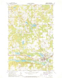 1969 Bagley1971 Print · USGSBagley and the Clearwater River valley are captured in the late sixties as the local rail and agricultural economy centered on the county seat. Researchers can trace the Old Red Lake Indian Reservation Boundary and locate family landmarks like Gran Cem, Concordia Ch Cem, and the County Fairground.
 - 1969 Map of Shevlin, 1971 Print
 1969 Shevlin1971 Print · USGSShevlin sits at a historic rail-and-river crossroads in Clearwater County during the late sixties. Genealogists can locate several family burial sites including Clearwater Cem and Landstad Cem, while the Burlington Northern line marks the town's industrial heart.
 - 1969 Map of Long Lost Lake, 1971 Print
 1969 Long Lost Lake1971 Print · USGSNorth-central Minnesota's wilderness is captured here in the late sixties, showcasing the dense lake country of the White Earth Indian Reservation. Trace the rugged terrain around Long Lost Lake, the shores of Juggler Lake, and the boundaries of White Earth State Forest.2 unique versions available
 - 1969 Map of Zerkel, 1972 Print
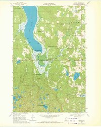 1969 Zerkel1972 Print · USGSClearwater County's lake country is documented here in the late sixties, showing the interplay between the White Earth State Forest and the regional water network. Researchers can trace historic access points like Ponsford Landing, the isolated Sugarbush Lookout Tower, and the early footprints of Minerva and Zerkel.2 unique versions available
Showing maps 1-25 of 207
Top cities of Clearwater County
- Bagley historical maps
- Clearbrook historical maps
- Gonvick historical maps
- Minerva historical maps
- Shevlin historical maps
- Leonard historical maps
Frequently asked questions
- What are the different types of historical maps available for Clearwater County?
- What is the oldest map of Clearwater County?
- Where can I purchase historical maps of Clearwater County for my home or office?
- Where can I download high-res historical maps of Clearwater County?
- Are there historical topographic maps available for Clearwater County?
- Is there historical aerial imagery available for Clearwater County?
- Where are historical maps of Clearwater County sourced from?