2020s Maps of Cottonwood County, Minnesota
Explore 22 historic maps of Cottonwood County from the 2020s. These maps offer a rare glimpse into what life looked like during the 2020s — showing old roads, neighborhoods, homes, and landmarks that have changed or disappeared over time.
Whether you're researching your family's past, planning a metal detecting trip, or studying how Cottonwood County's landscape evolved across the 2020s, these high-resolution maps are a powerful tool for exploring the history of this region.
- Focus on a specific era: All maps on this page are from the 2020s, giving you a focused view of this time period.
- See what’s changed: Compare century-old streets, trails, and buildings to today's modern landscape using overlays and satellite layers.
- Research with precision: Use these maps for genealogy, historical research, land use analysis, or educational projects.
- View, download, or print: Maps are fully viewable online in high resolution, and can be downloaded or printed for your own records.
Start exploring Cottonwood County's history through authentic maps from the 2020s. This is your window into the past.
Cottonwood County, MN maps
(22)- 2022 Map of Butterfield, 2022 Print
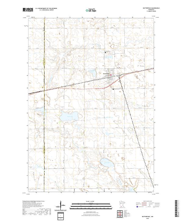 2022 Butterfield2022 Print · USGSSouthern Minnesota's prairie landscape near the Cottonwood and Watonwan county line is captured here in recent years. Genealogists and local researchers can trace the town of Butterfield and locate the nearby Mennonite Cem and Butterfield Cem among the region's many lakes.
 - 2022 Map of Heron Lake NW, 2022 Print
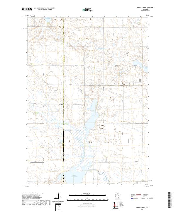 2022 Heron Lake NW2022 Print · USGSSouthwestern Minnesota's prairie landscape is captured here in the early twenty-first century as the drainage patterns of the Coteau des Prairies meet the Des Moines River. Researchers can locate the Emanuel Cem and trace the Des Moines River Trl through this agricultural corridor.
 - 2022 Map of Windom, 2022 Print
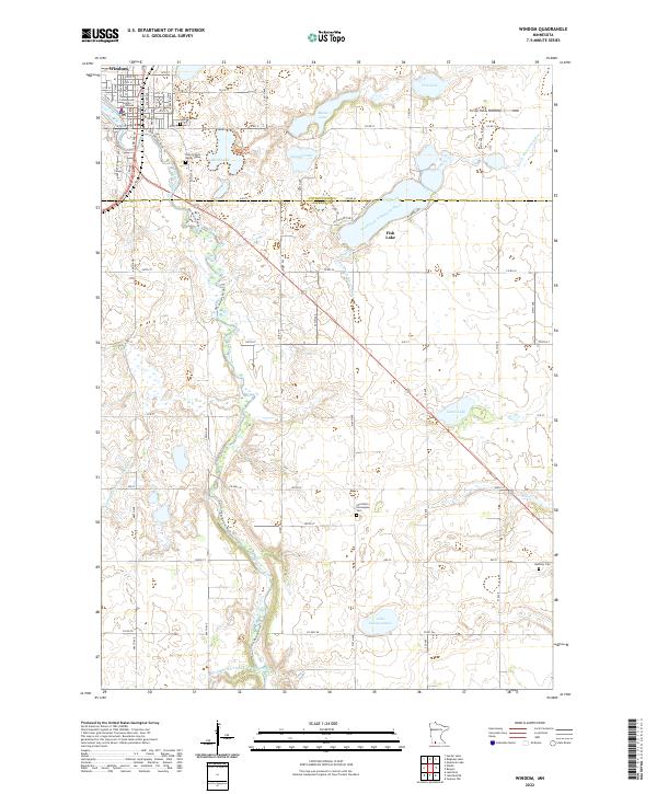 2022 Windom2022 Print · USGSWindom and the surrounding prairie are captured here in the early twenty-first century as the Des Moines River cuts through the Minnesota landscape. Genealogists and local historians can trace family roots at Lakeview Cem or Saint Francis Xavier Cem and locate landmarks like the Cottonwood County Courthouse.
 - 2022 Map of Mountain Lake SE, 2022 Print
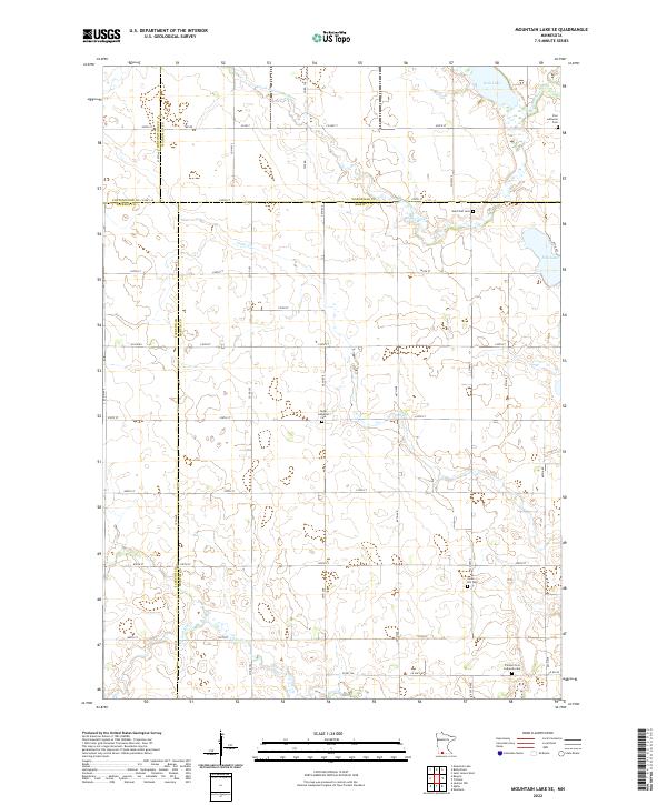 2022 Mountain Lake SE2022 Print · USGSSouthern Minnesota farmland is meticulously detailed in this recent survey of the four-county corner of Martin, Jackson, Watonwan, and Cottonwood. Genealogists can locate several historic burial sites, including Cedar Lutheran Cem, Cedar Hill Cem, and Zion Lutheran Cem.
 - 2022 Map of Heron Lake NE, 2022 Print
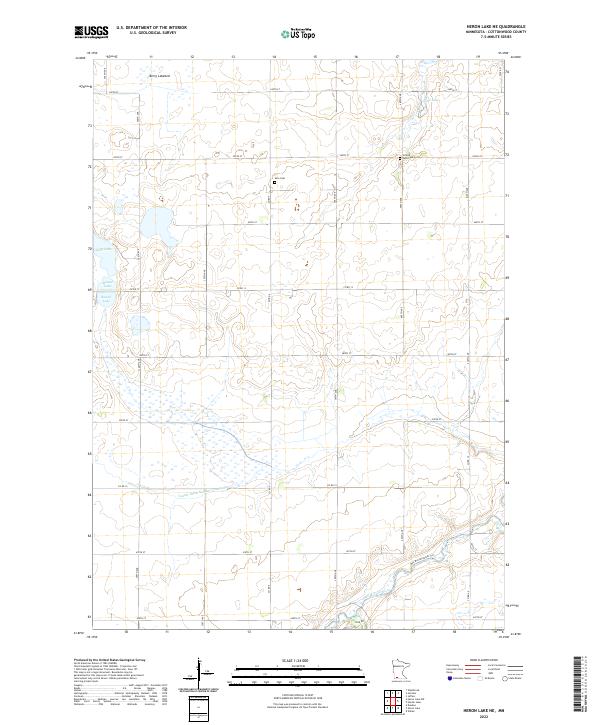 2022 Heron Lake NE2022 Print · USGSSouthwestern Minnesota farming country is defined here by its glacial lakes and the winding Des Moines River during the early twenty-first century. Family historians can locate Amo Cem and United Amo Cem or trace the drainage of Berry Lakebed and local ditches.
 - 2022 Map of Heron Lake, 2022 Print
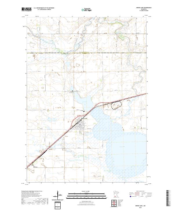 2022 Heron Lake2022 Print · USGSHeron Lake and its surrounding prairie wetlands are documented here in the early twenty-first century. Genealogists and local historians can trace family plots at Lakeside Cem or Sacred Heart Cem and explore the historic rail settlement of Miloma.
 - 2022 Map of Harder Lake, 2022 Print
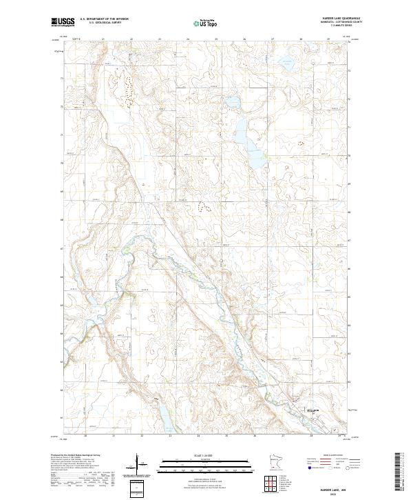 2022 Harder Lake2022 Print · USGSCottonwood County's agricultural heartland is documented here in the early twenty-first century, centered on the river valleys north of Windom. Researchers can trace the path of the Des Moines River and locate family lands near Harder Lake or along Kalash Rd.
 - 2022 Map of Bingham Lake, 2022 Print
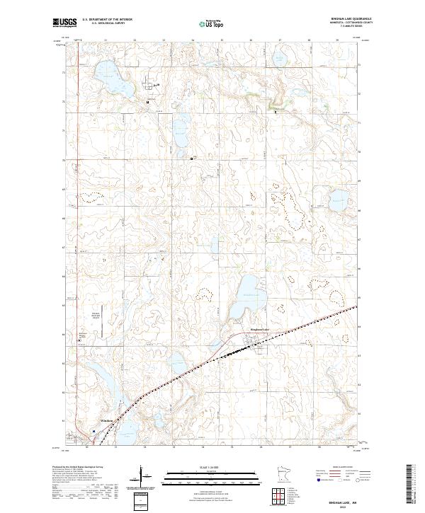 2022 Bingham Lake2022 Print · USGSBingham Lake and the surrounding Cottonwood County townships are shown here in the early twenty-first century as a landscape of prairie lakes and farms. Researchers can trace rural lineages at Delft Cem and Carson Cem or follow the waters of the Watonwan River.
 - 2022 Map of Bergen, 2022 Print
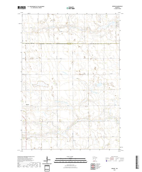 2022 Bergen2022 Print · USGSJackson County prairie land at the start of the 2020s reveals a blend of traditional agriculture and natural waterways. Researchers can locate Bergen and Hauges Cem or trace the winding paths of the S Fork Watonwan River and Elm Cr.
 - 2022 Map of Mountain Lake, 2022 Print
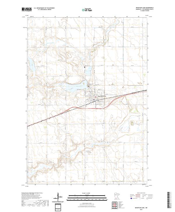 2022 Mountain Lake2022 Print · USGSMountain Lake and the surrounding Cottonwood County prairie are captured here in the early twenty-first century. Researchers can trace local heritage through the Mennonite Cem and follow the natural course of the Watonwan River and Long Lake.
 - 2022 Map of Walnut Grove, 2022 Print
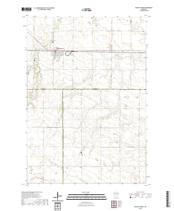 2022 Walnut Grove2022 Print · USGSWalnut Grove and the surrounding prairie lands appear here in recent years, showing the intersection of Redwood, Murray, and Cottonwood counties. Researchers can trace the local landscape of the Ingalls family era through features like Plum Cr, Walnut Grove Cem, and Saint Olaf Cem.
 - 2022 Map of Storden, 2022 Print
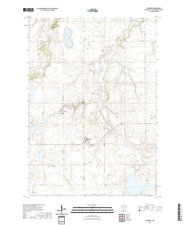 2022 Storden2022 Print · USGSStorden and the surrounding Cottonwood County farm country are captured in this 2022 survey, showing a landscape of sectional roads and prairie lakes. Researchers can locate Storden Baptist Cem, Bethany Cem, and the waters of Hurricane Lake.
 - 2022 Map of Sanborn NE, 2022 Print
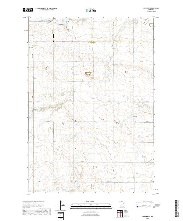
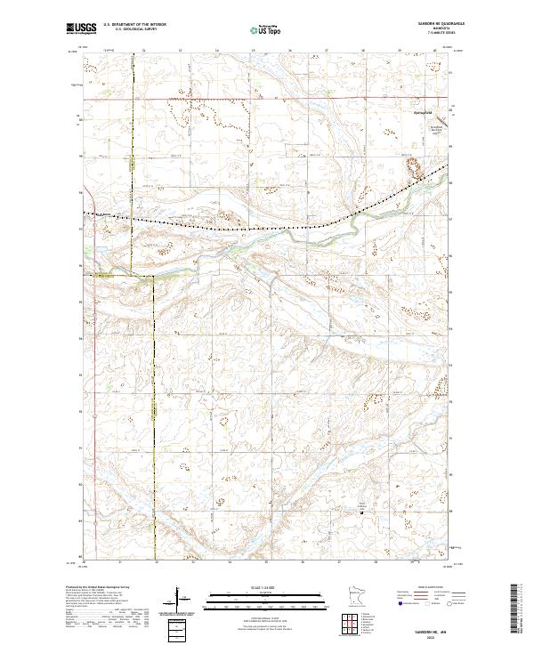 2022 Sanborn NE2022 Print · USGSAgricultural Brown County and the surrounding prairie lands come into focus in this recent topographic study. Genealogists and local historians can locate Springfield, the Christ Lutheran Cem, and the winding course of the Cottonwood River.
 - 2022 Map of Sanborn, 2022 Print
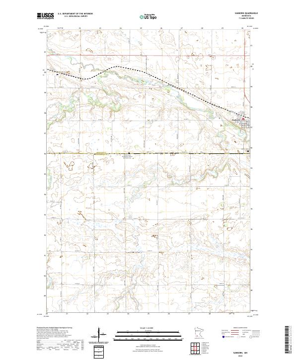 2022 Sanborn2022 Print · USGSSanborn and the surrounding prairie of Redwood and Cottonwood counties are captured here in the early twenty-first century. Genealogists and local historians can locate the Germantown Evangelical United Methodist Cem or trace the winding course of the Cottonwood River.
 - 2022 Map of Westbrook, 2022 Print
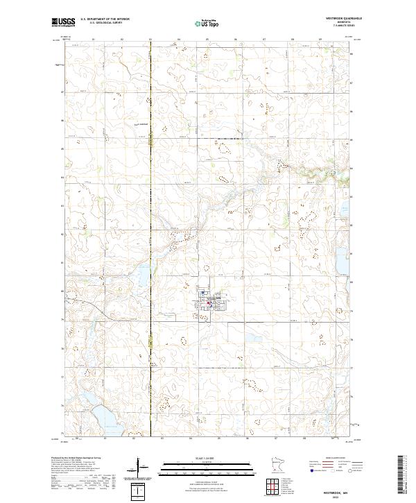 2022 Westbrook2022 Print · USGSWestbrook and the surrounding Cottonwood County plains are captured here in the early twenty-first century, showcasing a landscape of section roads and prairie wetlands. Local researchers can trace the course of Dutch Charley Cr or locate specific tracts near Snow Lakebed and Lake Julia.
 - 2022 Map of Darfur, 2022 Print
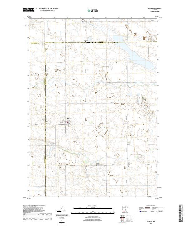 2022 Darfur2022 Print · USGSDarfur and the fertile prairies of Watonwan County are shown in this 2020s-era survey, highlighting the rural character of the Minnesota plains. Genealogists can locate several distinct burial sites including Haseman Post Cem, Salem Cem, and First Mennonite Cem.
 - 2022 Map of Lamberton, 2022 Print
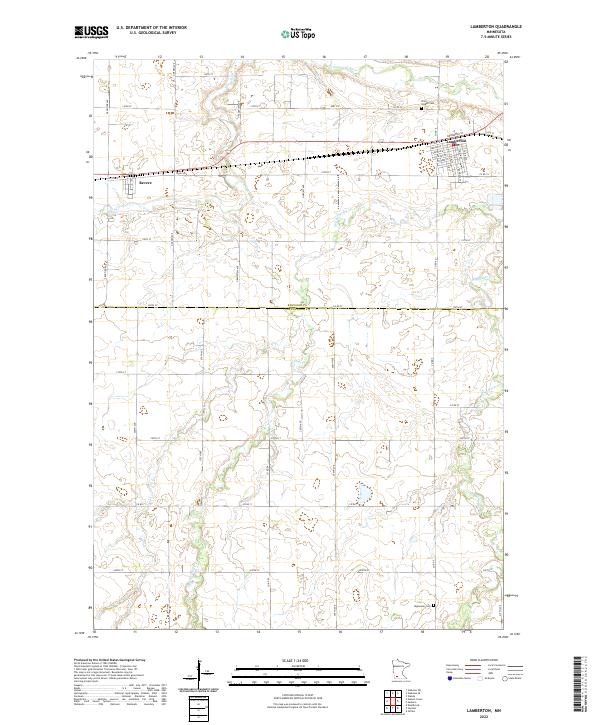 2022 Lamberton2022 Print · USGSThe rural landscapes of Redwood and Cottonwood counties are captured here in the early twenty-first century, centered on the settlements of Lamberton and Revere. Researchers can trace the local cemetery sites at Saint Joseph Cem and Highwater Cem alongside the winding course of Pell Cr.
 - 2022 Map of Jeffers, 2022 Print
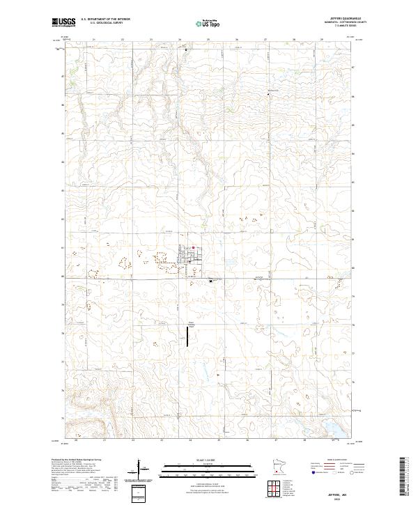 2022 Jeffers2022 Print · USGSIn the heart of Cottonwood County during the 2020s, this area shows a landscape of precision-grid farming and prairie river systems. Researchers can locate the small-town streets of Jeffers and trace local family history at Saint Johns Cem, Red Rock Cem, or the Ewen Landing Field.
 - 2022 Map of Comfrey, 2022 Print
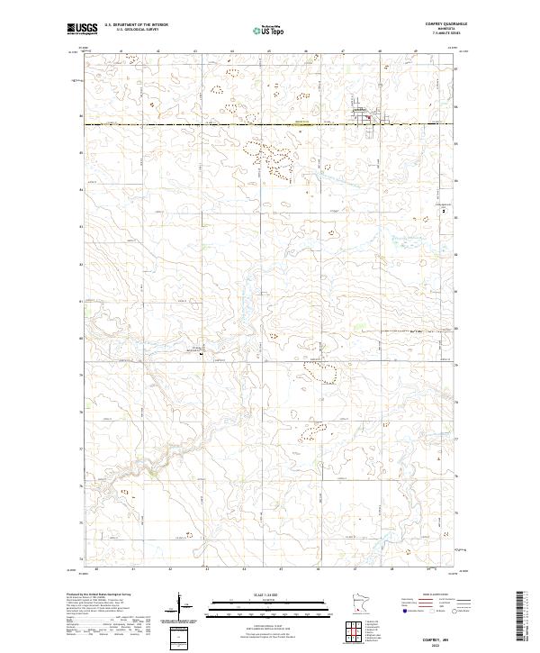 2022 Comfrey2022 Print · USGSThe area surrounding Comfrey is documented here as a settled agricultural grid along the Brown and Cottonwood county line. Researchers can locate family landmarks such as the Congregational Cem and follow the path of the N Fork Watonwan River.
 - 2022 Map of Dundee, 2022 Print
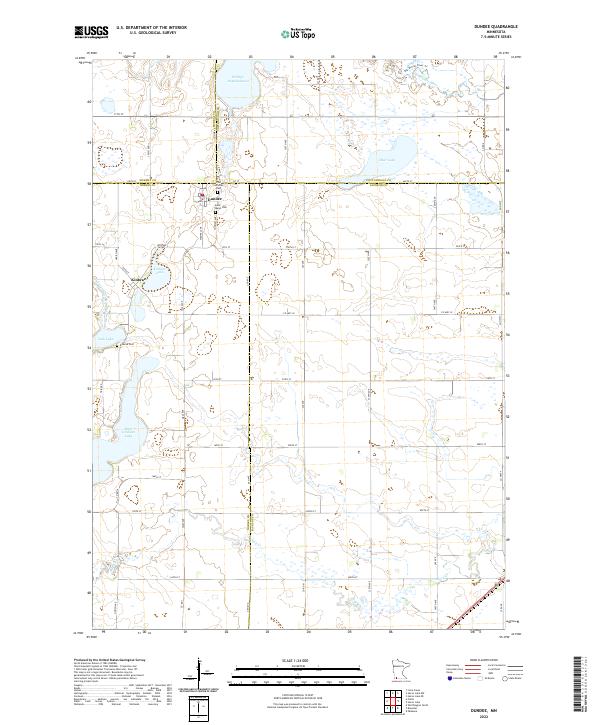 2022 Dundee2022 Print · USGSDundee and its surrounding prairie lakes are shown here in the early 2020s, highlighting a landscape defined by water and townships. Genealogists and researchers can locate family sites at the Lutheran Cem, Saint Marys Cem, and Kinbrae Cem near Kinbrae Lake.
 - 2022 Map of Wilder, 2022 Print
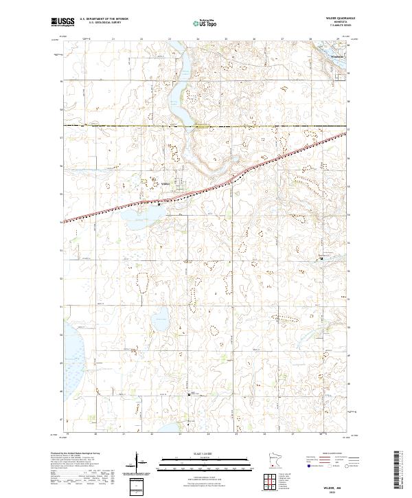 2022 Wilder2022 Print · USGSSouthwestern Minnesota's prairie and wetland landscape is captured here in the early twenty-first century as it spans the Cottonwood and Jackson county line. Genealogists and local historians can locate Wilder Cem, Delafield Cem, and the town of Wilder among the glacial waters of Teal Lake and String Lakes.
 - 2022 Map of Sanborn SE, 2022 Print
 2022 Sanborn SE2022 Print · USGSSouthwestern Minnesota farmland on the Cottonwood and Brown County line appears in this recent study of the rural landscape. Genealogists and local historians can trace the course of the Little Cottonwood River or locate the Delton Cem and the unique Red Rock Dells.
End of results
Showing maps 1-22 of 22
Top cities of Cottonwood County
- Windom historical maps
- Mountain Lake historical maps
- Jeffers historical maps
- Storden historical maps
- Bingham Lake historical maps
Frequently asked questions
- What are the different types of historical maps available for Cottonwood County?
- What is the oldest map of Cottonwood County?
- Where can I purchase historical maps of Cottonwood County for my home or office?
- Where can I download high-res historical maps of Cottonwood County?
- Are there historical topographic maps available for Cottonwood County?
- Is there historical aerial imagery available for Cottonwood County?
- Where are historical maps of Cottonwood County sourced from?