2020s Maps of Mendota Heights, Minnesota
Explore 4 historic maps of Mendota Heights from the 2020s. These maps offer a rare glimpse into what life looked like during the 2020s — showing old roads, neighborhoods, homes, and landmarks that have changed or disappeared over time.
Whether you're researching your family's past, planning a metal detecting trip, or studying how Mendota Heights's landscape evolved across the 2020s, these high-resolution maps are a powerful tool for exploring the history of this region.
- Focus on a specific era: All maps on this page are from the 2020s, giving you a focused view of this time period.
- See what’s changed: Compare century-old streets, trails, and buildings to today's modern landscape using overlays and satellite layers.
- Research with precision: Use these maps for genealogy, historical research, land use analysis, or educational projects.
- View, download, or print: Maps are fully viewable online in high resolution, and can be downloaded or printed for your own records.
Start exploring Mendota Heights's history through authentic maps from the 2020s. This is your window into the past.
Mendota Heights, MN maps
(4)- 2022 Map of Saint Paul East, 2022 Print
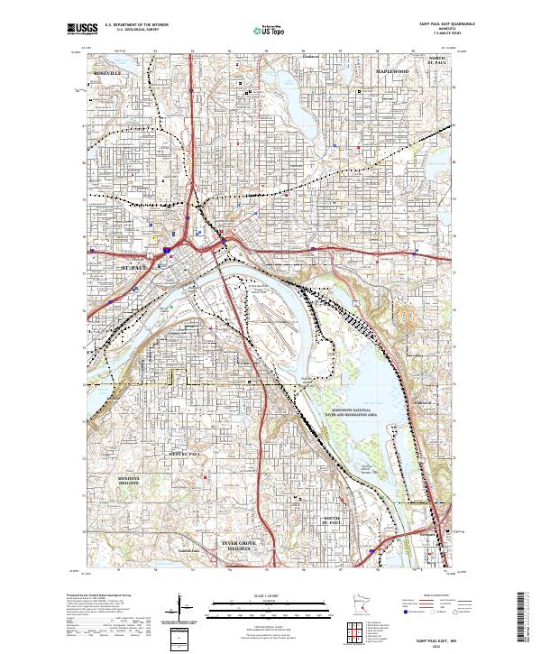 2022 Saint Paul East2022 Print · USGSGreater St. Paul and its eastern suburbs are shown here in the 2020s, centered on the strategic bend of the Mississippi River. Researchers can trace the legacy of urban development through civic landmarks like the Ramsey County Courthouse and numerous historic grounds such as Oakland Cem and Riverview Cem.
 - 2022 Map of Inver Grove Heights, 2022 Print
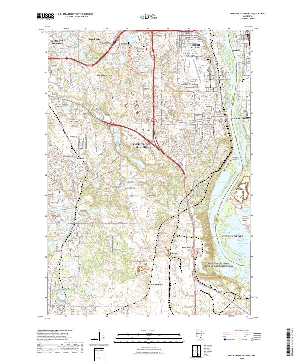 2022 Inver Grove Heights2022 Print · USGSThe southeastern Twin Cities suburbs and the Mississippi riverfront are captured here in the early twenty-first century. Genealogists and local historians can locate burial sites like Union Cem and Saint Patrick Cem or trace the river islands of Upper Grey Cloud Island.
 - 2022 Map of Saint Paul West, 2022 Print
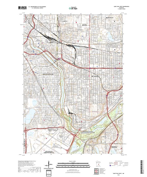 2022 Saint Paul West2022 Print · USGSThe Twin Cities riverfront comes alive in the 2020s, showing the dense corridor of universities and parklands along the Mississippi River. Genealogists and historians can locate final resting places at Fort Snelling National Cemetery or the venerable Pioneers and Soldiers Memorial Cem.
 - 2022 Map of Saint Paul SW, 2022 Print
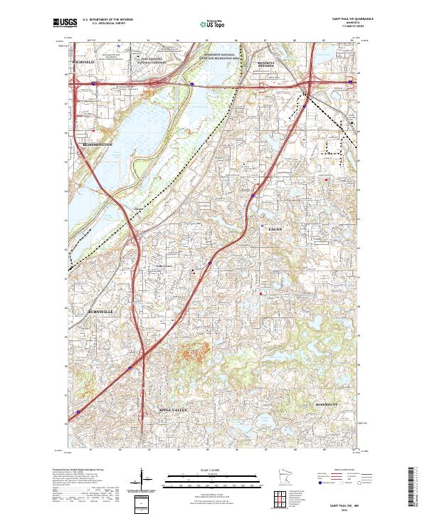 2022 Saint Paul SW2022 Print · USGSThe south-central Twin Cities suburbs are captured here at a moment of significant growth and conservation in the early 2020s. Researchers can locate family sites near Trinity Lone Oak Cem or trace the wetland borders of the Minnesota Valley National Wildlife Refuge.
End of results
Showing maps 1-4 of 4
Top cities near Mendota Heights
- Minneapolis historical maps
- Saint Paul historical maps
- Bloomington historical maps
- Brooklyn Park historical maps
- Woodbury historical maps
- Eagan historical maps
See more
Frequently asked questions
- What are the different types of historical maps available for Mendota Heights?
- What is the oldest map of Mendota Heights?
- Where can I purchase historical maps of Mendota Heights for my home or office?
- Where can I download high-res historical maps of Mendota Heights?
- Are there historical topographic maps available for Mendota Heights?
- Is there historical aerial imagery available for Mendota Heights?
- Where are historical maps of Mendota Heights sourced from?