2020s Maps of Osakis, Minnesota
Explore 3 historic maps of Osakis from the 2020s. These maps offer a rare glimpse into what life looked like during the 2020s — showing old roads, neighborhoods, homes, and landmarks that have changed or disappeared over time.
Whether you're researching your family's past, planning a metal detecting trip, or studying how Osakis's landscape evolved across the 2020s, these high-resolution maps are a powerful tool for exploring the history of this region.
- Focus on a specific era: All maps on this page are from the 2020s, giving you a focused view of this time period.
- See what’s changed: Compare century-old streets, trails, and buildings to today's modern landscape using overlays and satellite layers.
- Research with precision: Use these maps for genealogy, historical research, land use analysis, or educational projects.
- View, download, or print: Maps are fully viewable online in high resolution, and can be downloaded or printed for your own records.
Start exploring Osakis's history through authentic maps from the 2020s. This is your window into the past.
Osakis, MN maps
(3)- 2022 Map of Lake Osakis East, 2022 Print
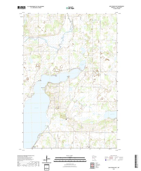 2022 Lake Osakis East2022 Print · USGSTodd County's lake-rich landscape is captured here in the early 2020s, centered on the diverse shorelines of eastern Lake Osakis and the town of Osakis. Researchers can trace local history through family-named landmarks like Caughren Point and rural burial sites such as Gordon Cem and Stallcop Cem.
 - 2022 Map of Osakis, 2022 Print
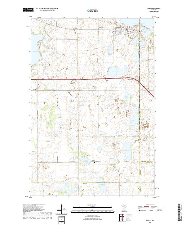 2022 Osakis2022 Print · USGSThe town of Osakis and its namesake Lake Osakis are shown here at the turn of the 21st century. Genealogists and local historians can trace the town's street grid and several burial grounds, including Evergreen Cem and English Grove Cem.
 - 2022 Map of West Union, 2022 Print
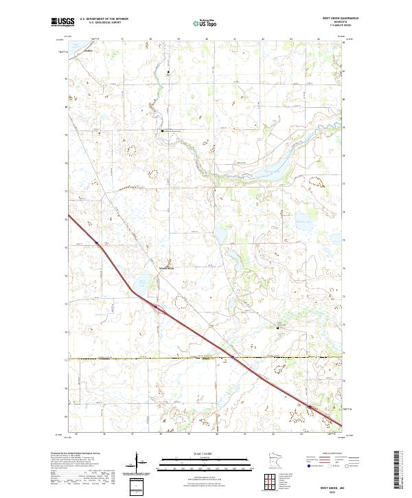 2022 West Union2022 Print · USGSTodd and Stearns Counties are documented in the early twenty-first century, showing the intersection of modern transit and rural tradition. Genealogists can locate Sauk Valley Lutheran Church Cem and Elim Cem or trace the Sauk River and West Union Lake.
End of results
Showing maps 1-3 of 3
Top cities near Osakis
- Alexandria historical maps
- Sauk Centre historical maps
- Glenwood historical maps
- Little Sauk historical maps
- Belle River historical maps
- Carlos historical maps
See more
Frequently asked questions
- What are the different types of historical maps available for Osakis?
- What is the oldest map of Osakis?
- Where can I purchase historical maps of Osakis for my home or office?
- Where can I download high-res historical maps of Osakis?
- Are there historical topographic maps available for Osakis?
- Is there historical aerial imagery available for Osakis?
- Where are historical maps of Osakis sourced from?