Old Maps of Glenwood, Minnesota
Explore 22 old maps of Glenwood, spanning from 1953 to today. These high-resolution historic maps reveal how streets, neighborhoods, landmarks, and natural features evolved over time — perfect for genealogy, metal detecting, research, and local history exploration.
What you can do with these maps:
- See how Glenwood changed over time: Compare historical maps to modern-day views to trace roads, homesites, rail lines & more.
- View detailed metadata: Each map includes creators, publishers, year, scale, and archive source.
- Overlay maps with satellite & LiDAR: Visualize the past alongside modern tools to explore terrain & human change.
- Trusted historical sources: Maps sourced from the USGS, Library of Congress, and other archives.
- Access maps your way: View online, download high-res files, or order prints for personal or research use.
Start exploring old maps of Glenwood to uncover forgotten places, hidden landmarks, and the deep history beneath your feet.
Glenwood, MN maps
(22)- 1953 Map of Saint Cloud, 1968 Print
 1953 Saint Cloud1968 Print · USGSCentral Minnesota's lake country and the Mississippi River valley are caught in a period of steady mid-century growth. Researchers can trace historic rail lines, old granite works, and local landmarks like St. Johns University, Camp Ripley, and the shores of Lake Minnewaska.3 unique versions available
 - 1957 Map of Saint Cloud
 1957 Saint Cloud1957 Print · USGSCentral Minnesota's lake country and rail corridors are meticulously detailed in the mid-1950s. Genealogists and researchers can trace the growth of towns like Alexandria, Willmar, and Saint Cloud along the Great Northern railroad line.
 - 1958 Map of Saint Cloud
 1958 Saint Cloud1958 Print · USGSCentral Minnesota in the mid-1950s shows a landscape of growing regional hubs and hundreds of glacial lakes connected by an extensive rail network. Genealogists and historians can trace the early footprints of Saint Cloud, Alexandria, and Willmar along the Great Northern Railway.
 - 1968 Map of Glenwood, 1970 Print
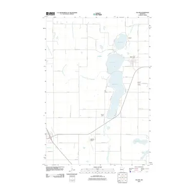
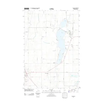
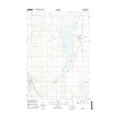
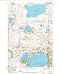 1968 Glenwood1970 Print · USGSThe Pope County lake country is captured here in the late sixties, centered on the growing community of Glenwood. Local historians can trace early rural life through landmarks like the Lake Reno Sch, Oak Hill Cem, and the crossing of the Soo Line railroad.
 - 1968 Map of Terrace, 1970 Print
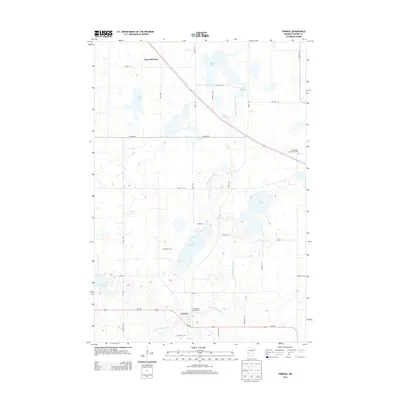
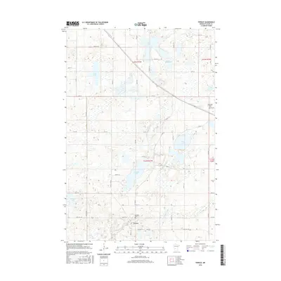
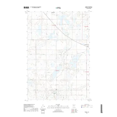
 1968 Terrace1970 Print · USGSPope County’s prairie and wetland landscape is showcased here in the late sixties, where the river meets the rail. Genealogists and local historians can trace the Soo Line through Sedan or locate the Immaculate Conception Cem and Gravel Pits Cem.2 unique versions available
 - 1968 Map of Villard, 1970 Print
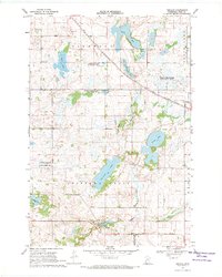
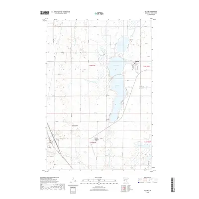
 1968 Villard1970 Print · USGSIn the late sixties, the lake country of Pope County was a hub of rail activity and lakeside settlement between Villard and Glenwood. Genealogists can trace family roots through numerous burial grounds like Calvary Cem and Lake Leven Cem while following the Northern Pacific line.3 unique versions available
 - 1986 Map of Lake Minnewaska
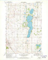
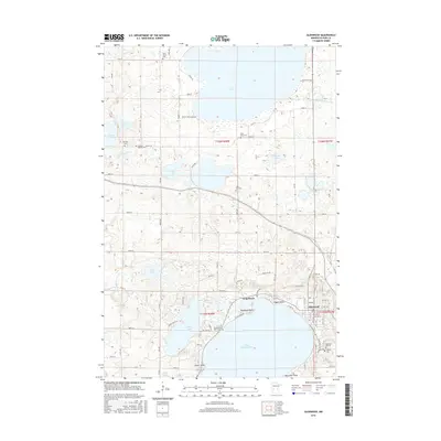
 1986 Lake Minnewaska1986 Print · USGSWest-central Minnesota's lake country is captured here in the mid-eighties, showing a landscape of intense glacial activity and growing regional hubs. Genealogists and researchers can trace the rail lines of the Soo Line and Burlington Northern through towns like Glenwood, Starbuck, and Osakis.2 unique versions available
 - 2010 Map of Terrace, 2010 Print
 2010 Terrace2010 Print · USGSCovers Glenwood, including Sedan, Pine Hill Park, and other nearby areas
 - 2010 Map of Glenwood, 2010 Print
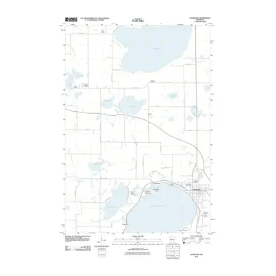 2010 Glenwood2010 Print · USGSCovers Glenwood, including Long Beach, Pope County, and other nearby areas
 - 2010 Map of Villard, 2010 Print
 2010 Villard2010 Print · USGSCovers Glenwood, including Villard, Pope County, and other nearby areas
 - 2013 Map of Glenwood, 2013 Print
 2013 Glenwood2013 Print · USGSCovers Glenwood, including Long Beach, Pope County, and other nearby areas
 - 2013 Map of Terrace, 2013 Print
 2013 Terrace2013 Print · USGSCovers Glenwood, including Sedan, Pine Hill Park, and other nearby areas
 - 2013 Map of Villard, 2013 Print
 2013 Villard2013 Print · USGSCovers Glenwood, including Villard, Pope County, and other nearby areas
 - 2016 Map of Villard, 2016 Print
 2016 Villard2016 Print · USGSCovers Glenwood, including Villard, Pope County, and other nearby areas
 - 2016 Map of Terrace, 2016 Print
 2016 Terrace2016 Print · USGSCovers Glenwood, including Sedan, Pine Hill Park, and other nearby areas
 - 2016 Map of Glenwood, 2016 Print
 2016 Glenwood2016 Print · USGSCovers Glenwood, including Long Beach, Pope County, and other nearby areas
 - 2019 Map of Terrace, 2019 Print
 2019 Terrace2019 Print · USGSCovers Glenwood, including Sedan, Pine Hill Park, and other nearby areas
 - 2019 Map of Glenwood, 2019 Print
 2019 Glenwood2019 Print · USGSCovers Glenwood, including Long Beach, Pope County, and other nearby areas
 - 2019 Map of Villard, 2019 Print
 2019 Villard2019 Print · USGSCovers Glenwood, including Villard, Pope County, and other nearby areas
 - 2022 Map of Terrace, 2022 Print
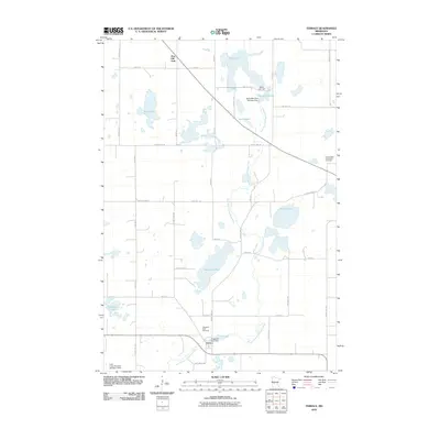
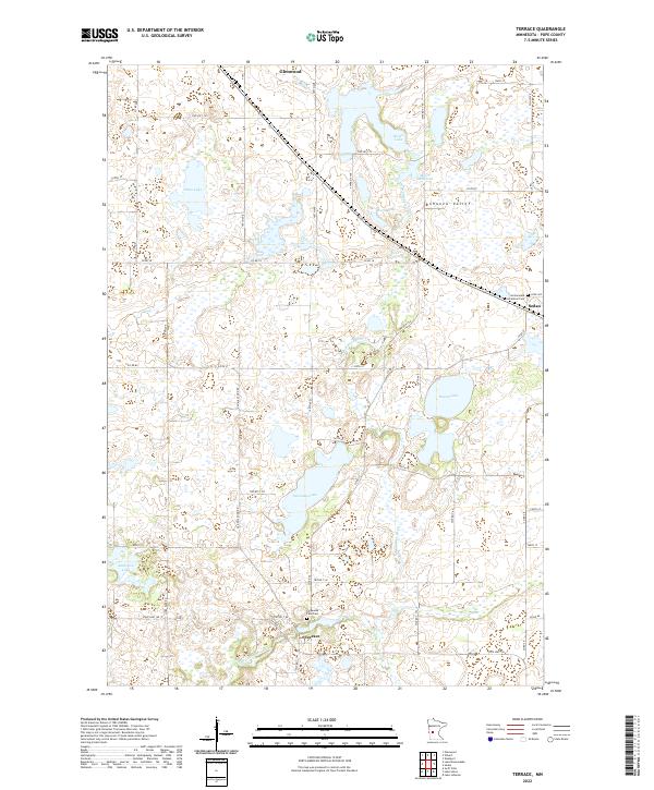 2022 Terrace2022 Print · USGSPope County's river-driven landscape is preserved here as it appeared in the early 2020s, centered on the winding E Br Chippewa River. Genealogists and local historians can trace early settlement patterns near Terrace, the Chippewa Falls Cem, and the village of Sedan.
 - 2022 Map of Glenwood, 2022 Print
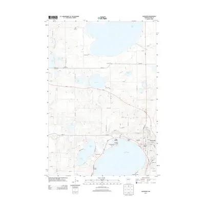
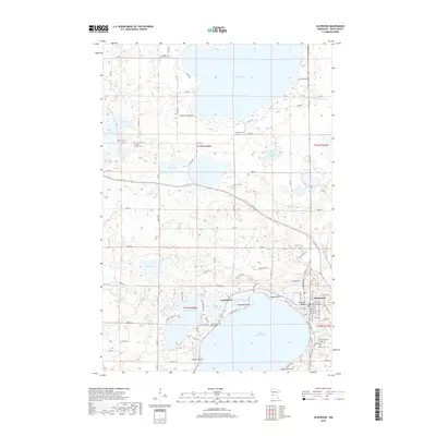
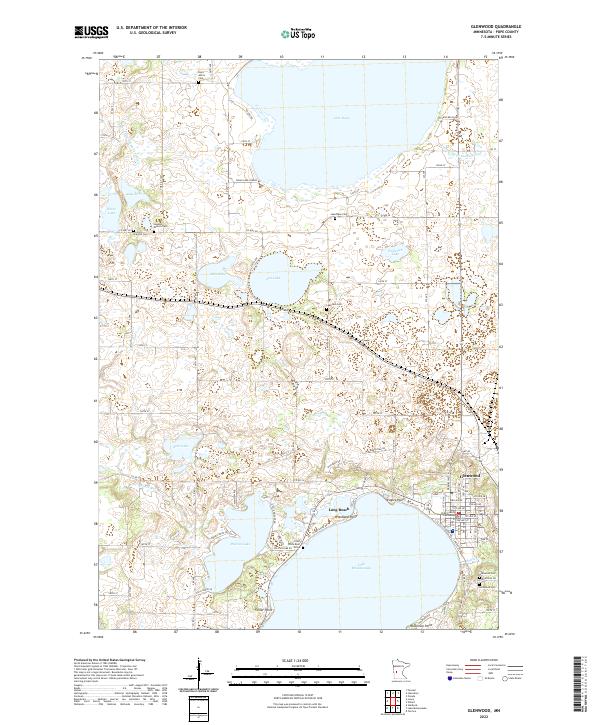 2022 Glenwood2022 Print · USGSThe lakeside communities of Glenwood and Long Beach are depicted here in the early twenty-first century. Genealogists can locate several historic burial sites, including the Swedish Mission Cem and the Chief White Bear Grave near Pelican Lake.
 - 2022 Map of Villard, 2022 Print
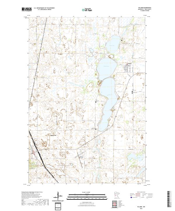 2022 Villard2022 Print · USGSPope County lake country is captured here in the 2020s, showcasing the established grid and water systems of the Bonanza Valley. Researchers can trace local heritage through numerous burial sites like Lake Leven Cem or follow the shoreline of Villard Lake.
End of results
Showing maps 1-22 of 22
Top cities near Glenwood
- Alexandria historical maps
- Osakis historical maps
- Starbuck historical maps
- Holmes City historical maps
- Long Beach historical maps
- Lowry historical maps
See more
Frequently asked questions
- What are the different types of historical maps available for Glenwood?
- What is the oldest map of Glenwood?
- Where can I purchase historical maps of Glenwood for my home or office?
- Where can I download high-res historical maps of Glenwood?
- Are there historical topographic maps available for Glenwood?
- Is there historical aerial imagery available for Glenwood?
- Where are historical maps of Glenwood sourced from?