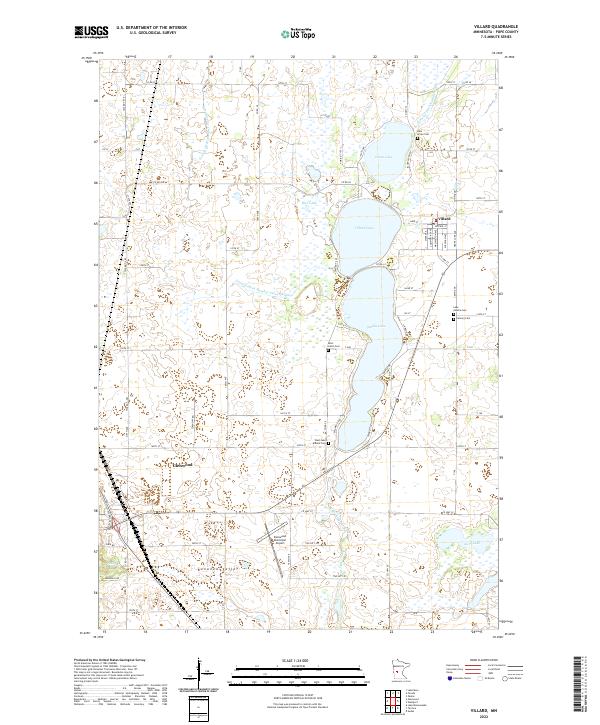
2022 Map of Villard
USGS Topo · Published 2022About this map
The town of Villard serves as a primary hub in this portion of Pope County, defined by a chain of significant water bodies including Villard Lake, Amelia Lake, and Leven Lake. The landscape is etched with complex drainage systems like Judicial Ditch Number Four and County Ditch Number Twentyeight, reflecting the managed water of the agricultural Bonanza Valley. To the west, the outskirts of Glenwood appear, supported by the Glenwood Municipal Airport. Genealogists and local historians will find a high concentration of burial sites throughout the lake district, such as Lake Leven Cem, Saint Johns Cem, Lake Amelia Cem, and Calvary Cem. These sites, alongside the Little Chippewa River and its various tributaries, illustrate the settlement patterns of a region where community life has long centered on the shores of these glacial lakes and the fertile land between them.
Find a feature on this map
53 named features on this map. Tap any name to fly to it.
Don’t see what you’re looking for? This feature index may not catch every label — zoom into the map to look around manually.
Map Details
Editions of this 2022 Villard Map
This is the sole edition of this map. No revisions or reprints were ever made.
Other maps of this area

1953 · Saint Cloud
USGS Topo · 1:250,000

1957 · Saint Cloud
USGS Topo · 1:250,000

1958 · Saint Cloud
USGS Topo · 1:250,000

1965 · Westport
USGS Topo · 1:24,000

1965 · Sedan
USGS Topo · 1:24,000

1966 · Osakis
USGS Topo · 1:24,000

1966 · Lake Mary
USGS Topo · 1:24,000

1966 · Forada
USGS Topo · 1:24,000

1968 · Glenwood
USGS Topo · 1:24,000

1968 · Terrace
USGS Topo · 1:24,000