
1966 Map of Osakis
USGS Topo · Published 1967About this map
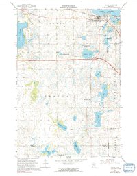
Osakis sits at the southern tip of Lake Osakis, a prominent water body that dominates the northern landscape of this mid-1960s survey. The town serves as a regional hub where the Great Northern railroad and major roadways intersect, surrounded by a dense concentration of civic sites including St Agnes Sch, Lakeside Cem, and Evergreen Cem. The surrounding townships of Orange, Gordon, and Union are characterized by an intricate network of glacial lakes and wetlands, many of which are preserved within the Osakis State Wildlife Management Area and the National Wildlife Management Area. Farther south, the rural character is punctuated by smaller water bodies like English Grove Lake and Kuntz Lake, with the English Grove Cem serving the local farming community. This survey provides a clear view of the transition between the developed lakeshore and the surrounding prairie and wetland environments.
Find a feature on this map
45 named features on this map. Tap any name to fly to it.
Don’t see what you’re looking for? This feature index may not catch every label — zoom into the map to look around manually.
Map Details
Editions of this 1966 Osakis Map
2 editions found
Other maps of this area

1953 · Saint Cloud
USGS Topo · 1:250,000

1957 · Saint Cloud
USGS Topo · 1:250,000

1958 · Saint Cloud
USGS Topo · 1:250,000

1965 · Westport
USGS Topo · 1:24,000

1965 · Raymond Lake
USGS Topo · 1:24,000

1966 · West Union
USGS Topo · 1:24,000

1966 · Lake Osakis East
USGS Topo · 1:24,000

1966 · Lake Osakis West
USGS Topo · 1:24,000

1966 · Alexandria East
USGS Topo · 1:24,000

1966 · Forada
USGS Topo · 1:24,000