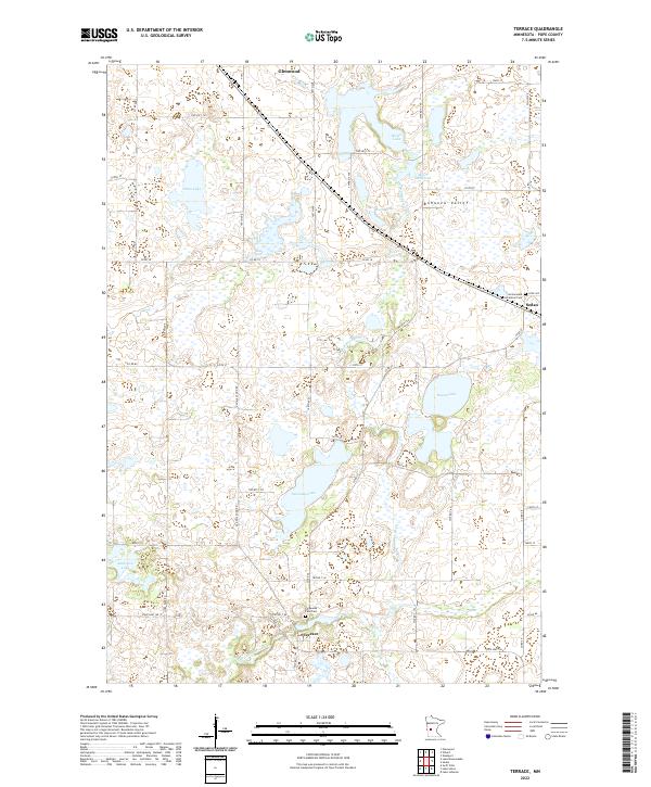
2022 Map of Terrace
USGS Topo · Published 2022About this map
The E Br Chippewa River carves a winding path through the heart of this Pope County landscape, anchoring a network of glacial lakes and wetlands that define the terrain. At the southern end, the settlement of Terrace sits near the Chippewa Falls Cem, reflecting the early pioneer focus on river-powered industry and community hubs. Further north, Marlu Millpond and Marlu Lake illustrate how the water was historically managed for local use.
Find a feature on this map
35 named features on this map. Tap any name to fly to it.
Don’t see what you’re looking for? This feature index may not catch every label — zoom into the map to look around manually.
Map Details
Editions of this 2022 Terrace Map
This is the sole edition of this map. No revisions or reprints were ever made.
Other maps of this area

1953 · Saint Cloud
USGS Topo · 1:250,000

1957 · Saint Cloud
USGS Topo · 1:250,000

1958 · Saint Cloud
USGS Topo · 1:250,000

1965 · Westport
USGS Topo · 1:24,000

1965 · Sedan
USGS Topo · 1:24,000

1967 · Lake Johanna
USGS Topo · 1:24,000

1968 · Glenwood
USGS Topo · 1:24,000

1968 · Terrace
USGS Topo · 1:24,000
1968 · Villard
USGS Topo · 1:24,000

1968 · Lake Simon
USGS Topo · 1:24,000