2020s Maps of Faribault County, Minnesota
Explore 19 historic maps of Faribault County from the 2020s. These maps offer a rare glimpse into what life looked like during the 2020s — showing old roads, neighborhoods, homes, and landmarks that have changed or disappeared over time.
Whether you're researching your family's past, planning a metal detecting trip, or studying how Faribault County's landscape evolved across the 2020s, these high-resolution maps are a powerful tool for exploring the history of this region.
- Focus on a specific era: All maps on this page are from the 2020s, giving you a focused view of this time period.
- See what’s changed: Compare century-old streets, trails, and buildings to today's modern landscape using overlays and satellite layers.
- Research with precision: Use these maps for genealogy, historical research, land use analysis, or educational projects.
- View, download, or print: Maps are fully viewable online in high resolution, and can be downloaded or printed for your own records.
Start exploring Faribault County's history through authentic maps from the 2020s. This is your window into the past.
Faribault County, MN maps
(19)- 2022 Map of Oza Tanka Lakebed, 2022 Print
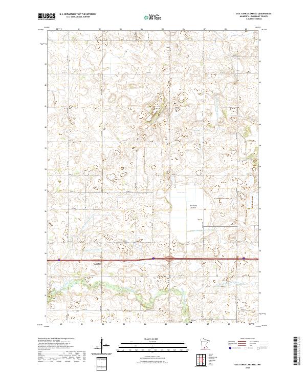 2022 Oza Tanka Lakebed2022 Print · USGSFaribault County is captured in this contemporary survey, showing a landscape reshaped by decades of agricultural drainage and prairie settlement. Genealogists and local historians can trace family roots at the Ellingson Family Cem or Saint Marys Cem, and study the massive Oza Tanka Lakebed.
 - 2022 Map of Bricelyn, 2022 Print
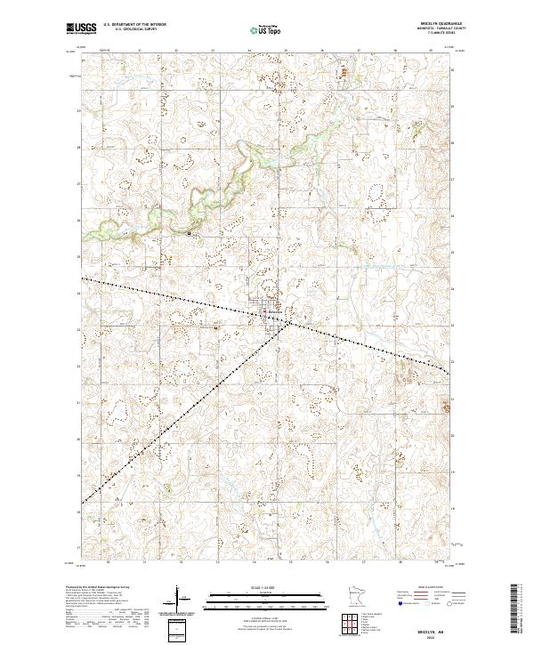 2022 Bricelyn2022 Print · USGSBricelyn and its surrounding farmlands are documented here during the early 2020s, showing a landscape defined by an extensive drainage network. Researchers can pinpoint the Bricelyn Cem, Clayton Cem, and numerous waterways like the E Br Blue Earth River.
 - 2022 Map of Wells, 2022 Print
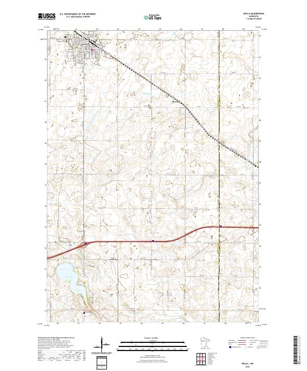 2022 Wells2022 Print · USGSThe agricultural heartland of southern Minnesota is documented here in the early twenty-first century, centered on the rail-aligned town of Wells. Genealogists and local historians can trace family plots at Rosehill Cem or explore the drainage of Rice Lake and the E Br Blue Earth River.
 - 2022 Map of Matawan, 2022 Print
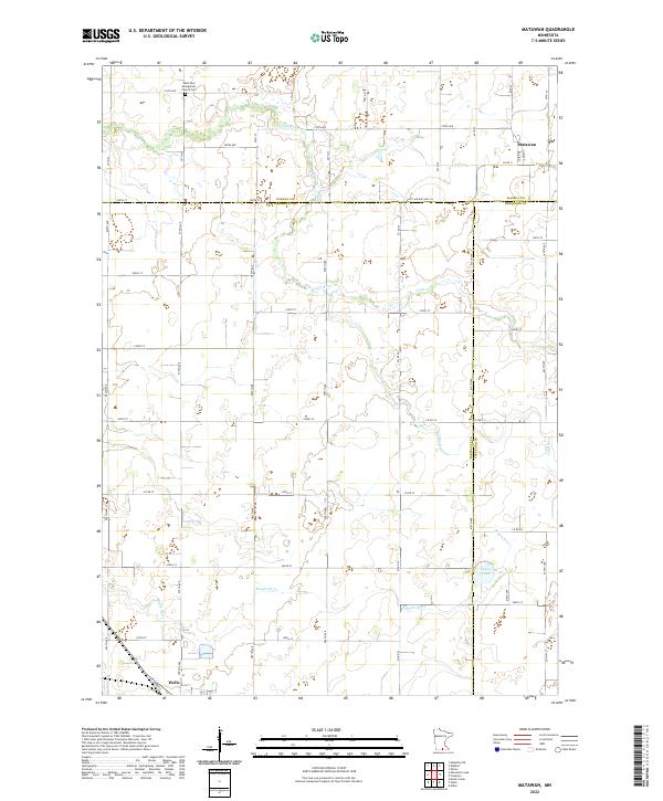 2022 Matawan2022 Print · USGSThe Faribault County borderlands come into focus in the early 2020s, showing a landscape defined by the Cobb River and rural township grids. Researchers can trace family sites near Matawan, the Saint Paul Evangelical Church Cem, and the outskirts of Wells.
 - 2022 Map of Minnesota Lake, 2022 Print
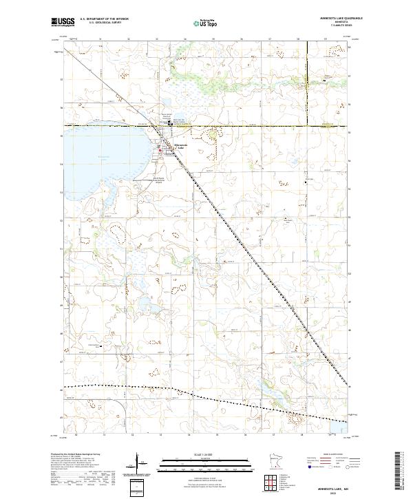 2022 Minnesota Lake2022 Print · USGSMinnesota Lake and the surrounding prairie farmsteads are captured here in the early twenty-first century. Researchers can locate numerous family and parish sites like Trahm's Farm Cem, Oak Grove Cem, and Peace United Church of Christ Cem.
 - 2022 Map of Frost, 2022 Print
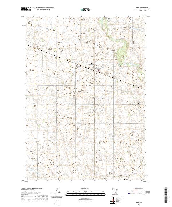 2022 Frost2022 Print · USGSFrost and the surrounding Faribault County countryside appear here in the early twenty-first century, showing a landscape defined by prairie agriculture. Researchers can locate family landmarks like South Blue Earth Lutheran Cem and Emerald Cem, or trace the winding E Br Blue Earth River.
 - 2022 Map of Kiester, 2022 Print
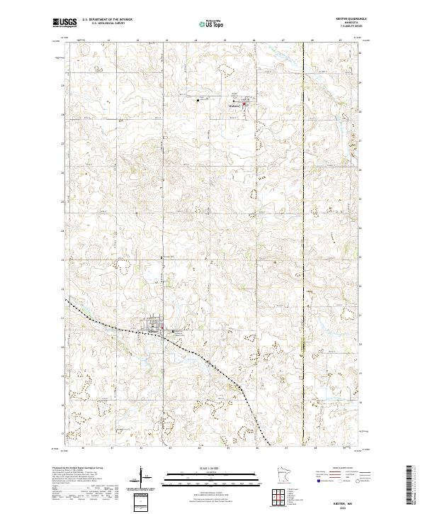 2022 Kiester2022 Print · USGSFaribault and Freeborn Counties are captured in this recent survey of rural Minnesota's farming heartland. Family historians can locate several local burial sites, including Fairview Cem and Saint Johns Cem, alongside the engineered waters of Judicial Ditch Number Twentyfive.
 - 2022 Map of Elmore, 2022 Print
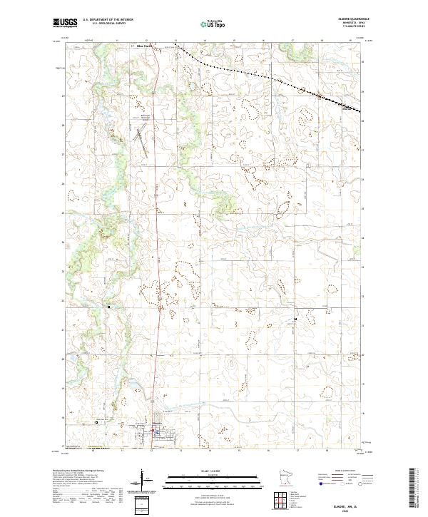 2022 Elmore2022 Print · USGSElmore and the southern reaches of Faribault County are captured here at the Minnesota-Iowa border in the early 2020s. Genealogists and local historians can trace the paths of the Middle Br Blue Earth River past Riverview Cem and the quiet grounds of Saint John's Cem.
 - 2022 Map of Huntley, 2022 Print
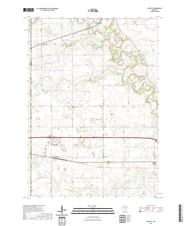 2022 Huntley2022 Print · USGSFaribault County’s agricultural heartland is documented here in the early 2020s, showing the enduring grid of section roads and drainage networks. Genealogists and local historians can trace family sites near West Verona Cem or explore the rural hubs of Huntley and Guckeen.
 - 2022 Map of Winnebago, 2022 Print
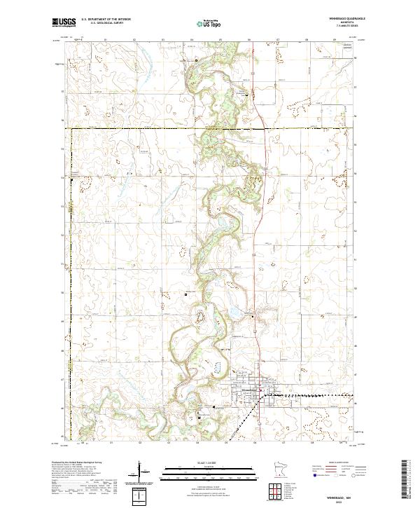 2022 Winnebago2022 Print · USGSIn the early twenty-first century, this corner of Faribault County remains defined by the winding Blue Earth River and the crossroads town of Winnebago. Researchers can locate numerous local burial grounds, including Wiltsey Cem, Saint Marys Cem, and the historic Pioneer Shelbyville Cem.
 - 2022 Map of Blue Earth, 2022 Print
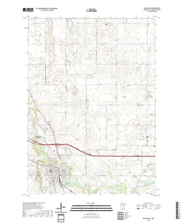 2022 Blue Earth2022 Print · USGSThe Faribault County seat and its surrounding townships are shown here in the early twenty-first century, centered on the river confluence. Genealogists can locate family sites at Riverside Cem, Immanuel Cem, and the Faribault County Courthouse.
 - 2022 Map of Brush Creek, 2022 Print
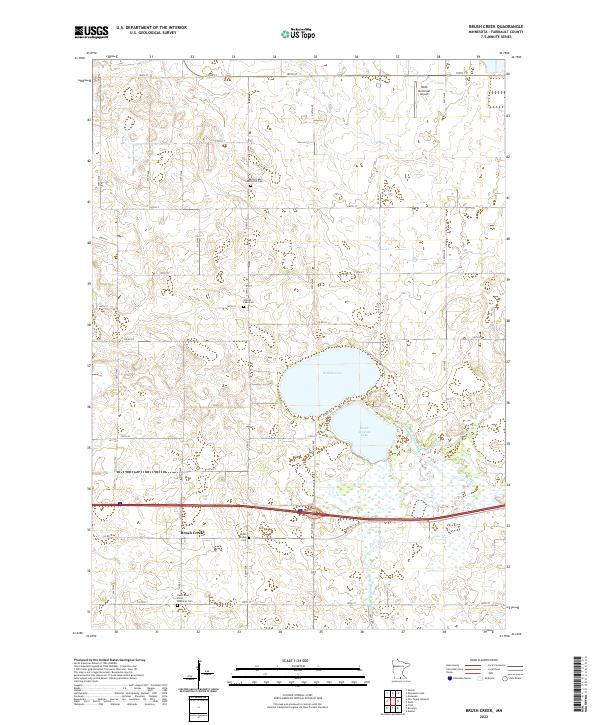 2022 Brush Creek2022 Print · USGSThe rural prairie of Faribault County is captured here in the early twenty-first century as agricultural traditions continue. Genealogists can locate legacy sites like Walnut Lake Methodist Cem, Brush Creek Cem, and the waters of South Walnut Lake.
 - 2022 Map of Delavan, 2022 Print
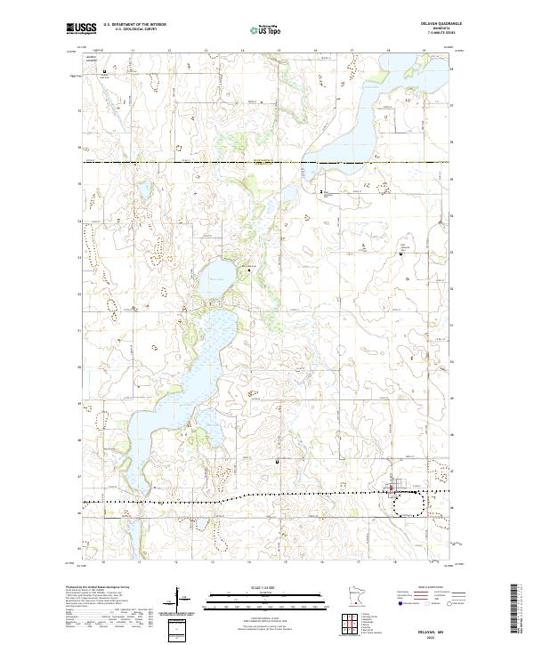 2022 Delavan2022 Print · USGSThe rural landscape around Delavan and the Faribault-Blue Earth county line is captured here in detail. Researchers can trace historical church and family sites at West Lutheran Cem, Jackson Lake Cem, and the shores of Bass Lake.
 - 2022 Map of Pilot Grove, 2022 Print
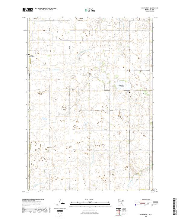 2022 Pilot Grove2022 Print · USGSFaribault County agriculture and drainage systems are captured in this recent survey of the Minnesota-Iowa borderlands. Genealogists and local historians can locate the Pilot Grove Cemetery and trace the modified landscape of the Pilot Grove Lakebed.
 - 2022 Map of Easton, 2022 Print
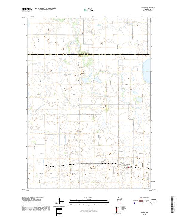 2022 Easton2022 Print · USGSFaribault County agriculture and rural life take center stage in this recent survey of the prairie landscape. Genealogists and local researchers can trace the roads around Easton to find Lura Cem, Saint Peter's Evangelical Lutheran Cem, and the banks of the Maple River.
 - 2022 Map of Lakota, 2022 Print
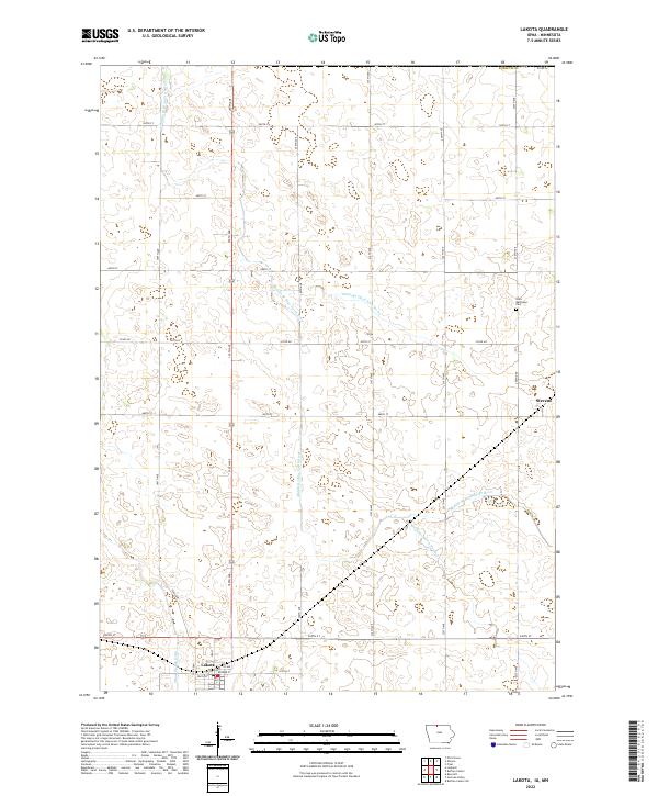 2022 Lakota2022 Print · USGSNorthwestern Iowa's agricultural landscape is seen here in recent years, centered on the community of Lakota. Researchers can trace local heritage at Saint Matthews Cem or follow the paths of the Middle Br Blue Earth River and Stevens.
 - 2022 Map of Buffalo Center NE, 2022 Print
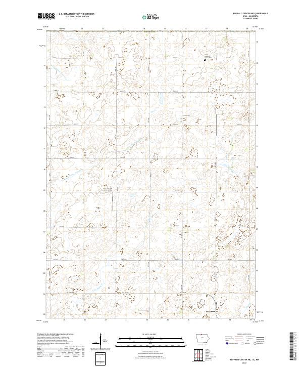 2022 Buffalo Center NE2022 Print · USGSNorthern Iowa farmland and the settlement of Thompson are captured in the early twenty-first century. Researchers can trace rural cemetery sites like Trinity Lutheran Church Cem and local landmarks such as Friesenborg & Larson Airport.
 - 2022 Map of Buffalo Center, 2022 Print
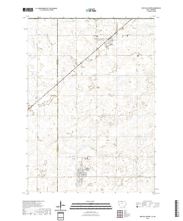 2022 Buffalo Center2022 Print · USGSThe borderlands of Winnebago and Kossuth counties are captured here in the early twenty-first century, showcasing a highly organized agricultural landscape. Researchers can locate family heritage sites at Olena Mound Cem and Graceland Cem or trace the early settlement footprints of Buffalo Center and Rake.
 - 2022 Map of Vinje, 2022 Print
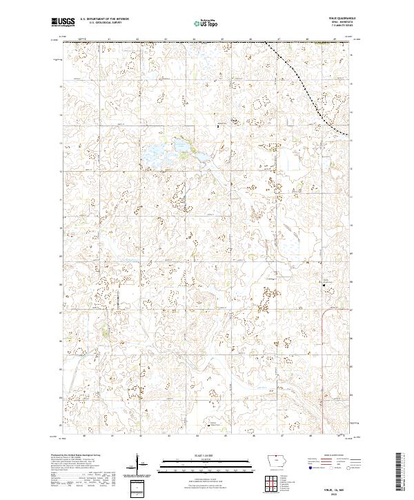 2022 Vinje2022 Print · USGSWinnebago County at the Minnesota border is captured here in the early twenty-first century, showcasing a landscape of enduring farmsteads and prairie drainage. Genealogists can locate family sites near Vinje or trace local history through Bethel Cem and Holmes Chapel Cem.
End of results
Showing maps 1-19 of 19
Top cities of Faribault County
- Blue Earth historical maps
- Wells historical maps
- Winnebago historical maps
- Elmore historical maps
- Minnesota Lake historical maps
- Kiester historical maps
See more
Frequently asked questions
- What are the different types of historical maps available for Faribault County?
- What is the oldest map of Faribault County?
- Where can I purchase historical maps of Faribault County for my home or office?
- Where can I download high-res historical maps of Faribault County?
- Are there historical topographic maps available for Faribault County?
- Is there historical aerial imagery available for Faribault County?
- Where are historical maps of Faribault County sourced from?