Old Maps of Faribault County, Minnesota
Explore 125 old maps of Faribault County, spanning from 1954 to today. These high-resolution historic maps reveal how streets, neighborhoods, landmarks, and natural features evolved over time — perfect for genealogy, metal detecting, research, and local history exploration.
What you can do with these maps:
- See how Faribault County changed over time: Compare historical maps to modern-day views to trace roads, homesites, rail lines & more.
- View detailed metadata: Each map includes creators, publishers, year, scale, and archive source.
- Overlay maps with satellite & LiDAR: Visualize the past alongside modern tools to explore terrain & human change.
- Trusted historical sources: Maps sourced from the USGS, Library of Congress, and other archives.
- Access maps your way: View online, download high-res files, or order prints for personal or research use.
Start exploring old maps of Faribault County to uncover forgotten places, hidden landmarks, and the deep history beneath your feet.
Faribault County, MN maps
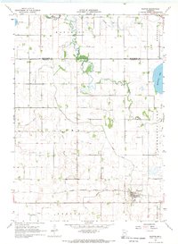
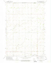
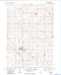
(125)- 1954 Map of Fairmont, 1967 Print
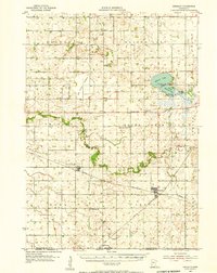
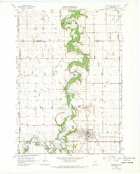
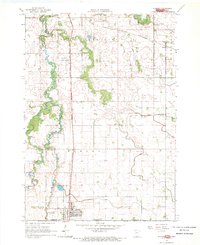
 1954 Fairmont1967 Print · USGSThe prairie landscape of southern Minnesota and northern Iowa comes alive in this mid-century survey of the Coteau des Prairies. Genealogists and historians can trace the rail-connected growth of Fairmont and Blue Earth or locate family roots near St Kilian Ch and Union Slough National Wildlife Refuge.3 unique versions available
 - 1954 Map of Mason City, 1967 Print
 1954 Mason City1967 Print · USGSSouthern Minnesota and northern Iowa are shown here at the height of the mid-century rail era, centered on the regional hubs of Mason City and Rochester. Researchers can trace the vanished paths of the Chicago Great Western and find local landmarks like Pilot Knob and Bear Lake.2 unique versions available
 - 1955 Map of Bricelyn, 1956 Print
 1955 Bricelyn1956 Print · USGSFaribault County agriculture and rail travel are at their peak in the mid-fifties, just north of the Iowa border. Genealogists and local historians can trace family roots through landmarks like St Marys Cem, the town of Bricelyn, and the reclaimed Oza Tanka Lakebed.
 - 1955 Map of Wells, 1956 Print
 1955 Wells1956 Print · USGSSouthern Minnesota in the mid-fifties remains a world of section-line roads and busy rail junctions between Wells and Alden. Genealogists and historians can trace numerous rural schoolhouses like Pioneer Sch and local landmarks such as Zion Ch or Arrowhead Point on Freeborn Lake.
 - 1957 Map of Mason City
 1957 Mason City1957 Print · USGSThe Minnesota-Iowa border region comes alive in this mid-century survey, from the industrial plants of Mason City to the medical hub of Rochester. Researchers can trace the rail-and-river economy through the Chicago Great Western Railway and the Shell Rock River.
 - 1958 Map of Mason City
 1958 Mason City1958 Print · USGSSouthern Minnesota and northern Iowa are shown during the mid-fifties when railroads still anchored the regional economy. Genealogists and historians can trace the intricate rail networks of the Illinois Central and find local landmarks in Mason City, Albert Lea, and Austin.
 - 1958 Map of Fairmont
 1958 Fairmont1958 Print · USGSThe borderlands of southern Minnesota and northern Iowa come alive in the mid-1950s, showing a landscape defined by glacial lakes and rail-line commerce. Researchers can trace historic landmarks like Lakeside Laboratory, Gridley Station, and the Bancroft Wildlife Refuge across the prairie.
 - 1967 Map of Pilot Grove, 1968 Print
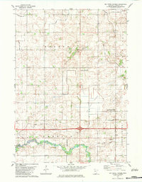
 1967 Pilot Grove1968 Print · USGSFaribault County agriculture and water management are on full display in this late-sixties survey of the Minnesota-Iowa border. Genealogists and researchers can locate the Pilot Grove Cemetery, the local Townhall, and the winding West Branch Blue Earth River.
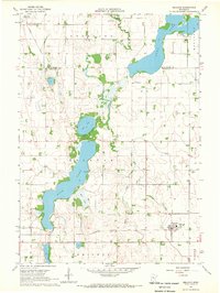
 - 1967 Map of Minnesota Lake, 1968 Print
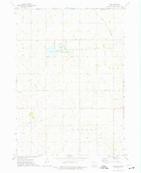
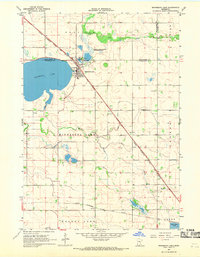 1967 Minnesota Lake1968 Print · USGSMinnesota Lake and its surrounding townships are captured in the late sixties as the local rail and agricultural systems remained firmly established. Genealogists and historians can trace family plots at Peace Cem or Zions Cem and locate landmarks like the Stokman State Wildlife Management Area.2 unique versions available
 - 1967 Map of Winnebago, 1968 Print
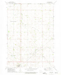
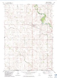
 1967 Winnebago1968 Print · USGSFaribault County in the late sixties reveals a landscape shaped by the Blue Earth River and the meeting of major rail lines. Genealogists and local historians can trace the locations of Basey Ch and several burial grounds like Rose Hill Cem and Riverside Cem.2 unique versions available
 - 1967 Map of Elmore, 1968 Print
 1967 Elmore1968 Print · USGSFaribault County and the Iowa borderlands come to life in the late sixties as agricultural patterns and rail lines define the prairie. Genealogists and local historians can trace rural landmarks like St Johns Ch, Dobson Cem, and the old Marna station site.
 - 1967 Map of Huntley, 1969 Print
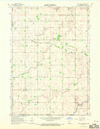
 1967 Huntley1969 Print · USGSFaribault County is captured in the late sixties as a thriving rail and agricultural hub at the crossroads of two major Midwestern lines. Researchers can trace family roots at West Verona Cem or follow the routes of the Chicago and North Western through Guckeen.2 unique versions available
 - 1967 Map of Matawan, 1969 Print
 1967 Matawan1969 Print · USGSSouthern Minnesota farming communities flourished in the late sixties as the rail lines connected small hubs to larger markets. Genealogists can trace family footprints near St Pauls Ch, the Townhall, and the rural sidings of Matawan and Wells.
 - 1967 Map of Easton, 1969 Print
 1967 Easton1969 Print · USGSFaribault County’s agricultural heartland is documented here in the late sixties, centered on the village of Easton. Researchers can trace the CHICAGO MILWAUKEE ST PAUL AND PACIFIC rail line and locate the Lura Cem among an extensive network of prairie drainage ditches.
 - 1967 Map of Delavan, 1969 Print
 1967 Delavan1969 Print · USGSThe fertile lake country of Faribault County is captured here in the late 1960s, showing a landscape defined by agriculture and water management. Researchers can locate family sites like Rice Lake Cem, the town of Delavan, and the path of the Chicago Milwaukee St Paul and Pacific railroad.
 - 1967 Map of Blue Earth, 1970 Print
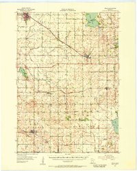
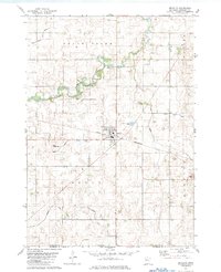
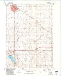
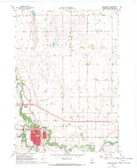 1967 Blue Earth1970 Print · USGSBlue Earth and the surrounding Faribault County prairie are shown in the late sixties as the local infrastructure began to modernize. Researchers can locate family roots at Riverside Cemetery, trace the old Chicago and North Western rail line, or find local landmarks like the Courthouse and Fairground.2 unique versions available
 - 1972 Map of Buffalo Center, 1975 Print
 1972 Buffalo Center1975 Print · USGSWinnebago County agriculture and small-town life are centered around Buffalo Center and Rake during the early seventies. Genealogists can locate several local burial grounds, including Olena Mound Cem and Township Cem, while following the path of the Chicago Rock Island and Pacific railroad.
 - 1972 Map of Buffalo Center NE, 1975 Print
 1972 Buffalo Center NE1975 Print · USGSWinnebago County farm country is captured here in the early 1970s as the rail and road networks of northern Iowa reached their modern form. Researchers can trace the CHICAGO ROCK ISLAND AND PACIFIC tracks through Thompson or locate local landmarks like Trinity Ch and Florence Park.
 - 1972 Map of Vinje, 1975 Print
 1972 Vinje1975 Print · USGSWinnebago County farmsteads and glacial lakes define this borderland region in the early seventies. Genealogists can locate rural landmarks like Bethel Ch, North Prairie Ch, and the small settlement of Vinje along the Chicago and North Western tracks.
 - 1972 Map of Lakota, 1975 Print
 1972 Lakota1975 Print · USGSThe northern Kossuth County borderlands come to life in the early seventies, showing a landscape of precise township lines and agricultural engineering. Genealogists and local historians can trace family-named sites like Boehm and Stevens or the grounds of St Matthews Cem.
 - 1982 Map of Bricelyn, 1983 Print
 1982 Bricelyn1983 Print · USGSBricelyn and the surrounding Faribault County townships are captured here in the early eighties as a high-functioning agricultural landscape. Genealogists and local historians can trace the Chicago and North Western rail line and locate Bricelyn Cem and Clayton Cem.
 - 1982 Map of Kiester, 1983 Print
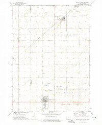
 1982 Kiester1983 Print · USGSSouthern Faribault County is shown here in the early eighties as a productive agricultural region tied together by the Chicago and North Western rail line. Researchers can locate family landmarks like St Johns Cem, the community of Walters, and several local Gravel Pits.
 - 1982 Map of Oza Tanka Lakebed, 1983 Print
 1982 Oza Tanka Lakebed1983 Print · USGSFaribault County agriculture and drainage systems are captured here in the early 1980s. Local researchers can locate rural family landmarks like St Marys Cem and King Cem, or trace the complex network of Oza Tanka Lakebed and Brush Creek.
 - 1982 Map of Wells, 1983 Print
 1982 Wells1983 Print · USGSWells and the surrounding Faribault County prairie are captured here in the early eighties as a thriving agricultural and rail corridor. Genealogists and local historians can trace the foundations of the community through St Casimir Cem, Rice Lake Cem, and the rail stops at Thistius and Baroda.
 - 1982 Map of Frost, 1983 Print
 1982 Frost1983 Print · USGSSouthern Minnesota farmland near the Iowa border is captured here in the early eighties, centered on the village of Frost. Genealogists and local historians can trace family plots across Emerald township and locate landmarks like Bethany Ch and Emerald Cem.
Showing maps 1-25 of 125
Top cities of Faribault County
- Blue Earth historical maps
- Wells historical maps
- Winnebago historical maps
- Elmore historical maps
- Minnesota Lake historical maps
- Kiester historical maps
See more
Frequently asked questions
- What are the different types of historical maps available for Faribault County?
- What is the oldest map of Faribault County?
- Where can I purchase historical maps of Faribault County for my home or office?
- Where can I download high-res historical maps of Faribault County?
- Are there historical topographic maps available for Faribault County?
- Is there historical aerial imagery available for Faribault County?
- Where are historical maps of Faribault County sourced from?