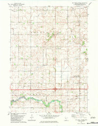
1982 Map of Oza Tanka Lakebed
USGS Topo · Published 1983About this map
Oza Tanka Lakebed defines this portion of Faribault County, representing a landscape transformed by intensive drainage and agricultural engineering. The terrain is crisscrossed by an extensive network of water management features, including Judicial Ditch No 1, County Ditch No 7, and numerous others that feed into the East Branch Blue Earth River. This grid of ditches reflects the transition of former wetlands into productive farmland, a defining characteristic of southern Minnesota’s rural development. Small clusters of local history are preserved in sites like St Marys Cem near Easton and King Cem to the south. The area’s mid-century aviation and infrastructure are visible through the Martin Landing Strip and the intersection of local roads at the settlement of Emerald.
Find a feature on this map
28 named features on this map. Tap any name to fly to it.
Don’t see what you’re looking for? This feature index may not catch every label — zoom into the map to look around manually.
Map Details
Editions of this 1982 Oza Tanka Lakebed Map
This is the sole edition of this map. No revisions or reprints were ever made.
Other maps of this area

1954 · Fairmont
USGS Topo · 1:250,000

1954 · Mason City
USGS Topo · 1:250,000

1955 · Bricelyn
USGS Topo · 1:62,500

1957 · Mason City
USGS Topo · 1:250,000

1958 · Mason City
USGS Topo · 1:250,000

1958 · Fairmont
USGS Topo · 1:250,000

1967 · Minnesota Lake
USGS Topo · 1:24,000

1967 · Elmore
USGS Topo · 1:24,000
1967 · Easton
USGS Topo · 1:24,000
1967 · Delavan
USGS Topo · 1:24,000