
1967 Map of Minnesota Lake
USGS Topo · Published 1968About this map
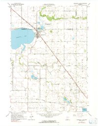
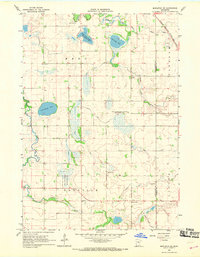
Minnesota Lake serves as the focal point of this Southern Minnesota landscape, situated at the junction of Blue Earth and Faribault counties. The town is a critical rail hub for the Chicago Milwaukee St Paul and Pacific railroad, which cuts diagonally through the townships of Danville and Walnut Lake. This survey captures the agricultural and ecological character of the late 1960s, noting the Stokman State Wildlife Management Area and several local burial sites such as Peace Cem, Oak Grove Cem, and St John Cem. The surrounding plains are drained by the Maple River and Cobb River, with numerous county ditches highlighting the intensive water management required for the region's farming economy. Distinctive landmarks like the town Water Tank and a Radio Tower provide vertical relief in an otherwise low-lying prairie terrain.
Find a feature on this map
30 named features on this map. Tap any name to fly to it.
Don’t see what you’re looking for? This feature index may not catch every label — zoom into the map to look around manually.
Map Details
Editions of this 1967 Minnesota Lake Map
2 editions found
Other maps of this area

1954 · Mason City
USGS Topo · 1:250,000

1955 · Bricelyn
USGS Topo · 1:62,500

1955 · Wells
USGS Topo · 1:62,500

1957 · Mason City
USGS Topo · 1:250,000

1958 · Mason City
USGS Topo · 1:250,000

1967 · Waldorf
USGS Topo · 1:24,000
1967 · Matawan
USGS Topo · 1:24,000
1967 · Mapleton
USGS Topo · 1:24,000
1967 · Easton
USGS Topo · 1:24,000
1967 · Mapleton NE
USGS Topo · 1:24,000