1955 Map of Wells
USGS Topo · Published 1956About this map
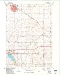
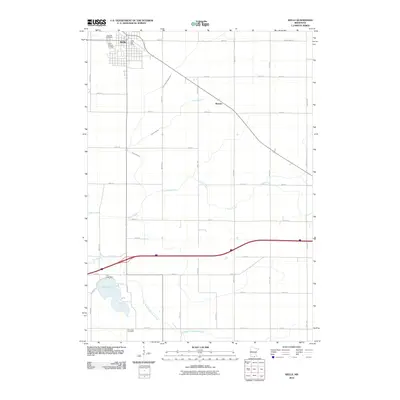
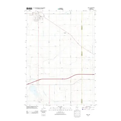
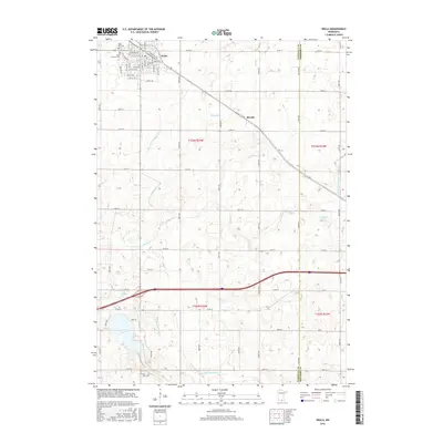
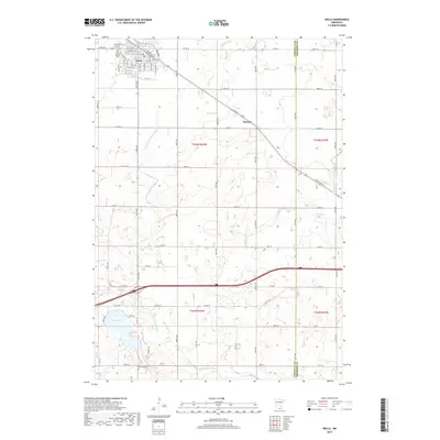
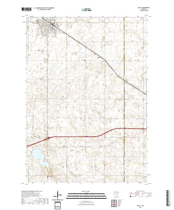
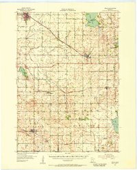
The agrarian landscape of Southern Minnesota is defined by a dense grid of township roads and rail corridors connecting the regional hubs of Wells and Alden. This mid-century survey reveals a social fabric in transition, documented by numerous rural schoolhouses such as Pioneer Sch and Heideman Sch marked as abandoned, indicating the consolidation of smaller school districts. Three major railroads, including the Chicago Milwaukee St Paul and Pacific and the Chicago and North Western, intersect at Wells, cementing its role as a vital shipping point for the surrounding prairie. Significant water features like Freeborn Lake with its Arrowhead Point and the winding East Branch Blue Earth River break the geometry of the section lines. Local genealogy is supported by the inclusion of the Wells Hospital, several rural churches like Zion Ch, and cemeteries including Rose Hill Cem and St Casimir Cem near the town center.
Find a feature on this map
45 named features on this map. Tap any name to fly to it.
Don’t see what you’re looking for? This feature index may not catch every label — zoom into the map to look around manually.
Map Details
Editions of this 1955 Wells Map
This is the sole edition of this map. No revisions or reprints were ever made.
Historical Maps of Wells Through Time
7 maps found