Loading...
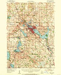
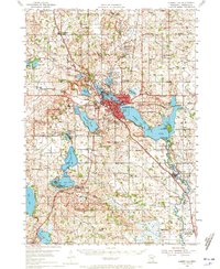
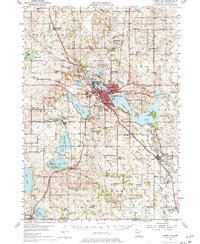
Loading map...1954 Map of Albert Lea
USGS Topo · Published 1956About this map
Albert Lea serves as a major regional hub in the mid-1950s, defined by its intricate lakes and a dense network of competing railroads. The landscape is characterized by the expansive Albert Lea Lake and Fountain Lake, with the Myre State Park shoreline beginning to take shape to the east. Five different rail lines, including the Illinois Central and the Chicago Milwaukee St Paul and Pacific, converge on the city, illustrating the area's importance as a transportation corridor.
Find a feature on this map
94 named features on this map. Tap any name to fly to it.
Don’t see what you’re looking for? This feature index may not catch every label — zoom into the map to look around manually.
Map Details
Date Portrayed1954
Date Published1956
PublisherU.S. Geological Survey
Map TypeTopographic
Scale1:62,500
Physical Dimensions21.53 x 27.23 inches
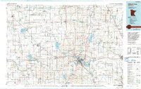
Editions of this 1954 Albert Lea Map
3 editions found
Historical Maps of Albert Lea Through Time
Featured Locations
Source Details
SourceU.S. Geological Survey
CopyrightPublic Domain