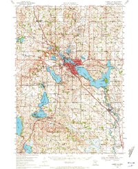
1954 Map of Albert Lea
USGS Topo · Published 1972About this map
The city of Albert Lea sits at a critical rail junction where several major lines converge, including the Chicago Milwaukee St Paul and Pacific and the Illinois Central. This mid-century landscape is defined by its extensive water bodies, from Fountain Lake at the city center to the sprawling Albert Lea Lake and its surrounding Myre State Park. The surrounding townships like Bancroft and Freeborn County are densely dotted with rural schoolhouses and churches that served a robust agricultural community, such as Lerdal Sch and Central Ch.
Find a feature on this map
89 named features on this map. Tap any name to fly to it.
Don’t see what you’re looking for? This feature index may not catch every label — zoom into the map to look around manually.
Map Details
Editions of this 1954 Albert Lea Map
3 editions found
Other maps of this area

1954 · Albert Lea
USGS Topo · 1:62,500

1954 · Hayward
USGS Topo · 1:62,500

1954 · Mason City
USGS Topo · 1:250,000

1955 · Wells
USGS Topo · 1:62,500

1957 · Mason City
USGS Topo · 1:250,000

1958 · Mason City
USGS Topo · 1:250,000

1967 · Hollandale
USGS Topo · 1:24,000

1967 · Freeborn
USGS Topo · 1:24,000

1967 · Hartland
USGS Topo · 1:24,000

1967 · Ellendale
USGS Topo · 1:24,000