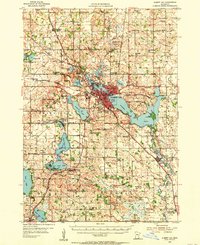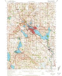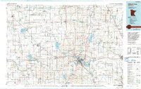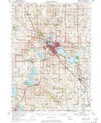
1954 Map of Albert Lea
USGS Topo · Published 1977About this map
Albert Lea sits at the heart of a complex hydrologic and transit network in southern Minnesota, where the Shell Rock River and a series of glacial lakes shaped the development of Freeborn County. The landscape in the 1950s was defined by the confluence of four major rail lines, including the Illinois Central and the Chicago Rock Island and Pacific, which fueled the growth of surrounding townships like Bancroft and Riceland. This survey captures the era's agricultural and civic infrastructure, from the Albert Lea Municipal Airport to numerous rural schoolhouses such as Jeklyn Sch and Hammer Sch.
Find a feature on this map
97 named features on this map. Tap any name to fly to it.
Don’t see what you’re looking for? This feature index may not catch every label — zoom into the map to look around manually.
Map Details
Editions of this 1954 Albert Lea Map
3 editions found