Old Maps of Hubbard County, Minnesota for Academic Research
Study the evolution of Hubbard County with 195 high-resolution historic maps. Whether you're teaching, researching, or modeling changes in land use, these maps provide essential visual documentation of urban, environmental, and geographic change.
- Analyze long-term change: Track patterns in development, transportation, and natural features.
- Ideal for environmental or urban studies: Support academic projects with primary historical map data.
- Use in the classroom or lab: Educators and researchers rely on these maps to bring historical context to life.
These maps are a powerful tool for teaching, research, and visualizing how Hubbard County has changed over the decades.
Hubbard County, MN maps
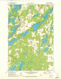
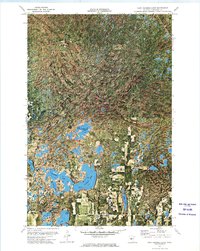
(195)- 1953 Map of Brainerd, 1966 Print
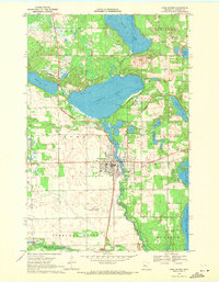
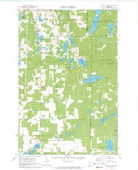
 1953 Brainerd1966 Print · USGSCentral Minnesota's lake country and iron ranges are detailed in the mid-fifties, showing the intersection of industry and wilderness. Researchers can locate specific local landmarks like the Crow Wing County Courthouse or trace the early paths of the Soo Line Railroad and the Cuyuna Range Iron Mines.3 unique versions available
 - 1954 Map of Bemidji, 1966 Print
 1954 Bemidji1966 Print · USGSNorthern Minnesota's lake country and timberlands are captured here at a mid-century peak of rail and road expansion. Genealogists and historians can trace family roots through numerous small settlements like Mahnomen, Clearbrook, and Walker, while locating local landmarks such as White Earth Church.4 unique versions available
 - 1957 Map of Brainerd
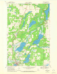
 1957 Brainerd1957 Print · USGSNorth-central Minnesota's lake-rich landscape is captured in the mid-1950s as a crossroads of rail, river, and forest. Genealogists and historians can trace the paths of the Great Northern and Soo Line railroads through hubs like Brainerd, Wadena, and Detroit Lakes.
 - 1957 Map of Bemidji
 1957 Bemidji1957 Print · USGSNorthern Minnesota in the mid-fifties is defined by its massive lake systems and the sprawling timberlands of the Chippewa National Forest. Genealogists and researchers can trace old rail lines like the Great Northern RR and locate settlements such as Moberg, Naytahwaush, and Lake Itasca.
 - 1958 Map of Bemidji
 1958 Bemidji1958 Print · USGSNorthern Minnesota in the late fifties is a vast landscape of tribal lands and timber forests tied together by rail. Genealogists and researchers can trace old rail stops and lakeside communities from Walker to Fosston, or explore the source of the Mississippi at Lake Itasca.
 - 1958 Map of Brainerd
 1958 Brainerd1958 Print · USGSCentral Minnesota in the late fifties is a landscape of dense lake chains, rail hubs, and sprawling state forests. Genealogists and local historians can trace old property alignments near the Mississippi River or locate family sites in Brainerd, Little Falls, and Detroit Lakes.
 - 1965 Map of Brainerd
 1965 Brainerd1965 Print · USGSNorth-central Minnesota in the mid-fifties presents a complex landscape of sprawling lake systems and established rail corridors. Genealogists and historians can trace the growth of timber towns along the Northern Pacific RR and explore early borders of the White Earth Indian Reservation or Tamarac National Wildlife Refuge.
 - 1968 Map of Guthrie, 1970 Print
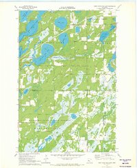
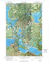
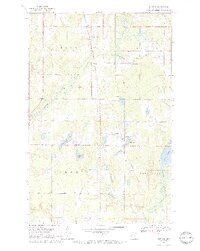 1968 Guthrie1970 Print · USGSHubbard County near the end of the 1960s was a landscape of small settlements and glacial waters connected by the Northern Pacific rail line. Genealogists can trace family landmarks like Nary Cem, Malvik Ch Cem, and the community Townhall in Guthrie.2 unique versions available
 - 1968 Map of Bemidji East, 1970 Print
 1968 Bemidji East1970 Print · USGSThe shorelines of the Mississippi headwaters in the late sixties show a landscape shaped by rail and water. Researchers can trace local genealogy and industry through Nymore, the Midway Seaplane Base, and the junction of the Great Soo and Northern Pacific lines.3 unique versions available
 - 1968 Map of Frontenac Lake, 1970 Print
 1968 Frontenac Lake1970 Print · USGSHubbard County timberlands and glacial lakes are captured here in the late sixties, showcasing a landscape defined by water and woods. Genealogists and local historians can trace the early layout of the Paul Bunyan State Forest and identify landmarks like the Townhall and Camp Thunderbird.2 unique versions available
 - 1968 Map of Bemidji West, 1971 Print
 1968 Bemidji West1971 Print · USGSThe headwaters of the Mississippi intersect with a growing college town and rail hub in the late 1960s. Genealogists and historians can trace the campuses of Bemidji State College and Oak Hills Institute, or locate family plots at Greenwood Cem and Wilton Cem.2 unique versions available
 - 1969 Map of Park Rapids, 1971 Print
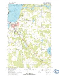
 1969 Park Rapids1971 Print · USGSPark Rapids and the surrounding lake country are shown here in the late sixties as the region's recreation and rail economies converged. Researchers can locate local landmarks like Greenwood Cem, trace the Burlington Northern line, and identify early sites like the Fish Hatchery.2 unique versions available
 - 1969 Map of Menahga, 1971 Print
 1969 Menahga1971 Print · USGSNorth-central Minnesota's lake country is captured in the late sixties, showing the transition of the Burlington Northern line through the region. Genealogists and researchers can trace the developed landscape of Menahga, the site of Pine Haven Ch, and the waters of Blueberry Lake.2 unique versions available
 - 1969 Map of Park Rapids SW, 1971 Print
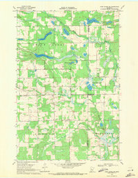 1969 Park Rapids SW1971 Print · USGSBecker, Hubbard, and Wadena Counties meet in this late 1960s landscape dominated by the Shell River and Straight River. Genealogists and local historians can trace family ties at Green Valley Cemetery or Alajoki Cemetery.
 - 1969 Map of Park Rapids NW, 1971 Print
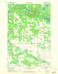 1969 Park Rapids NW1971 Print · USGSThe Becker and Hubbard county line comes alive in the late sixties, showing a landscape defined by state forests and glacial lakes. Genealogists and historians can locate the Crandall Cem or trace the winding courses of the Straight River and Shell River.
 - 1970 Map of Nevis, 1972 Print
 1970 Nevis1972 Print · USGSThe Hubbard County lakelands and the village of Nevis are captured here in the early seventies as the region supported both timber and transit. Genealogists and historians can trace the Burlington Northern tracks and locate family sites at Lakeview Cem or the Lemon Cem.2 unique versions available
 - 1970 Map of Dorset, 1972 Print
 1970 Dorset1972 Print · USGSHubbard County's lake country is captured here in the early seventies, centered on the village of Dorset. Genealogists and local historians can trace the Burlington Northern rail line and locate landmarks like Henrietta Cem and Dorset Lookout Tower.2 unique versions available
 - 1970 Map of Huntersville, 1972 Print
 1970 Huntersville1972 Print · USGSThe Hubbard and Wadena County line in the early 1970s is a landscape of glacial lakes and dense woods. Researchers can trace local burial sites like Hubbard Cem, explore the winding Shell River, and locate the settlement of Huntersville near the state forest.
 - 1970 Map of Oshawa, 1972 Print
 1970 Oshawa1972 Print · USGSThe Hubbard and Cass county line in the early seventies shows a landscape dedicated to forestry and rural survival. Researchers can trace the footprints of the timber industry through the State Nursery, the Badoura Lookout Tower, and the settlement at Oshawa.2 unique versions available
 - 1970 Map of Crystal Lake, 1972 Print
 1970 Crystal Lake1972 Print · USGSThe lake-strewn woods of Hubbard and Cass Counties are captured here in the early 1970s, showcasing a landscape defined by state and national forests. Genealogists and local historians can trace the sites of Akeley, Chamberlain, and the White Oak Cem.2 unique versions available
 - 1970 Map of First Crow Wing Lake, 1972 Print
 1970 First Crow Wing Lake1972 Print · USGSThe Crow Wing River chain winds through Hubbard County during the early seventies, linking the First Crow Wing Lake to its neighbors. Trace the boundaries of the Badoura State Forest or find the remote Campground near Tripp Lake.
 - 1972 Map of Alida, 1974 Print
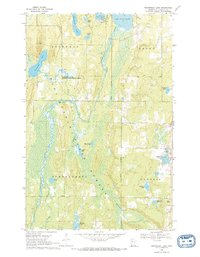
 1972 Alida1974 Print · USGSNorthern Minnesota's glacial lake country is frozen in time during the early seventies, capturing the headwaters region as it transitioned into the modern era. Genealogists and local historians can locate the Alida settlement, the Township Cem, and the winding course of the Little Mississippi River.
 - 1972 Map of Mantrap Lake, 1974 Print
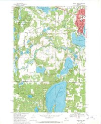
 1972 Mantrap Lake1974 Print · USGSHubbard County in the early seventies shows a landscape defined by the dense woods and glacial waters of the Paul Bunyan State Forest. Researchers can find the local Lake Emma Cem and trace the development around Emmaville and Mantrap Lake.2 unique versions available
 - 1972 Map of East Crooked Lake, 1974 Print
 1972 East Crooked Lake1974 Print · USGSHubbard County in the early seventies is shown here as a dense expanse of the Paul Bunyan State Forest and its myriad glacial lakes. Trace the shorelines of East Crooked Lake, find the Thorpe Lookout Tower, or locate early Public Access points for fishing and recreation.
 - 1972 Map of Benedict, 1974 Print
 1972 Benedict1974 Print · USGSNorthern Minnesota lake country in the early seventies is mapped in detail here, spanning the Hubbard and Cass county lines. Researchers can trace the Leech Lake Indian Reservation Boundary and locate landmarks like the Merrill Landing Strip or Laporte.
Showing maps 1-25 of 195
Top cities of Hubbard County
- Park Rapids historical maps
- Arago historical maps
- Guthrie historical maps
- Akeley historical maps
- Nevis historical maps
- Lake George historical maps
See more
Frequently asked questions
- What are the different types of historical maps available for Hubbard County?
- What is the oldest map of Hubbard County?
- Where can I purchase historical maps of Hubbard County for my home or office?
- Where can I download high-res historical maps of Hubbard County?
- Are there historical topographic maps available for Hubbard County?
- Is there historical aerial imagery available for Hubbard County?
- Where are historical maps of Hubbard County sourced from?