1980s Maps of Lake No. 2, Minnesota
Explore 8 historic maps of Lake No. 2 from the 1980s. These maps offer a rare glimpse into what life looked like during the 1980s — showing old roads, neighborhoods, homes, and landmarks that have changed or disappeared over time.
Whether you're researching your family's past, planning a metal detecting trip, or studying how Lake No. 2's landscape evolved across the 1980s, these high-resolution maps are a powerful tool for exploring the history of this region.
- Focus on a specific era: All maps on this page are from the 1980s, giving you a focused view of this time period.
- See what’s changed: Compare century-old streets, trails, and buildings to today's modern landscape using overlays and satellite layers.
- Research with precision: Use these maps for genealogy, historical research, land use analysis, or educational projects.
- View, download, or print: Maps are fully viewable online in high resolution, and can be downloaded or printed for your own records.
Start exploring Lake No. 2's history through authentic maps from the 1980s. This is your window into the past.
Lake No. 2, MN maps
(8)- 1980 Map of Port Wing
 1980 Port Wing1980 Print · USGSThe Lake Superior shoreline and the deep forests of Bayfield and Douglas counties are captured here in the early eighties. Genealogists and historians can trace the rail lines through Iron River or locate the lakeside landings at Cornucopia and Port Wing.
 - 1981 Map of Slate Lake West, 1982 Print
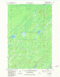
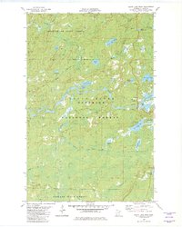 1981 Slate Lake West1982 Print · USGSLake County's wilderness is captured in the early eighties as a dense network of forests and waterways. Trace the remote settlement of Happy Wanderer or explore the drainage of the Stony River near Slate Lake and Jackpot Lake.2 unique versions available
 - 1981 Map of Highland, 1982 Print
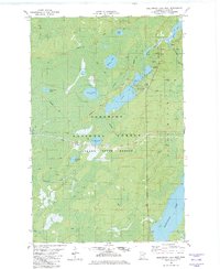
 1981 Highland1982 Print · USGSLake County's North Shore backcountry is shown in the early eighties, centered on the vital iron ore transit corridor. Genealogists and local historians can trace the small settlements of Highland, Wales, and Alger along the Duluth Missabe and Iron Range Railroad.
 - 1981 Map of Brimson, 1982 Print
 1981 Brimson1982 Print · USGSSt. Louis County is captured here in the early 1980s, where the logging and rail history of northern Minnesota meets the wilderness. Researchers can locate remote burial sites at Brimson Cem, trace the Duluth Missabe and Iron Range tracks, or follow the Old Railroad Grade.2 unique versions available
 - 1981 Map of Kane Lake, 1982 Print
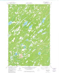
 1981 Kane Lake1982 Print · USGSLake County timber and rail operations are captured here in the early eighties, showing the deep woods near the Duluth Missabe and Iron Range Railroad. Trace the old rail stop at Norshor Junction or the remote outpost at McNair near Kane Lake.2 unique versions available
 - 1981 Map of Toimi, 1982 Print
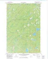
 1981 Toimi1982 Print · USGSThe Iron Range fringes of St. Louis County in the late seventies reveal a landscape defined by timber and transit. Genealogists and historians can trace the community core around Toimi, including the Bassett Cem, the Townhall, and the Seven Beaver Mining Railroad.2 unique versions available
 - 1982 Map of Mt Weber
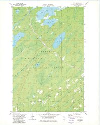
 1982 Mt Weber1982 Print · USGSLake County's timber and iron country is detailed here in the early eighties, showcasing the intersection of industrial rail and protected forests. Researchers can trace the paths of the Duluth Missabe and Iron Range and an Old RR Grade near Sullivan Lake.2 unique versions available
 - 1982 Map of Greenwood Lake West
 1982 Greenwood Lake West1982 Print · USGSLake County's north woods are captured here in the early eighties, showcasing a vast network of wilderness lakes and timber lands. Trace industrial and recreational history through features like the Mining Railroad, Sand Lake, and the remote Winter Trails.2 unique versions available
End of results
Showing maps 1-8 of 8
Top cities near Lake No. 2
Top neighborhoods of Lake No. 2
- Stewart historical maps
- Waldo historical maps
- McNair historical maps
- Wales historical maps
- Knife River historical maps
- Highland historical maps
See more
Frequently asked questions
- What are the different types of historical maps available for Lake No. 2?
- What is the oldest map of Lake No. 2?
- Where can I purchase historical maps of Lake No. 2 for my home or office?
- Where can I download high-res historical maps of Lake No. 2?
- Are there historical topographic maps available for Lake No. 2?
- Is there historical aerial imagery available for Lake No. 2?
- Where are historical maps of Lake No. 2 sourced from?